Cavinti | |
|---|---|
| Municipality of Cavinti | |
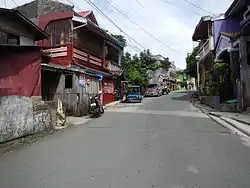 Downtown area | |
 Flag  Seal | |
| Nickname(s): The Ecotourism, Adventure, Falls and Glamping Capital of the Philippines | |
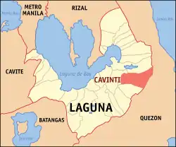 Map of Laguna with Cavinti highlighted | |
OpenStreetMap | |
.svg.png.webp) Cavinti Location within the Philippines | |
| Coordinates: 14°14′42″N 121°30′25″E / 14.245°N 121.507°E | |
| Country | Philippines |
| Region | Calabarzon |
| Province | Laguna |
| District | 4th district |
| Founded | 1619 |
| Annexation to Luisiana | October 12, 1903 |
| Reestablished | September 12, 1907 |
| Barangays | 19 (see Barangays) |
| Government | |
| • Type | Sangguniang Bayan |
| • Mayor | Arrantlee R. Arroyo |
| • Vice Mayor | Milbert D. Oliveros |
| • Representative | Maria Jamina Katherine B. Agarao |
| • Municipal Council | Members |
| • Electorate | 19,731 voters (2022) |
| Area | |
| • Total | 203.58 km2 (78.60 sq mi) |
| Elevation | 251 m (823 ft) |
| Highest elevation | 436 m (1,430 ft) |
| Lowest elevation | 7 m (23 ft) |
| Population (2020 census)[3] | |
| • Total | 23,980 |
| • Density | 120/km2 (310/sq mi) |
| • Households | 6,300 |
| Economy | |
| • Income class | 3rd municipal income class |
| • Poverty incidence | 2.66 |
| • Revenue | ₱ 135.3 million (2020) |
| • Assets | ₱ 276.1 million (2020) |
| • Expenditure | ₱ 122.6 million (2020) |
| • Liabilities | ₱ 89.12 million (2020) |
| Service provider | |
| • Electricity | First Laguna Electric Cooperative (FLECO) |
| Time zone | UTC+8 (PST) |
| ZIP code | 4013 |
| PSGC | |
| IDD : area code | +63 (0)49 |
| Native languages | Tagalog |
| Website | www |
Cavinti, officially the Municipality of Cavinti (Tagalog: Bayan ng Cavinti), is a 3rd class municipality in the province of Laguna, Philippines. According to the 2020 census, it has a population of 23,980 people.[3]
It is in the Sierra Madre mountain range. Major produce are its pandan made products, including the Sambalilo (straw hat). It is also known as the Ecotourism, Adventure, Falls and Glamping Capital of the Philippines.
The official song of the Municipality of Cavinti and its people is Cavinti Hymn or Imno ng Cavinti. The anthem was composed by Bonifacio J. Linay, a native of Cavinti.
History
The municipality of Cavinti was originally a part of Lumban, Laguna. It was only in 1619 when the town gained complete and independent status as a parish by virtue of a papal bull believed to have come directly from Rome. In fact, this was why, again according to the legends, the two Puhawan brothers of Lumban, in search of food in early 1600, reached Cavinti where they found an image which turned out to be that of El Salvador. They brought the image to their home in Lumban. But in no time, it got lost only to be found again the very same place where it was first discovered. Today on that hallowed grounds stands majestically the centuries-old Catholic Church in honor of El Salvador built by the town's forebears for all the generations to enjoy and cherish.
The church's early structures were made of light materials. For many times they had to rebuild it on account of destruction wrought by natural calamities such as earthquakes, typhoons, and fires.
The ecclesiastical supervision of the church also belonged to Lumban since its founding. Even at the time of the construction of the first stone church in 1621.[5]
The Spanish Period
During this era, Cavinti is one of the least villages of Lumban, Laguna. The population is very low and no significant development was recorded since during that time development was focused on Municipality of Lumban. The town of Cavinti serves that time as a hunting ground for hunters.[6]
The American Period
In 1903, Cavinti was reduced as part of Luisiana by virtue of Act No. 939.[7] It later separated from Luisiana to be reconstituted as an independent municipality by virtue of Act No. 1712 in 1907.[8]
Cavinti became one of the municipalities with high insurgency due to the construction of hydropower dam where several lands were submerged.
Two connected man-made lakes (Lake Lumot and Lake Caliraya) were built by American engineers in 1943 to supply water to the Caliraya Hydroelectric Plant. As the dams were constructed, entrepreneurs with foresight created two adjacent communities which were envisioned to be ecological communities, where one can enjoy the beauty and richness of unspoiled nature. The results were man-made mountain lakes complete with coves and sandbars - Lake Caliraya and Lake Lumot. The Americans also seeded the lake with Largemouth Black Bass imported from the US, which continues to proliferate and provide game fishers with year-round weekend excitement.
In fact, the two lakes are some of the places in the whole country where Philippine anglers can attempt to catch the famed Largemouth Black Bass, one of the top freshwater gamefish of the United States of America. During this regime, no further economic and infrastructure projects were implemented in the town of Cavinti.[9]
The Japanese Occupation
All over the country, Japanese period was the days of disorder, fear, and desolation. Shortage of food, limited infrastructure, limited medical services and limited educational services were rampant in the whole country. The Philippines was run by a ‘puppet’ government as it was being governed by the watchful eyes of the Japanese Imperial Army.
During this regime, insurgency becomes rampant and no further economic and infrastructure was implemented in the town of Cavinti.[10]
The Third Republic
During this period, people in Municipality of Cavinti gave their hope in the new form of government. However, due to the effect of war, there was an extensive problem in infrastructure specifically roads, bridges and the construction of schools along with the problems of pestilence and starvation. Thus, there was no further development for the town of Cavinti right until the 1960s, when ground was broken on the Lake Caliraya shoreline for the building of the resort communities which began a period of economic rebirth.[11] Today, the highland town of Northeastern Laguna continues to grow economically and as a tourism center for visitors coming from all over the country and overseas.
Geography
Cavinti is situated on the eastern side of the province of Laguna. The town is bounded by the municipality of Lumban in the north, by the municipalities of Sampaloc, Quezon and Mauban, Quezon in the east, Pagsanjan in the west, and by Luisiana in the south. It has 19 barangays.
Cavinti is 12 kilometres (7.5 mi) from Santa Cruz and exactly 100 kilometers from Manila.
Climate
Like most areas in the province of Laguna, the Climate of Cavinti is characterized by two pronounced seasons: dry from March to May and wet during the rest of the year.
| Climate data for Cavinti, Laguna | |||||||||||||
|---|---|---|---|---|---|---|---|---|---|---|---|---|---|
| Month | Jan | Feb | Mar | Apr | May | Jun | Jul | Aug | Sep | Oct | Nov | Dec | Year |
| Mean daily maximum °C (°F) | 25 (77) |
26 (79) |
27 (81) |
30 (86) |
30 (86) |
29 (84) |
28 (82) |
28 (82) |
28 (82) |
27 (81) |
26 (79) |
25 (77) |
27 (81) |
| Mean daily minimum °C (°F) | 21 (70) |
21 (70) |
21 (70) |
22 (72) |
23 (73) |
23 (73) |
23 (73) |
23 (73) |
23 (73) |
22 (72) |
22 (72) |
22 (72) |
22 (72) |
| Average precipitation mm (inches) | 58 (2.3) |
41 (1.6) |
32 (1.3) |
29 (1.1) |
91 (3.6) |
143 (5.6) |
181 (7.1) |
162 (6.4) |
172 (6.8) |
164 (6.5) |
113 (4.4) |
121 (4.8) |
1,307 (51.5) |
| Average rainy days | 13.4 | 9.3 | 9.1 | 9.8 | 19.1 | 22.9 | 26.6 | 24.9 | 25.0 | 21.4 | 16.5 | 16.5 | 214.5 |
| Source: Meteoblue (modeled/calculated data, not measured locally)[12] | |||||||||||||
Barangays
Cavinti is politically subdivided into 19 barangays. [13] Each barangay consists of puroks and some have sitios.
Currently, there are 2 barangays which are classified as urban (highlighted in bold).
- Anglas
- Bangco
- Bukal
- Bulajo
- Cansuso
- Duhat
- Inao-Awan
- Kanluran Talaongan
- Labayo
- Layasin
- Layug
- Lumot/Mahipon
- Paowin
- Poblacion
- Sisilmin
- Silangan Talaongan
- Sumucab
- Tibatib
- Udia
Poblacion
It is the center of commercial and business activities in Cavinti. Almost all of the basic municipal facilities are located in Poblacion including the Municipal Hall, Town Plaza, the Public Market, and many commercial and business establishments. The Catholic Church (Transfiguration Parish) and Aglipayan Church are also located in Poblacion.
Demographics
| Year | Pop. | ±% p.a. |
|---|---|---|
| 1903 | 4,027 | — |
| 1918 | 5,334 | +1.89% |
| 1939 | 7,254 | +1.47% |
| 1948 | 6,193 | −1.74% |
| 1960 | 8,297 | +2.47% |
| 1970 | 10,462 | +2.34% |
| 1975 | 11,463 | +1.85% |
| 1980 | 13,222 | +2.90% |
| 1990 | 15,131 | +1.36% |
| 1995 | 16,157 | +1.24% |
| 2000 | 19,494 | +4.11% |
| 2007 | 20,469 | +0.68% |
| 2010 | 20,809 | +0.60% |
| 2015 | 21,702 | +0.80% |
| 2020 | 23,980 | +1.98% |
| Source: Philippine Statistics Authority[14][15][16][17] | ||
In the 2020 census, the population of Cavinti was 23,980 people,[3] with a density of 120 inhabitants per square kilometre or 310 inhabitants per square mile.
People from Cavinti are being called by nearby towns as "kabintiin".
Language
The language spoken in the town is the national language of the country: Filipino language (Tagalog). The media of instruction in schools are English and Tagalog languages.
Economy
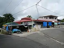
Cavinti is primarily an agricultural town. At the población, there are only a few commercial establishments which cater to the basic services of the people.
Sources of income of the people of Cavinti are mainly focused on tourism and agriculture such as palay, bamboo, pandan, copra, coconut, vegetables and fruit trees. Piggery and poultry farming are also sources of additional income for the townfolks. The business income of the local government primarily comes from CBK Power Plants, Resorts, Hotels and Restaurants and operation of several tourism-related projects.
Annual budget:
- Internal revenue allotment : Php 47,346,700.00
- Economic enterprise : Php 24,452,640.00
- National wealth share : Php 8,000,000.00
- Local revenue : Php 17,762,500.00
- Total : Php 97,561,840.00
- Income class : 3rd Class
Annual events and festivals
- Sambalilo Festival
- (August 1 – 6) - The Sambalilo Festival is one of the most colorful and prosperous festivals in the province of Laguna. It is celebrated to celebrate the handmade sombrero(hat) made from pandan that has been the foremost livelihood of the people since time immemorial. Highlights of the fiesta include trade fair exhibits, Cavinti's Got Talent, Brass band bonanza, street dancing, fireworks display, Cavinti Fun run, Palarong Pinoy (Traditional or cultural games), Exhibition game of PBA players vs. Cavinti All Stars and the world's biggest Sambalilo.
- Mayflower Festival
- (Celebrated during the month of May) - It is an old annual tradition by the Catholic majority which includes offering of flowers to the image of the Virgin Mary by those young girls all dressed in white called "associadas" while praying the rosary, and the holding of various Santacruzans around the town. The Hermanos and Hermanas, chosen for each year, lead the festivities as a way of sharing their blessings to them.
Tourist destinations


Natural features like waterfalls, rivers, lakes, caves and mountains are located in Cavinti. The Pagsanjan Falls, which is locally known as Cavinti Falls, is actually located in Cavinti. Access to the falls is through Cavinti's own Pueblo El Salvador Cavinti Nature's Park and Picnic Groove in barangay Tibatib-Anglas. Visitors can view the nearby Mount Banahaw along the man-made lakes of Caliraya and Lumot. Sailing, wind surfing and kayaking are other activities common along the lake areas. There also other sites in Cavinti, like the Bumbungan Twin Falls, The Cavinti Underground River and Caves Complex, the Bayakan Falls and Bat Cave.
List of tourist destinations:
- Cavinti Falls (a.k.a. Pagsanjan Falls) (Barangay Anglas/Tibatib)
- Cavinti Underground River and Caves Complex (Barangay Mahipon/Paowin)
- Nakulo Falls (Barangay Anglas/Tibatib)
- Caliraya Lake is a man-made lake popular for surface water sports and recreational fishing. (Barangay East and West Talaongan) and shared with the town of Lumban
- Lumot lake is another man-made lake connected to Caliraya Lake by an underground penstock, which is also popular for water sports and sport fishing. (Barangay Mahipon, Inao-awan, Bukal, Cansuso, and Paowin)
- Bumbungan Eco Park (Barangay Tibatib)
- Pueblo El Salvador Cavinti Nature's Park and Picnic Grove (Barangay Anglas/Tibatib)
- Japanese Garden (Barangay West Talaongan)
- Bayakan Falls (Barangay Tibatib)
- Bat Cave (Barangay Tibatib)
- Bumbungan Twin Falls (Barangay Sumucab)
- Talon ng Caliraya (Barangay West and East Talaongan)
- Roman Catholic Church (Transfiguration Parish) (1606)
- Farmshare Agri Park (Barangay Duhat)
- Domelis Campsite (Barangay Silangan Talaongan)
Government
Local government
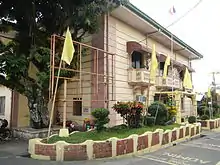
Like other towns in the Philippines, Cavinti is governed by a mayor and vice mayor who are elected to three-year terms. The mayor is the executive head and leads the town's departments in executing the Sangguniang Bayan's ordinances and improving public services. The vice mayor heads a legislative council consisting of councilors, as members.
Elected officials
At present, Cavinti Municipal officials are:
| Name | Party | |
|---|---|---|
| Mayor | ||
| Arrantlee R. Arroyo | PDP–Laban | |
| Vice Mayor | ||
| Milbert L. Oliveros | PDP–Laban | |
| Municipal Councilors | ||
| Charles Clifford F. Matta | Independent | |
| Jimmy Jose V. Oliveros | Lakas | |
| Romel J. Villanueva | Independent | |
| Stephanie Princess P. De Guzman | Nacionalista | |
| Godfrey L. Lubuguin | Aksyon | |
| Elma P. Flores | PDP–Laban | |
| Glenn Haze M. Cabuhat | Independent | |
| Habshan Dave D. Blastique | PDP–Laban | |
Infrastructure
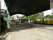
- Municipal health clinics
- Public market
- Cavinti Covered Plaza
- Cavinti Sports Complex
- ABC Multi-Purpose Hall
Transportation
Cavinti is exactly 100 kilometres (62 mi) from Manila. From Manila via Calamba, a bus will take you to Santa Cruz, Laguna. In Santa Cruz, jeepneys going to Cavinti can be found at the jeepney's terminal. Via Santa Cruz, you will pass by the town of Pagsanjan before you reach Cavinti. You will easily know it when you have reached the town because the roads become zigzagged with many sharp twists and turns. Transportation to its barangays are served by tricycles and jeepneys.
Another routes/mode of transportation to go to Cavinti:
- Cavinti to Santa Cruz (jeepney - via Pagsanjan) - Main (Cavinti)
- Cavinti to Santa Cruz (jeepney - via Lumban) - Main (Cavinti)
- Lucban to Santa Cruz (mini-bus) - Via Cavinti
- Lucena to Santa Cruz (mini-bus) - Via Cavinti
- Luisiana to Santa Cruz (jeepney) - Via Cavinti
- Infanta to Lucena (bus) - via Cavinti
Roads and bridges:
- There are two main roads in Cavinti, the Cailles St. where the Public Market and many commercial and business establishments located and the Magsaysay Drive where many commercial, stores, and business establishments located too.
- The two main bridges in Cavinti is the Cavinti Bridge which connects the barangay Duhat and barangay Poblacion, and another main bridge in Cavinti is the Tibatib Bridge which connects the barangay Tibatib and barangay Poblacion.
Communication system
- Landline : PLDT
- Internet connection : SmartBroadband, Globe, PLDT
- Cellular phones : Smart, Globe, Sun Cellular, DITO 4G
- Postal service : Philpost Inc.
- Cable/PayTV : Royal Cable / Community Cable Cignal (PLDT)
Utilities
- Electricity : (FLECO) First Laguna Electric Cooperative
- Water - Cavinti Water Supply System
Education
Public and private schools in Cavinti:
High schools:
- Public : 4
- Private: 1
Elementary :
- Public : 17
- Private: 1
Day Care schools : 17
College : DEAF School (BarangayPaowin)
Media
- All TV: Channel 2
- GMA Network: Channel 7
- TV5: Channel 5
- People's Television Network: Channel 4
- GTV: Channel 27
- A2Z: Channel 11
Transport
Local Provincial Buses South Luzon, from Santa Cruz route via to Luisiana:
- Traditional Jeepney and Fully Aircon Van from Santa Cruz.
References
- ↑ Municipality of Cavinti | (DILG)
- ↑ "2015 Census of Population, Report No. 3 – Population, Land Area, and Population Density" (PDF). Philippine Statistics Authority. Quezon City, Philippines. August 2016. ISSN 0117-1453. Archived (PDF) from the original on May 25, 2021. Retrieved July 16, 2021.
- 1 2 3 Census of Population (2020). "Region IV-A (Calabarzon)". Total Population by Province, City, Municipality and Barangay. Philippine Statistics Authority. Retrieved 8 July 2021.
- ↑ "PSA Releases the 2018 Municipal and City Level Poverty Estimates". Philippine Statistics Authority. 15 December 2021. Retrieved 22 January 2022.
- ↑ Archived 2017-10-29 at the Wayback Machine. Cavinti.gov.ph. Retrieved on 01-12-17.
- ↑ Archived 2017-10-29 at the Wayback Machine. Cavinti.gov.ph. Retrieved on 01-12-17.
- ↑ Act No. 939 (12 October 1903), "An Act reducing the thirty municipalities of the Province of La Laguna to nineteen", Lawyerly, retrieved July 10, 2023
- ↑ Act No. 1712 (12 September 1907), An Act to Increase the Number of Municipalities in the Province of La Laguna From Twenty-two to Twenty-three, by Separating From Luisiana the Former Municipality of Cavinti and Giving to It the Territory Which It Comprised Prior to the Passage of Act Numbered Nine Hundred and Thirty-nine, retrieved July 10, 2023
- ↑ Archived 2017-10-29 at the Wayback Machine. Cavinti.gov.ph. Retrieved on 01-12-17.
- ↑ Archived 2017-10-29 at the Wayback Machine. Cavinti.gov.ph. Retrieved on 01-12-17.
- ↑ Archived 2017-10-29 at the Wayback Machine. Cavinti.gov.ph. Retrieved on 01-12-17.
- ↑ "Cavinti: Average Temperatures and Rainfall". Meteoblue. Retrieved 11 May 2020.
- ↑ "Province: Laguna". PSGC Interactive. Quezon City, Philippines: Philippine Statistics Authority. Retrieved 12 November 2016.
- ↑ Census of Population (2015). "Region IV-A (Calabarzon)". Total Population by Province, City, Municipality and Barangay. Philippine Statistics Authority. Retrieved 20 June 2016.
- ↑ Census of Population and Housing (2010). "Region IV-A (Calabarzon)" (PDF). Total Population by Province, City, Municipality and Barangay. National Statistics Office. Retrieved 29 June 2016.
- ↑ Censuses of Population (1903–2007). "Region IV-A (Calabarzon)". Table 1. Population Enumerated in Various Censuses by Province/Highly Urbanized City: 1903 to 2007. National Statistics Office.
{{cite encyclopedia}}: CS1 maint: numeric names: authors list (link) - ↑ "Province of Laguna". Municipality Population Data. Local Water Utilities Administration Research Division. Retrieved 17 December 2016.
- ↑ "Poverty incidence (PI):". Philippine Statistics Authority. Retrieved December 28, 2020.
- ↑ "Estimation of Local Poverty in the Philippines" (PDF). Philippine Statistics Authority. 29 November 2005.
- ↑ "2003 City and Municipal Level Poverty Estimates" (PDF). Philippine Statistics Authority. 23 March 2009.
- ↑ "City and Municipal Level Poverty Estimates; 2006 and 2009" (PDF). Philippine Statistics Authority. 3 August 2012.
- ↑ "2012 Municipal and City Level Poverty Estimates" (PDF). Philippine Statistics Authority. 31 May 2016.
- ↑ "Municipal and City Level Small Area Poverty Estimates; 2009, 2012 and 2015". Philippine Statistics Authority. 10 July 2019.
- ↑ "PSA Releases the 2018 Municipal and City Level Poverty Estimates". Philippine Statistics Authority. 15 December 2021. Retrieved 22 January 2022.
.svg.png.webp)