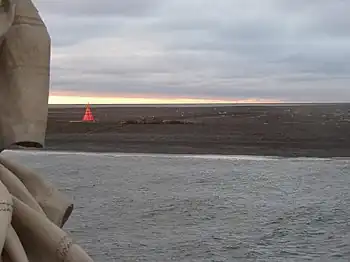
Moffen, 2005.

Moffen, clearly labelled on this map, is on the northern coast of Spitsbergen.
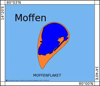
Chart of Moffen.
Moffen is a small, low island north of the mouth of Wijdefjorden, on the northern coast of Spitsbergen, the largest island of the Svalbard archipelago. The island lies just north of 80° so has become a popular target for vessels touring the archipelago but landing or entering the inner waters is strictly forbidden for fear of disturbing the wildlife as the island is an important haul-out area for Walrus and a nesting site for birds. The island was first labelled on a map by Hendrick Doncker, of Amsterdam, in 1655.
References
- Conway, W. M. 1906. No Man's Land: A History of Spitsbergen from Its Discovery in 1596 to the Beginning of the Scientific Exploration of the Country. Cambridge: At the University Press.
- Norwegian Polar Institute: Place names in Norwegian polar areas
80°00′N 14°30′E / 80.000°N 14.500°E
Wikimedia Commons has media related to Moffen.
This article is issued from Wikipedia. The text is licensed under Creative Commons - Attribution - Sharealike. Additional terms may apply for the media files.