Route 331 | ||||
|---|---|---|---|---|
| Route information | ||||
| Maintained by Nova Scotia Department of Transportation and Infrastructure Renewal | ||||
| Length | 57 km[1] (35 mi) | |||
| Major junctions | ||||
| South end | ||||
| North end | ||||
| Location | ||||
| Country | Canada | |||
| Province | Nova Scotia | |||
| Counties | Queens County, Lunenburg | |||
| Highway system | ||||
| ||||
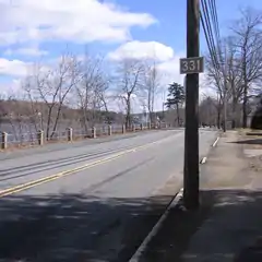
Route 331 outside Bridgewater beside the Lahave River.
Route 331 is a collector road in the Canadian province of Nova Scotia.
It is located on the province's South Shore, connecting Mill Village at Highway 103 with Bridgewater at Route 325.
Communities
Parks
- Rissers Beach Provincial Park
History
The entirety of Collector Highway 331 was once designated as Trunk Highway 31.
See also
References
This article is issued from Wikipedia. The text is licensed under Creative Commons - Attribution - Sharealike. Additional terms may apply for the media files.