Route 1 | ||||
|---|---|---|---|---|
| Trans-Canada Highway Highway of Heroes[1] | ||||
Route 1 highlighted in red. | ||||
| Route information | ||||
| Maintained by Prince Edward Island Department of Transportation and Infrastructure Renewal | ||||
| Length | 119.6 km[2] (74.3 mi) | |||
| Major junctions | ||||
| West end | ||||
| East end | ||||
| Location | ||||
| Country | Canada | |||
| Province | Prince Edward Island | |||
| Counties | Prince, Queens | |||
| Major cities | Charlottetown | |||
| Highway system | ||||
|
| ||||
| ||||

Route 1 is a 120-kilometre (75 mi) long provincial highway that serves as the Prince Edward Island section of the Trans-Canada Highway. Route 1 traverses the southern shores of Prince Edward Island, from the Confederation Bridge in Borden-Carleton to the Wood Islands ferry dock, and bypasses the provincial capital, Charlottetown. It is an uncontrolled access 2-lane highway with a maximum speed limit of 90 km/h (55 mph), except within towns and urban areas.
Route description

Route 1 serves several towns and communities along the southern shore of Prince Edward Island, as well as bypassing the provincial capital, Charlottetown. The route begins at an intersection in Borden-Carleton at the northern end of the Confederation Bridge (the bridge itself and its approach roads are unnumbered federal roads). The bridge crosses the Northumberland Strait to New Brunswick, where the highway becomes New Brunswick Route 16. Travelling eastward, a spur route, Route 1A, branches north towards Summerside. The highway continues meandering east through the communities of Crapaud and Bonshaw, and bypasses Clyde River and Cornwall before crossing the waterway dividing the North River and Graham Rogers Lake into Charlottetown.[2]
Within Charlottetown, Route 1 jogs north along Upton Road then east onto the Charlottetown Perimeter Highway, a four-lane controlled access road bypassing the city. The highway is partially concurrent with Route 2 and includes a displaced left turn intersection with the St. Peter's Highway. The road continues towards the city centre before turning and crossing the Hillsborough River on the Hillsborough River Bridge into Stratford. From there the route travels south near the shore of the Northumberland Strait to Wood Islands. Vehicles can continue via the Northumberland Ferries Limited ferry to Nova Scotia Highway 106 at Caribou, Nova Scotia.[2]
Route 1 features the only grade-separated interchanges in the province: a trumpet interchange with the spur Route 1A in Albany, and double roundabout diamond interchanges at Route 27 in New Haven and Route 19 in Cornwall.
History
On May 17, 2010, construction began on upgrades to the Charlottetown Perimeter Highway.[3] This work was completed later that year on October 15.[4] Route 1 was then transferred from its old routing along University Avenue and Grafton Street onto the new highway.
A proposal to realign Route 1 through Strathgartney Provincial Park west of Charlottetown was met with significant public opposition in 2011.[5] Construction started on a revised route avoiding the park, dubbed Plan B by opponents, in October 2012. Environmentalists protesting at the work site caused construction to be halted for several days.[6] Darcie Lanthier, then interim leader of the P.E.I. Green Party, was arrested[7] and several protesters charged with trespassing before construction resumed. The realignment opened to traffic on September 23, 2013.[8] The protest group, which became known as Stop Plan B, monitored construction throughout the project and returned in October 2015 to plant trees along the new alignment.[9]
.jpg.webp)
On September 6, 2016, construction began on the Cornwall Perimeter Highway, a new alignment bypassing the town of Cornwall to the north.[10][11] Construction was mostly complete and the new bypass opened to traffic on October 1, 2019.[12] Upon its opening, the former alignment was renumbered Route 27. The town plans to develop the former arterial highway into a commercial thoroughfare and community hub.[13]
Major intersections
| County | Location | km[2] | mi | Destinations | Notes |
|---|---|---|---|---|---|
| Northumberland Strait (Abegweit Passage) | −9.2– −1.7 | −5.7– −1.1 | Confederation Bridge (toll leaving PEI) | ||
| Prince | Borden-Carleton | −0.7 | −0.43 | Toll booth (westbound only) | |
| 0.0 | 0.0 | Borden Avenue (west) / Dickie Road (east) | West of this point the Confederation Bridge toll booths and approach ramps are under federal jurisdiction. | ||
| 1.8 | 1.1 | ||||
| Albany | 6.0 | 3.7 | Interchange | ||
| North Tryon | 11.1 | 6.9 | Intersections offset; 35 m (115 ft) concurrency | ||
| | 12.5 | 7.8 | |||
| Tryon | 13.9 | 8.6 | |||
| Queens | Crapaud | 17.1 | 10.6 | ||
| Hampton | 21.9 | 13.6 | |||
| DeSable | 25.9 | 16.1 | |||
| Green Road | 28.4 | 17.6 | |||
| Strathgartney | 34.3 | 21.3 | |||
| New Haven | 37.2 | 23.1 | West end of Route 9 concurrency | ||
| 37.6 | 23.4 | East end of Route 9 concurrency | |||
| Clyde River | 39.7 | 24.7 | Interchange, west end of Cornwall Perimeter Highway[11] | ||
| Cornwall | 45.1 | 28.0 | Interchange | ||
| 47.3 | 29.4 | Roundabout, east end of Cornwall Perimeter Highway[11] | |||
| | 47.7– 48.5 | 29.6– 30.1 | North River Causeway crossing the North River and Graham Rogers Lake | ||
| Charlottetown | 49.1 | 30.5 | Upton Road / Maypoint Road / Capital Drive | Roundabout; Route 1 branches north onto Upton Road | |
| 50.2 | 31.2 | Upton Road / Charlottetown Perimeter Highway | Roundabout; Route 1 branches east onto Charlottetown Perimeter Highway | ||
| 52.0 | 32.3 | West end of Route 2 concurrency | |||
| 53.7 | 33.4 | ||||
| 55.2 | 34.3 | East end of Route 2 concurrency, displaced left turn | |||
| 59.1 | 36.7 | Grafton Street / Water Street | Route 1 branches east onto Hillsborough Bridge | ||
| | 59.4– 60.7 | 36.9– 37.7 | Hillsborough River Bridge crossing the Hillsborough River | ||
| Stratford | 61.1 | 38.0 | |||
| 63.1 | 39.2 | Roundabout | |||
| Mount Albion | 71.7 | 44.6 | |||
| Mount Mellick | 74.0 | 46.0 | |||
| 76.7 | 47.7 | ||||
| Cherry Valley | 78.4 | 48.7 | |||
| | 83.2 | 51.7 | |||
| Orwell | 86.5 | 53.7 | |||
| | 92.0 | 57.2 | |||
| Eldon | 94.3 | 58.6 | |||
| | 96.5 | 60.0 | |||
| South Pinette | 103.3 | 64.2 | |||
| Flat River | 107.5 | 66.8 | |||
| Belle River | 110.3 | 68.5 | |||
| | 110.9 | 68.9 | |||
| 115.1 | 71.5 | ||||
| Wood Islands | 117.8 | 73.2 | |||
| 118.0 | 73.3 | ||||
| 119.3 | 74.1 | ||||
| Northumberland Strait | |||||
1.000 mi = 1.609 km; 1.000 km = 0.621 mi
| |||||
References
- ↑ Poirier, Brett (June 30, 2014). "Highway of Heroes unveiled in Prince Edward Island". The Guardian. Retrieved January 12, 2018.
- 1 2 3 4 Google. "PEI Route 1 - Length and route" (Map). Google Maps. Google.
- ↑ "Governments Celebrate Highway Improvements on the Charlottetown Perimeter Highway". Infrastructure Canada. May 17, 2010. Retrieved September 8, 2016.
- ↑ Infrastructure Canada (October 15, 2010). "Completed Road Work on Two Island Highways Will Improve Traffic Flow and Increase Transit Safety". Government of Canada. Retrieved September 8, 2016.
- ↑ Stewart, Date (December 20, 2011). "Province steers away from provincial park". The Guardian. Retrieved September 8, 2016.
- ↑ "Protest shuts down highway project for 2nd day". CBC News. October 5, 2012. Retrieved September 8, 2016.
- ↑ Tutton, Michael (October 10, 2012). "Interim leader of P.E.I. Green Party arrested in protest". CTV News Atlantic. Retrieved September 8, 2016.
- ↑ "Plan B Trans-Canada reroute partially opens near Bonshaw". CBC News. September 23, 2013. Retrieved September 8, 2016.
- ↑ "Plan B protesters return to P.E.I. highway site to plant trees". CBC News. October 11, 2015. Retrieved September 8, 2016.
- ↑ "Construction to begin for roundabouts of Cornwall bypass". The Guardian. August 24, 2016. Archived from the original on September 16, 2016. Retrieved September 8, 2016.
- 1 2 3 "Cornwall bypass route unveiled". The Guardian. September 8, 2016. Archived from the original on September 9, 2016. Retrieved September 7, 2016.
- ↑ "New portion of Trans-Canada Highway opens on P.E.I." CBC News. October 21, 2019. Retrieved November 13, 2019.
- ↑ Doria-Brown, Jessica (August 28, 2019). "Cornwall's Main Street coming to life as bypass nears completion". CBC News. Retrieved November 13, 2019.
Portions of the Trans-Canada Highway system | ||
|---|---|---|
| British Columbia | 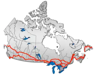 | |
| Alberta | ||
| Saskatchewan | ||
| Manitoba | ||
| Ontario | ||
| Quebec | ||
| New Brunswick | ||
| Prince Edward Island | ||
| Nova Scotia | ||
| Newfoundland | ||
| ||