Achthuizen | |
|---|---|
Village | |
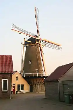
 Windmill Windlust | |
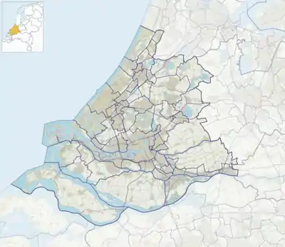
 Achthuizen Location in the province of South Holland in the Netherlands  Achthuizen Location in the Netherlands | |
| Coordinates: 51°41′14″N 4°16′52″E / 51.6872262°N 4.2811338°E | |
| Country | Netherlands |
| Province | South Holland |
| Municipality | Goeree-Overflakkee |
| Area | |
| • Total | 10.63 km2 (4.10 sq mi) |
| Elevation | 0.5 m (1.6 ft) |
| Population (2021)[1] | |
| • Total | 1,075 |
| • Density | 100/km2 (260/sq mi) |
| Time zone | UTC+1 (CET) |
| • Summer (DST) | UTC+2 (CEST) |
| Postal code | 3256[1] |
| Dialing code | 0187 |
Achthuizen is a village in the Dutch province of South Holland. It is a part of the municipality of Goeree-Overflakkee, and lies about 17 km south of Spijkenisse.
The village was first mentioned around 1750 as "De Agthuisen", and means "eight houses".[3] Achthuizen has two diagonally placed centres and looks like a number 8 from the air. Most of the settlement dates from after 1930. Achthuizen was a Roman Catholic enclave on the Protestant island of Goeree. The Catholic Assumption of Mary Church is a neoclassic church from 1846.[4]
The village has a working windmill, Windlust, which is operated on a volunteer basis.[5]
Gallery
_-_Achthuizen_-_20004547_-_RCE.jpg.webp) Assumption of Mary Church (1968)
Assumption of Mary Church (1968)_tijde%252C_Bestanddeelnr_905-5390.jpg.webp) Crashed helicopter during the North Sea flood of 1953
Crashed helicopter during the North Sea flood of 1953
References
- 1 2 3 "Kerncijfers wijken en buurten 2021". Central Bureau of Statistics. Retrieved 3 May 2022.
- ↑ "Postcodetool for 3256AA". Actueel Hoogtebestand Nederland (in Dutch). Het Waterschapshuis. 24 July 2019. Retrieved 3 May 2022.
- ↑ "Achthuizen - (geografische naam)". Etymologiebank (in Dutch). Retrieved 3 May 2022.
- ↑ "Achthuizen". Plaatsengids (in Dutch). Retrieved 3 May 2022.
- ↑ "Windlust (Achthuizen, Zuid-Holland)". Nederlandse Molendatabase. Retrieved 2013-05-12.
Wikimedia Commons has media related to Achthuizen.
This article is issued from Wikipedia. The text is licensed under Creative Commons - Attribution - Sharealike. Additional terms may apply for the media files.