| Anthony Branch Tributary to Warm Fork Spring River | |
|---|---|
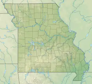
 Location of Anthony Branch mouth  Anthony Branch (the United States) | |
| Location | |
| Country | United States |
| State | Missouri |
| County | Oregon |
| Physical characteristics | |
| Source | Mill Creek divide |
| • location | about 6 miles west of Alton, Missouri |
| • coordinates | 36°41′17.21″N 091°30′47.50″W / 36.6881139°N 91.5131944°W[1] |
| • elevation | 1,010 ft (310 m)[2] |
| Mouth | Warm Fork Spring River |
• location | about 4 miles north of Thayer, Missouri |
• coordinates | 36°36′0.22″N 091°32′52.51″W / 36.6000611°N 91.5479194°W[2] |
• elevation | 584 ft (178 m)[2] |
| Length | 6.64 mi (10.69 km)[3] |
| Basin size | 18.55 square miles (48.0 km2)[4] |
| Discharge | |
| • location | Warm Fork Spring River |
| • average | 24.21 cu ft/s (0.686 m3/s) at mouth with Warm Fork Spring River[4] |
| Basin features | |
| Progression | Warm Fork Spring River → Spring River → Black River → White River → Mississippi River → Gulf of Mexico |
| River system | White River |
| Tributaries | |
| • left | unnamed tributaries |
| • right | unnamed tributaries |
| Bridges | Oregon 327 |
Anthony Branch is a stream in Oregon County in the Ozarks of southern Missouri.[2] It is a tributary of the Warm Fork Spring River.
The stream source area lies south of Missouri Route P about 5 miles west of Alton. The stream flows south-southeast for about six miles and joins the Warm Fork about 4.5 miles north of Thayer.[5]
Anthony Branch, historically called "Anthony Creek", has the name of the local Anthony family.[6]
See also
References
- ↑ "Geographic Names Information System". edits.nationalmap.gov. US Geological Survey. Retrieved January 12, 2023.
- 1 2 3 4 U.S. Geological Survey Geographic Names Information System: Anthony Branch
- ↑ "ArcGIS Web Application". epa.maps.arcgis.com. US EPA. Retrieved January 12, 2023.
- 1 2 "Watershed Report | Office of Water | US EPA". watersgeo.epa.gov. US EPA. Retrieved January 12, 2023.
- ↑ Missouri Atlas & Gazetteer, DeLorme, 1998, First edition, p. 65, ISBN 0-89933-224-2
- ↑ "Oregon County Place Names, 1928–1945". The State Historical Society of Missouri. Archived from the original on June 24, 2016. Retrieved November 24, 2016.
This article is issued from Wikipedia. The text is licensed under Creative Commons - Attribution - Sharealike. Additional terms may apply for the media files.