| Babak | |
|---|---|
 A bridge over the Babak during the colonial era | |
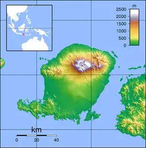
 Location of river mouth | |
| Location | |
| Country | Indonesia |
| Province | West Nusa Tenggara |
| Municipalities | East Lombok, Central Lombok, West Lombok |
| Physical characteristics | |
| Source | Mount Timanuk |
| • elevation | 2575 m |
| Mouth | Lombok Strait |
• coordinates | 8°39′34″S 116°4′9″E / 8.65944°S 116.06917°E |
| Length | 55 km |
| Basin size | 259 km2 |
The Babak River is a river that flows in the island of Lombok, in West Nusa Tenggara, Indonesia.
Course
It originates at Mount Timanuk in East Lombok Regency, with a source elevation of 2,575 meters. It flows in a southwesterly direction, with a parallel drainage pattern, reaching the Lombok Strait at the district of Labuapi, West Lombok Regency. The length of the river's main course is around 55 km.[1]
Watershed
The watershed of the river covers an area of 259 km2.[1] Due to the highly seasonal flow of the river, which overflows during monsoon season and dries up during the dry seasons, it is considered a "critical watershed".[2] Since 2007, efforts have been made by local communities to restore forests in the river's basin, reducing the impact of erosion and flooding.[3]
See also
References
- 1 2 "Katalog Sungai Babak". sda.pu.go.id (in Indonesian). Directorate General of Water Resources, Ministry of Public Works. Retrieved 31 July 2021.
- ↑ "Restorasi Sungai Babak di Lombok-NTB yang kritis difasilitasi BWS". Antara News (in Indonesian). 22 March 2019. Retrieved 31 July 2021.
- ↑ Nandini, Ryke; Kusumandari, Ambar; Gunawan, Totok; Sadono, Ronggo (30 April 2019). "PERUBAHAN KUALITAS LINGKUNGAN PADA HUTAN KEMASYARAKATAN DI DAERAH ALIRAN SUNGAI BABAK, PULAU LOMBOK (Environmental Quality Changes in Community Forests in the Babak River Basin, Lombok Island)". Journal Penelitian Kehutanan FALOAK (in Indonesian). 3 (1): 43–50. doi:10.20886/jpkf.2019.3.1.43-50. ISSN 2579-5805.