Belvoir | |
|---|---|
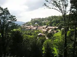
 A general view of Belvoir | |
 Coat of arms | |
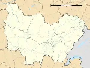
Location of Belvoir | |
 Belvoir  Belvoir | |
| Coordinates: 47°19′06″N 6°36′15″E / 47.3183°N 6.6042°E | |
| Country | France |
| Region | Bourgogne-Franche-Comté |
| Department | Doubs |
| Arrondissement | Montbéliard |
| Canton | Bavans |
| Government | |
| • Mayor (2020–2026) | Christian Brand[1] |
| Area 1 | 9.31 km2 (3.59 sq mi) |
| Population | 92 |
| • Density | 9.9/km2 (26/sq mi) |
| Time zone | UTC+01:00 (CET) |
| • Summer (DST) | UTC+02:00 (CEST) |
| INSEE/Postal code | 25053 /25430 |
| Elevation | 506–671 m (1,660–2,201 ft) |
| 1 French Land Register data, which excludes lakes, ponds, glaciers > 1 km2 (0.386 sq mi or 247 acres) and river estuaries. | |
Belvoir (French pronunciation: [bɛlvwaʁ]) is a commune in the Doubs department in the Bourgogne-Franche-Comté region in eastern France.
Geography
Belvoir lies 18 km (11 mi) southeast of Clerval on a prominent hill.
History
Belvoir is noted for the Belvoir Castle, Château de Belvoir in French, built by Jean de Chalon. It has been rebuilt, now dating to the 12th-17th centuries, and the date of 1224 inscribed above the arch of the north tower is the oldest inscription in Arabic numerals in the region.
Of the first lords of Belvoir, a branch of the Rougemont family, Hue (Huon) I (c. 1188-1239) was a Crusader.[3]
The domain later became the property of the Cusance family, of which Béatrix de Cusance is arguably the most famous member, and the Rohan family were the last noble owners of the castle.
Population
| Year | Pop. | ±% |
|---|---|---|
| 1962 | 120 | — |
| 1968 | 130 | +8.3% |
| 1975 | 115 | −11.5% |
| 1982 | 100 | −13.0% |
| 1990 | 98 | −2.0% |
| 1999 | 102 | +4.1% |
| 2008 | 99 | −2.9% |
| 2012 | 97 | −2.0% |
See also
- Belvoir disambiguation page
- Communes of the Doubs department
References
- ↑ "Répertoire national des élus: les maires". data.gouv.fr, Plateforme ouverte des données publiques françaises (in French). 2 December 2020.
- ↑ "Populations légales 2021". The National Institute of Statistics and Economic Studies. 28 December 2023.
- ↑ at routedescommunes.com (in French)