| Blaby | |
|---|---|
| Former County constituency for the House of Commons | |
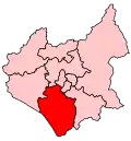
 Boundary of Blaby in Leicestershire for the 2005 general election | |
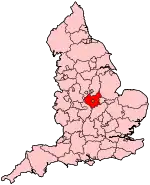
 Location of Leicestershire within England | |
| County | Leicestershire |
| 1974–2010 | |
| Seats | One |
| Created from | Harborough |
| Replaced by | South Leicestershire |
Blaby was a county constituency represented in the House of Commons of the Parliament of the United Kingdom, which existed from 1974 until 2010. It elected one Member of Parliament (MP) by the first past the post system of election. It was a safe seat for the Conservative Party, being held by Conservative MPs throughout its existence.
History
Blaby constituency was created in 1974 from parts of the Harborough seat. It is named after the village of Blaby in south west Leicestershire. A safe Conservative seat consisting mostly of middle-class commuter towns and villages for the neighbouring city of Leicester, it was held for many years by the former Chancellor of the Exchequer Nigel Lawson. Lawson was succeeded in 1992 by Andrew Robathan, who held the seat until its abolition.
Following its review of parliamentary representation in Leicestershire, the Boundary Commission for England renamed the Blaby constituency as South Leicestershire, with minor alterations to its boundaries, in time for the 2010 election.
Boundaries
1974–1983: The Rural Districts of Blaby and Lutterworth.
1983–1997: The District of Blaby, and the District of Harborough wards of Broughton, Dunton, Gilmorton, Kilworth, Lutterworth Linden, Lutterworth St Mary's, Lutterworth Sherrier, Lutterworth Wycliffe, Peatling, and Ullesthorpe.
1997–2010: The District of Blaby wards of Cosby, Countesthorpe, Croft Hill, Enderby, Flamville, Fosse, Glen Parva, Millfield, Narborough, Normanton, Northfield, Ravenhurst, St John's, Stanton, Whetstone, Winchester, and Winstanley, and the District of Harborough wards of Broughton, Dunton, Gilmorton, Kilworth, Lutterworth Linden, Lutterworth St Mary's, Lutterworth Sherrier, Lutterworth Wycliffe, Peatling, and Ullesthorpe.
Members of Parliament
| Election | Member[1] | Party | Notes | |
|---|---|---|---|---|
| February 1974 | Nigel Lawson | Conservative | Later Baron Lawson of Blaby; Cabinet minister 1981-89 | |
| 1992 | Andrew Robathan | Conservative | Later Baron Robathan of Poultney | |
| 2010 | Constituency abolished: see South Leicestershire | |||
Elections

Elections in the 1970s
| Party | Candidate | Votes | % | ±% | |
|---|---|---|---|---|---|
| Conservative | Nigel Lawson | 26,892 | 48.7 | ||
| Liberal | G. Broad | 14,594 | 26.4 | ||
| Labour | D. E. Lack | 13,749 | 24.9 | ||
| Majority | 12,298 | 22.3 | |||
| Turnout | 55,235 | 85.6 | |||
| Conservative win (new seat) | |||||
| Party | Candidate | Votes | % | ±% | |
|---|---|---|---|---|---|
| Conservative | Nigel Lawson | 25,405 | 49.9 | +1.2 | |
| Labour | Malcolm Fox | 13,244 | 26.0 | +1.1 | |
| Liberal | D. Inman | 12,290 | 24.1 | −2.3 | |
| Majority | 12,161 | 23.9 | +1.6 | ||
| Turnout | 50,939 | 78.3 | −7.3 | ||
| Conservative hold | Swing | ||||
| Party | Candidate | Votes | % | ±% | |
|---|---|---|---|---|---|
| Conservative | Nigel Lawson | 33,221 | 58.1 | +8.2 | |
| Labour | Keith Hill | 12,581 | 22.0 | −4.0 | |
| Liberal | D. Inman | 9,277 | 16.2 | −7.9 | |
| National Front | P. Gegan | 2,056 | 3.6 | New | |
| Majority | 20,640 | 36.1 | +12.2 | ||
| Turnout | 57,135 | 83.3 | +5.0 | ||
| Conservative hold | Swing | ||||
Elections in the 1980s
| Party | Candidate | Votes | % | ±% | |
|---|---|---|---|---|---|
| Conservative | Nigel Lawson | 32,689 | 58.7 | +0.6 | |
| Alliance (Liberal) | Richard Lustig | 15,573 | 28.0 | +11.8 | |
| Labour | Christopher Wrigley | 6,838 | 12.3 | −9.7 | |
| National Front | P. Gegan | 568 | 1.0 | −2.6 | |
| Majority | 17,116 | 30.7 | −5.4 | ||
| Turnout | 55,668 | 77.4 | −5.9 | ||
| Conservative hold | Swing | ||||
| Party | Candidate | Votes | % | ±% | |
|---|---|---|---|---|---|
| Conservative | Nigel Lawson | 37,732 | 60.5 | +1.8 | |
| Alliance (Liberal) | Richard Lustig | 15,556 | 25.0 | −3.0 | |
| Labour | James Roberts | 9,046 | 14.5 | +2.2 | |
| Majority | 22,176 | 35.5 | +4.8 | ||
| Turnout | 62,334 | 80.9 | +3.5 | ||
| Conservative hold | Swing | ||||
Elections in the 1990s
| Party | Candidate | Votes | % | ±% | |
|---|---|---|---|---|---|
| Conservative | Andrew Robathan | 39,498 | 57.9 | −2.6 | |
| Labour | Ethel Ranson | 14,151 | 20.8 | +6.3 | |
| Liberal Democrats | Marjorie Lewin | 13,780 | 20.2 | −4.8 | |
| BNP | John Peacock | 521 | 0.8 | New | |
| Natural Law | Sue Lincoln | 260 | 0.4 | New | |
| Majority | 25,347 | 37.1 | +1.6 | ||
| Turnout | 68,210 | 83.4 | +2.5 | ||
| Conservative hold | Swing | ||||
| Party | Candidate | Votes | % | ±% | |
|---|---|---|---|---|---|
| Conservative | Andrew Robathan | 24,564 | 45.8 | −12.1 | |
| Labour | Ross Willmott | 18,090 | 33.8 | +13.0 | |
| Liberal Democrats | Geoff Welsh | 8,001 | 14.9 | −5.3 | |
| Referendum | Robert Harrison | 2,018 | 3.8 | New | |
| BNP | John Peacock | 523 | 1.0 | +0.2 | |
| Independent | Terence Stokes | 397 | 0.7 | New | |
| Majority | 6,474 | 12.0 | −25.1 | ||
| Turnout | 53,593 | 76.1 | −7.3 | ||
| Conservative hold | Swing | ||||
Elections in the 2000s
| Party | Candidate | Votes | % | ±% | |
|---|---|---|---|---|---|
| Conservative | Andrew Robathan | 22,104 | 46.4 | +0.6 | |
| Labour | John Morgan | 15,895 | 33.4 | −0.4 | |
| Liberal Democrats | Geoff Welsh | 8,286 | 17.4 | +2.5 | |
| BNP | Edward Scott | 1,357 | 2.8 | +1.8 | |
| Majority | 6,209 | 13.0 | +1.0 | ||
| Turnout | 47,642 | 64.5 | −11.6 | ||
| Conservative hold | Swing | ||||
| Party | Candidate | Votes | % | ±% | |
|---|---|---|---|---|---|
| Conservative | Andrew Robathan | 22,487 | 45.5 | −0.9 | |
| Labour | John Morgan | 14,614 | 29.6 | −3.8 | |
| Liberal Democrats | Jeff Stephenson | 9,382 | 19.0 | +1.6 | |
| BNP | Michael Robinson | 1,704 | 3.5 | +0.7 | |
| UKIP | Delroy Young | 1,201 | 2.4 | New | |
| Majority | 7,873 | 15.9 | +2.9 | ||
| Turnout | 49,388 | 65.5 | +1.0 | ||
| Conservative hold | Swing | +1.5 | |||
From the general election of 2010, Blaby has been re-shaped and renamed South Leicestershire.
See also
Notes and references
- ↑ Leigh Rayment's Historical List of MPs – Constituencies beginning with "B" (part 3)
- ↑ "Election Data 1983". Electoral Calculus. Archived from the original on 15 October 2011. Retrieved 18 October 2015.
- ↑ "Election Data 1987". Electoral Calculus. Archived from the original on 15 October 2011. Retrieved 18 October 2015.
- ↑ "Election Data 1992". Electoral Calculus. Archived from the original on 15 October 2011. Retrieved 18 October 2015.
- ↑ "Politics Resources". Election 1992. Politics Resources. 9 April 1992. Archived from the original on 24 July 2011. Retrieved 6 December 2010.
- ↑ "Election Data 1997". Electoral Calculus. Archived from the original on 15 October 2011. Retrieved 18 October 2015.
- ↑ "Election Data 2001". Electoral Calculus. Archived from the original on 15 October 2011. Retrieved 18 October 2015.
- ↑ "Election Data 2005". Electoral Calculus. Archived from the original on 15 October 2011. Retrieved 18 October 2015.
Sources
- "United Kingdom Parliamentary Election Results 1997". Election Demon. 15 December 2019. Archived from the original on 15 December 2019.
- Guardian Unlimited Politics | Ask Aristotle | Blaby - Election History Archived 30 November 2004 at the Wayback Machine - Elections (1992–1997)
- UK General Elections since 1832 Archived 5 May 2004 at the Wayback Machine - Elections (1974–1992)