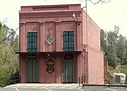
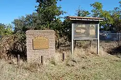
This list includes properties and districts listed on the California Historical Landmark listing in Shasta County, California. Click the "Map of all coordinates" link to the right to view a Google map of all properties and districts with latitude and longitude coordinates in the table below.

Image [1] Landmark name Location City or town Summary
Bass Hill
Bass Hill
148 Bass Hill Castle Crags State Park
40°45′15″N 122°19′23″W / 40.754134°N 122.323094°W / 40.754134; -122.323094 (Bass Hill)
Central Valley California-Oregon Stagecoach Company road on Bass Hill
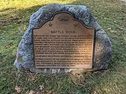
Battle Rock
Battle Rock
116 Battle Rock Castle Crags State Park
41°08′54″N 122°19′17″W / 41.148326°N 122.321521°W / 41.148326; -122.321521 (Battle Rock)
Castella
Bell's Bridge
Bell's Bridge
519 Bell's Bridge Hwy 99 & Clear Creek Rd.
40°31′00″N 122°22′54″W / 40.516569°N 122.3816°W / 40.516569; -122.3816 (Bell's Bridge)
Redding
Clear Creek
Clear Creek
78 Clear Creek Old Hwy 99 and Canyon Rd.
40°35′32″N 122°28′40″W / 40.592222°N 122.477778°W / 40.592222; -122.477778 (Clear Creek)
Redding Pierson B. Reading gold find site
Dersch Homestead
Dersch Homestead
120 Dersch Homestead Dersch Rd. at Bear Creek
40°29′10″N 122°09′03″W / 40.486217°N 122.150867°W / 40.486217; -122.150867 (Dersch Homestead)
Anderson
Fort Crook
Fort Crook
355 Fort Crook McArthur Rd. & Soldier Mountain Dr.
41°05′19″N 121°30′52″W / 41.088633°N 121.51435°W / 41.088633; -121.51435 (Fort Crook)
Glenburn
Fort Reading
Fort Reading
379 Fort Reading Deschutes and Dersch Rds.
40°28′35″N 122°13′49″W / 40.47645°N 122.230367°W / 40.47645; -122.230367 (Fort Reading)
Anderson
Foundation of Catholic Basilica
483 Foundation of Catholic Basilica Red Bluff Rd and Crocker Alley
40°35′34″N 122°29′19″W / 40.592683°N 122.488733°W / 40.592683; -122.488733 (Foundation of Catholic Basilica)
Shasta
French Gulch
French Gulch
166 French Gulch Historic district
40°41′58″N 122°38′19″W / 40.699483°N 122.638733°W / 40.699483; -122.638733 (French Gulch)
French Gulch
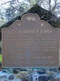
Lockhart Ferry
Lockhart Ferry
555 Lockhart Ferry State Hwy 299
41°00′09″N 121°26′38″W / 41.0024°N 121.4438°W / 41.0024; -121.4438 (Lockhart Ferry)
Fall River Mills
Noble Pass Route
Noble Pass Route
11 Noble Pass Route Lassen Volcanic National Park
40°33′29″N 121°31′54″W / 40.5581444444444°N 121.531777777778°W / 40.5581444444444; -121.531777777778 (Noble Pass Route)
Old California-Oregon Road
58 Old California-Oregon Road NW corner of Hwy 273 and Spring Gulch Rd.
40°27′57″N 122°19′30″W / 40.465928°N 122.32487°W / 40.465928; -122.32487 (Old California-Oregon Road)
Anderson
Old town of Shasta
Old town of Shasta
77 Old town of Shasta Shasta State Historic Park
40°35′56″N 122°29′32″W / 40.599°N 122.49225°W / 40.599; -122.49225 (Old town of Shasta)
Shasta Also on the NRHP list as NPS-71000199
Pioneer baby's grave
377 Pioneer baby's grave State Hwy 299
40°36′14″N 122°29′58″W / 40.603983°N 122.499417°W / 40.603983; -122.499417 (Pioneer baby's grave)
Shasta
Reading Adobe
Reading Adobe
10 Reading Adobe Reading Island Park, 213 Adobe Rd.
40°22′17″N 122°17′01″W / 40.371283°N 122.283717°W / 40.371283; -122.283717 (Reading Adobe)
Cottonwood
Reading's Bar
Reading's Bar
32 Reading's Bar Clear Creek Bridge
40°29′41″N 122°29′50″W / 40.49465°N 122.49725°W / 40.49465; -122.49725 (Reading's Bar)
Redding Also the site of Clear Creek Diggings-Horsetown.
Site of first school in Fall River Valley
759 Site of first school in Fall River Valley State Hwy 299
41°04′15″N 121°20′15″W / 41.070967°N 121.337483°W / 41.070967; -121.337483 (Site of first school in Fall River Valley)
McArthur
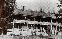
Southern Hotel & Stage Station
33 Southern Hotel & Stage Station On old Hwy 99, 0.7 mi SW of Sims exit
41°04′01″N 122°21′42″W / 41.066937°N 122.36153°W / 41.066937; -122.36153 (Southern Hotel & Stage Station)
Castella
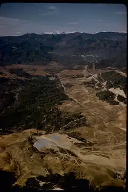
Whiskeytown
Whiskeytown
131 Whiskeytown Whiskey Creek Rd. & State Hwy 299
40°38′05″N 122°33′40″W / 40.6348°N 122.561°W / 40.6348; -122.561 (Whiskeytown)
Whiskeytown The site of Whiskeytown is under Whiskeytown Lake, marker is by the lake.

References

  1. "California Historical Landmarks By County". Ohp.parks.ca.gov. Retrieved 2019-04-03.

See also

This article is issued from Wikipedia. The text is licensed under Creative Commons - Attribution - Sharealike. Additional terms may apply for the media files.