Carey, Ohio | |
|---|---|
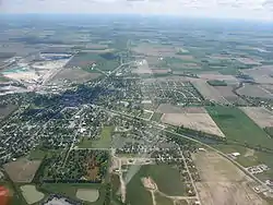
 Aerial view of Carey | |
| Motto: "Rock Solid Since 1858!" | |
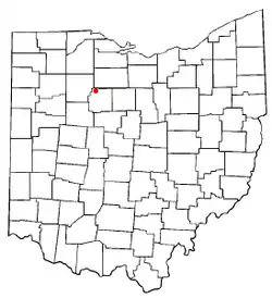
 Location of Carey, Ohio | |
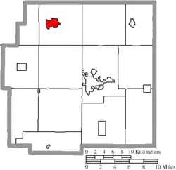
 Location of Carey in Wyandot County | |
| Coordinates: 40°57′7″N 83°22′54″W / 40.95194°N 83.38167°W | |
| Country | United States |
| State | Ohio |
| County | Wyandot |
| Township | Crawford |
| Government | |
| • Mayor | Jennifer Rathburn |
| Area | |
| • Total | 2.17 sq mi (5.61 km2) |
| • Land | 2.16 sq mi (5.59 km2) |
| • Water | 0.01 sq mi (0.02 km2) |
| Elevation | 820 ft (250 m) |
| Population (2020) | |
| • Total | 3,565 |
| • Density | 1,651.23/sq mi (637.52/km2) |
| Time zone | UTC-5 (Eastern (EST)) |
| • Summer (DST) | UTC-4 (EDT) |
| ZIP code | 43316 |
| Area code | 419 |
| FIPS code | 39-12112[3] |
| GNIS feature ID | 1056766[2] |
| Website | Village of Carey, Ohio |
Carey is a village in Wyandot County, Ohio, United States. The population was 3,565 at the 2020 census.
History
The village is near Sheriden Cave, where habitation occurred around 11,000BC.[4] The village of Carey was founded in 1843 when William M. Buell and R. M. Shuler laid out the town on land that they owned. The town was named after Judge John Carey, an early prominent resident.[5][6]
Geography
Carey is located at 40°57′7″N 83°22′54″W / 40.95194°N 83.38167°W (40.951978, -83.381673).[7]
According to the United States Census Bureau, the village has a total area of 1.99 square miles (5.15 km2), of which 1.98 square miles (5.13 km2) is land and 0.01 square miles (0.03 km2) is water.[8]
Demographics
| Census | Pop. | Note | %± |
|---|---|---|---|
| 1870 | 692 | — | |
| 1880 | 1,148 | 65.9% | |
| 1890 | 1,605 | 39.8% | |
| 1900 | 1,816 | 13.1% | |
| 1910 | 2,225 | 22.5% | |
| 1920 | 2,488 | 11.8% | |
| 1930 | 2,722 | 9.4% | |
| 1940 | 2,984 | 9.6% | |
| 1950 | 3,260 | 9.2% | |
| 1960 | 3,722 | 14.2% | |
| 1970 | 3,523 | −5.3% | |
| 1980 | 3,674 | 4.3% | |
| 1990 | 3,684 | 0.3% | |
| 2000 | 3,901 | 5.9% | |
| 2010 | 3,674 | −5.8% | |
| 2020 | 3,565 | −3.0% | |
| U.S. Decennial Census[9] | |||
2010 census
As of the census[10] of 2010, there were 3,674 people, 1,521 households, and 983 families living in the village. The population density was 1,855.6 inhabitants per square mile (716.5/km2). There were 1,646 housing units at an average density of 831.3 per square mile (321.0/km2). The racial makeup of the village was 96.2% White, 0.2% African American, 0.2% Native American, 1.6% Asian, 0.7% from other races, and 1.0% from two or more races. Hispanic or Latino of any race were 2.0% of the population.
There were 1,521 households, of which 34.7% had children under the age of 18 living with them, 44.8% were married couples living together, 13.8% had a female householder with no husband present, 6.0% had a male householder with no wife present, and 35.4% were non-families. 31.1% of all households were made up of individuals, and 11.9% had someone living alone who was 65 years of age or older. The average household size was 2.41 and the average family size was 2.99.
The median age in the village was 37.1 years. 26.4% of residents were under the age of 18; 8.2% were between the ages of 18 and 24; 25.4% were from 25 to 44; 27% were from 45 to 64; and 13% were 65 years of age or older. The gender makeup of the village was 49.3% male and 50.7% female.
2000 census
As of the census[3] of 2000, there were 3,901 people, 1,543 households, and 1,023 families living in the village. The population density was 1,977.6 inhabitants per square mile (763.6/km2). There were 1,607 housing units at an average density of 814.6 per square mile (314.5/km2). The racial makeup of the village was 96.41% White, 0.15% African American, 0.10% Native American, 1.74% Asian, 0.85% from other races, and 0.74% from two or more races. Hispanic or Latino of any race were 1.38% of the population.
There were 1,543 households, out of which 33.2% had children under the age of 18 living with them, 47.6% were married couples living together, 13.2% had a female householder with no husband present, and 33.7% were non-families. 29.9% of all households were made up of individuals, and 12.3% had someone living alone who was 65 years of age or older. The average household size was 2.49 and the average family size was 3.07.
In the village, the population was spread out, with 26.9% under the age of 18, 9.9% from 18 to 24, 28.6% from 25 to 44, 20.2% from 45 to 64, and 14.4% who were 65 years of age or older. The median age was 34 years. For every 100 females there were 93.3 males. For every 100 females age 18 and over, there were 90.6 males.
The median income for a household in the village was $33,116, and the median income for a family was $40,921. Males had a median income of $30,938 versus $22,123 for females. The per capita income for the village was $15,309. About 4.6% of families and 8.6% of the population were below the poverty line, including 8.5% of those under age 18 and 9.2% of those age 65 or over.
Education
Carey Public Schools are part of the Carey Exempted Village School District. There is one elementary school, one high school, and one Catholic School (Our Lady of Consolation) in the district. Students attend Carey High School.[11] The school mascot is the Blue Devil. Carey High School (CHS) offers many athletic teams such as football, basketball, track, cross country, volleyball, softball, golf, baseball and wrestling.
Carey has a lending library, the Dorcas Carey Public Library.[12]
Government
Carey is served by a mayor and a six-member village council.[13] The mayor and council members are elected for four-year terms, with elections every two years. Two council members are elected in the same cycle as the mayor; the remaining four council members are elected in alternate election years. Carey's current mayor, Jennifer Rathburn, is a lifelong resident of the village who was elected in 2017 after previous stints as interim mayor and council president.[14]
Notable people
- John Carey, US Congressman who lived and died in Carey. The town was named after him.
- Don Wedge, NFL and Collegiate Official
References
- ↑ "ArcGIS REST Services Directory". United States Census Bureau. Retrieved September 20, 2022.
- 1 2 "US Board on Geographic Names". United States Geological Survey. October 25, 2007. Retrieved January 31, 2008.
- 1 2 "U.S. Census website". United States Census Bureau. Retrieved January 31, 2008.
- ↑ Room, News. "Indian Trail Caverns home to major archaeological find | The Courier". Retrieved March 6, 2020.
{{cite web}}:|first1=has generic name (help) - ↑ "Village of Carey -- Where it all began..." Retrieved April 23, 2007.
- ↑ Gannett, Henry (1905). The Origin of Certain Place Names in the United States. Govt. Print. Off. p. 69.
- ↑ "US Gazetteer files: 2010, 2000, and 1990". United States Census Bureau. February 12, 2011. Retrieved April 23, 2011.
- ↑ "US Gazetteer files 2010". United States Census Bureau. Archived from the original on July 2, 2012. Retrieved January 6, 2013.
- ↑ "Census of Population and Housing". Census.gov. Retrieved June 4, 2015.
- ↑ "U.S. Census website". United States Census Bureau. Retrieved January 6, 2013.
- ↑ "Carey Exempted Village Schools". Carey Exempted Village Schools. Archived from the original on July 27, 2012. Retrieved August 4, 2012.
- ↑ "Wyandot County Public Libraries". Every Library. Retrieved March 3, 2018.
- ↑ "Local Government Leadership Team". Village of Carey. Archived from the original on August 5, 2018. Retrieved August 4, 2018.
- ↑ "Our Current Mayor". Village of Care. Archived from the original on August 5, 2018. Retrieved August 4, 2018.
