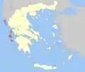
Central Corfu and Diapontian Islands
Κεντρική Κέρκυρα και Διαπόντια Νησιά | |
|---|---|
 Central Corfu and Diapontian Islands Location within the region  | |
| Coordinates: 39°38′N 19°49′E / 39.633°N 19.817°E | |
| Country | Greece |
| Administrative region | Ionian Islands |
| Regional unit | Corfu |
| Government | |
| • Mayor | Merope Ydraiou |
| Area | |
| • Municipality | 259.5 km2 (100.2 sq mi) |
| Population (2011)[1] | |
| • Municipality | 68,558 |
| • Municipality density | 260/km2 (680/sq mi) |
| Time zone | UTC+2 (EET) |
| • Summer (DST) | UTC+3 (EEST) |
| Website | www |
Central Corfu and Diapontian Islands (Greek: Κεντρική Κέρκυρα και Διαπόντια Νησιά Kentriki Kerkyra kai Diapontia Nisia) is a municipality in the Ionian Islands region in Greece. It covers the central part of the island of Corfu and the Diapontian Islands. The municipality was formed at the 2019 local government reform, when the pre-existing municipality of Corfu was divided in three.[2] Its seat is the city Corfu.[2]
The municipality consists of the following eight subdivisions (municipal units):[2]
References
- ↑ "Απογραφή Πληθυσμού - Κατοικιών 2011. ΜΟΝΙΜΟΣ Πληθυσμός" (in Greek). Hellenic Statistical Authority.
- 1 2 3 "Τροποποίηση του άρθρου 1 του ν. 3852/2010" [Amendment of Article 1 of l. 3852/2010] (in Greek). Government Gazette. p. 1164.
This article is issued from Wikipedia. The text is licensed under Creative Commons - Attribution - Sharealike. Additional terms may apply for the media files.
