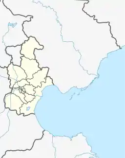
Dingzigu Subdistrict
丁字沽街道 | |
|---|---|
.jpg.webp) Tianjin Train Station located inside the subdistrict, 2011 | |
.png.webp) Location in Hongqiao District | |
 Dingzigu Subdistrict  Dingzigu Subdistrict | |
| Coordinates: 39°10′25″N 117°09′30″E / 39.17361°N 117.15833°E | |
| Country | China |
| Municipality | Tianjin |
| District | Hongqiao |
| Village-level Divisions | 14 communities |
| Area | |
| • Total | 2.48 km2 (0.96 sq mi) |
| Elevation | 8 m (26 ft) |
| Population (2010) | |
| • Total | 98,652 |
| • Density | 40,000/km2 (100,000/sq mi) |
| Time zone | UTC+8 (China Standard) |
| Postal code | 300130 |
| Area code | 022 |
Dingzigu Subdistrict (Chinese: 丁字沽街道; pinyin: Dīngzìgū Jiēdào) is a subdistrict situated in the northern part of Hongqiao District, Tianjin, China. It borders Tianmu Town to its north, Xinkaihe Subdistrict to its east, Xigu and Xiyuzhuang Subdistricts to its south, and Xianyang North Road Subdistrict to its west. Its population was 98,652 as of 2010.[1]
The subdistrict was formed in 1952. Its name Dingzigu comes from the fact that the section of the Grand Canal that passes through this region is shaped like a Chinese Character Ding (丁).[2]
Geography
Dingzigu subdistrict is situated on the south of Grand Canal.
Administrative divisions
At the end of 2021, Dingzigu Subdistrict comprised 14 residential communities. They can be seen in the list below:[3]
| Subdivision Names | Name Transliterations |
|---|---|
| 光采 | Guangcai |
| 风貌里 | Fengmaoli |
| 三段 | Sanduan |
| 六段 | Liuduan |
| 十段 | Shiduan |
| 勤俭桥 | Qinjianqiao |
| 桃花园 | Taohuayuan |
| 东大楼 | Dongdalou |
| 潞河园 | Luheyuan |
| 北平房 | Beipingfang |
| 胜灾 | Shengzhai |
| 十三段 | Shisanduan |
| 光荣道 | Guangrongdao |
| 南北大街 | Nanbei Dajie |
See also
References
- ↑ "China: Tiānjīn Municipal Province (Districts and Townships) - Population Statistics, Charts and Map". www.citypopulation.de. Retrieved 2022-11-05.
- ↑ 中华人民共和国政区大典:天津市卷 (in Chinese). 中国社会出版社. 2020.
- ↑ "2021年统计用区划代码和城乡划分代码". www.stats.gov.cn. Retrieved 2022-12-08.
This article is issued from Wikipedia. The text is licensed under Creative Commons - Attribution - Sharealike. Additional terms may apply for the media files.