Dunchurch | |
|---|---|
Compact rural community[1] | |
 | |
| Etymology: named after Dunchurch, Warwickshire | |
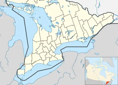
 Dunchurch Location of Dunchurch in southern Ontario | |
| Coordinates: 45°38′55″N 79°51′04″W / 45.64861°N 79.85111°W[1] | |
| Country | Canada |
| Province | Ontario |
| Census division | Parry Sound District |
| Municipality | Whitestone |
| First settled | Summer 1870 |
| First named | 1873 |
| Given present name | 1877 |
| Elevation | 258 m (846 ft) |
| Time zone | UTC-5 (Eastern (EST)) |
| • Summer (DST) | UTC-4 (EDT) |
| Postal Code | P0A 1G0[3] |
| Area codes | 705, 249[4] |
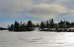
Dunchurch is a compact rural community in the Canadian province of Ontario, located in the municipality of Whitestone in Parry Sound District.[1][5][6][7][8]
History
The community was first settled in late summer 1870 when Arthur Millin, arriving on The Great North Road (that had begun construction in 1867) from Parry Sound, claimed a homestead plot.[9] In 1873, the community was given the name Newcombe. The first log schoolhouse, which doubled as a union church (a church available to multiple denominations), was erected in 1875 on land in the centre of the community.[9] To avoid confusion with similarly named places in the province, in 1877 postmaster George Kelcey renamed the community after his birthplace in Warwickshire, England.[10] Organizing for the founding of a Presbyterian church was first recorded in 1889, and a church building completed in 1897 as Knox Presbyterian Church. The building serves today as Knox United Church.[11] The first public lending library opened in Dunchurch in 1973 in part of a portable classroom.[12]
Geography
The community is on Whitestone Lake, which eventually flows to Georgian Bay on Lake Huron as part of the Magnetawan River system. Two narrows in the community, Dunchurch Narrows and Dunchurch Second Narrows — with a small basin in between —, separate the North Reach of Whitestone Lake from the Middle Reach.[6]
Climate
The Meteorological Service of Canada had a measurement station (site ID: 6112133) at Dunchurch operating from 1973 to 2014.
| Dunchurch (MSC site ID: 6112133) | ||||||||||||||||||||||||||||||||||||||||||||||||||||||||||||
|---|---|---|---|---|---|---|---|---|---|---|---|---|---|---|---|---|---|---|---|---|---|---|---|---|---|---|---|---|---|---|---|---|---|---|---|---|---|---|---|---|---|---|---|---|---|---|---|---|---|---|---|---|---|---|---|---|---|---|---|---|
| Climate chart (explanation) | ||||||||||||||||||||||||||||||||||||||||||||||||||||||||||||
| ||||||||||||||||||||||||||||||||||||||||||||||||||||||||||||
| ||||||||||||||||||||||||||||||||||||||||||||||||||||||||||||
Government
The offices of the Municipality of Whitestone are in Dunchurch.[14] They were built for the then Township of Hagerman in 1997.[12] The building also houses a branch of the Whitestone Fire department. Adjacent is the Whitestone and Area Nursing Station, managed by West Parry Sound Health Centre, where healthcare services are provided by a nurse practitioner.[15] The community is the site of one of two waste management facilities in Whitestone.[16]
Transportation
Dunchurch is on Ontario Highway 124 and on Ontario Highway 520.[8]
Education
Whitestone Lake Public School (JK–8) is operated by the Near North District School Board.[17]
The Whitestone Public Library is located in Dunchurch. As of January 2021, the facility is closed for renovation and expansion, which will include the addition of two meeting rooms and a conference room.[12]
External links
References
- 1 2 3 "Dunchurch". Geographical Names Data Base. Natural Resources Canada. Retrieved 2021-01-10.
- ↑ "Google Earth". Retrieved 2021-01-12.
- ↑ "Post Office Locator - Dunchurch, Ontario". Canada Post. Retrieved 2008-06-09.
- ↑ "Canadian Area Code Maps". Canadian Numbering Administration Consortium. Retrieved 2021-01-12.
- ↑ "Toporama (on-line map and search)". Atlas of Canada. Natural Resources Canada. Retrieved 2021-01-12.
- 1 2 "Ontario Geonames GIS (on-line map and search)". Ontario Ministry of Natural Resources and Forestry. 2014. Retrieved 2021-01-12.
- ↑ Restructured municipalities - Ontario map #4 (Map). Restructuring Maps of Ontario. Ontario Ministry of Municipal Affairs and Housing. 2006. Retrieved 2021-01-12.
- 1 2 Map 8 (PDF) (Map). 1 : 700,000. Official road map of Ontario. Ministry of Transportation of Ontario. 2020-01-01. Retrieved 2021-01-12.
- 1 2 Mcfie, John (2006-06-29). "How the three 'Rs' came to the town of Dunchurch". Huntsville Forester. Retrieved 2021-01-12.
- ↑ Rayburn, Alan (1997). Place names of Ontario. Toronto: University of Toronto Press. p. 98. ISBN 0-8020-7207-0. Retrieved 16 October 2017.
- ↑ Mcfie, John (2013-06-05). "Old minute book records the Dunchurch church's beginnings". Huntsville Forester. Retrieved 2021-01-12.
- 1 2 3 "Our history". Whitestone Public Library. Retrieved 2021-01-12.
- ↑ "Dunchurch". Canadian Climate Normals 1971–2000 Station Data. Environment Canada. Retrieved 2021-01-12.
- ↑ "Home page". Municipality of Whitestone. Retrieved 2021-01-12.
- ↑ "Whitestone and Area Nursing Station". Rural Nursing Stations. West Parry Sound Health Centre. Retrieved 2021-01-12.
- ↑ "Waste Management & Landfill Sites". Municipality of Whitestone. Retrieved 2021-01-12.
- ↑ "Whitestone Lake Public School". Near North District School Board. Retrieved 2021-01-12.