Dunyapur
دنیا پور | |
|---|---|
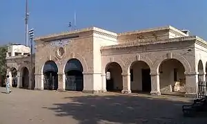
 A picture of the Dunaypur Railway Station | |
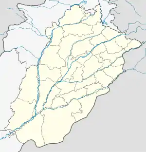
 Dunyapur Location in Punjab  Dunyapur Dunyapur (Pakistan) | |
| Coordinates: 29°48′10″N 71°44′36″E / 29.80275°N 71.74344°E[1] | |
| Country | |
| Province | |
| District | Lodhran |
| Tehsil | Dunyapur |
| Population | |
| • Total | 41,554 |
| Time zone | UTC+5 (PST) |
| • Summer (DST) | UTC+6 (PDT) |
| Website | www.tmadunyapur.com |
Dunyapur is a city in Lodhran District of Punjab, Pakistan. It is located 33 kilometres (21 mi) north of the district capital of Lodhran, on the bank of the Bahawalpur road. It is the headquarters of the Dunyapur Tehsil. As of 2017, the city's population is 41,554. Major castes are Awan, Arain, Gujjar, Jutt and Rajpoot.
History
Dunyapūr was listed in the Ain-i-Akbari as a pargana in sarkar Multan, counted as part of the Bet Jalandhar Doab.[3]: 329 It was assessed at 1,876,862 dams in revenue and supplied a force of 50 cavalry and 400 infantry.[3]: 329
Demographics
As of 2017, the city of Dunyapur has a population of 41,554 (20,923 male, 20,621 female, and 10 other).[2] The average household size is 6.20 people.[4] In terms of age distribution, 26.6% of Dunyapur residents were under age 10 in 2017 (11,069 in total); 18.9% were between 10 and 18 (7,874 in total); 49.0% were between 18 and 60 (20,363 in total); and 5.4% were over the age of 60 (2,248 in total).[2] The city's working population was 10,820 (not counting children under the age of 10).[2] In terms of religion, 41,190 residents were Muslim and 364 were non-Muslim.[2]
The overall literacy rate in the city is 67.07% (73.42% among males and 60.74% among females).[2] In terms of education, a total of 5,719 males and 4,547 females had completed primary school but had not completed matriculation exams; 3,151 males and 2,684 females had completed matriculation but not university, and 1,005 males and 1,025 females had completed university.[2]
The city had 6,643 houses as of 2017; 5,685 were pakka, 728 were semi-pakka, and 230 were kachcha.[4] 5,893 houses (88.7%) had potable water, 6,556 (98.7%) had access to electricity, 4,490 (67.6%) had access to gas, 4,097 (61.7%) had a kitchen, 6,395 (96.3%) had at a bathroom, and 6,483 (97.6%) had a latrine.[4]
References
- ↑ "Geonames Search". Do a radial search using these coordinates here.
- 1 2 3 4 5 6 7 Census 2017 District Wise Results: District Lodhran: Selected population statistics of urban localities (PDF). Pakistan Bureau of Statistics. Retrieved 26 March 2023.
- 1 2 Abu'l-Fazl ibn Mubarak (1891). The Ain-i-Akbari. Translated by Jarrett, Henry Sullivan. Calcutta: Asiatic Society of Bengal. Retrieved 21 January 2021.
- 1 2 3 Census 2017 District Wise Results: District Lodhran: Selected housing characteristics of urban localities (PDF). Pakistan Bureau of Statistics. Retrieved 26 March 2023.