Edmonds | |
|---|---|
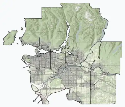
 Edmonds Location of Edmonds within Metro Vancouver | |
| Coordinates: 49°13′10″N 122°57′00″W / 49.21944°N 122.95000°W | |
| Country | Canada |
| Province | British Columbia |
| Region | Lower Mainland |
| Regional District | Metro Vancouver |
| City | Burnaby |
| Government | |
| • Mayor | Mike Hurley |
| • MP (Fed.) | Jagmeet Singh (NDP) |
| • MP (Fed.) | Peter Julian (NDP) |
| • MLA (Prov.) | Raj Chouhan (BC NDP) |
| Elevation | 100 m (300 ft) |
| Population (2021) | |
| • Total | 22,318[1][2][3] |
| Time zone | UTC−8 (PST) |
| • Summer (DST) | UTC−7 (PDT) |
Edmonds is a neighbourhood in the southeast of Burnaby, British Columbia, Canada. It is considered one of four town centres by the city of Burnaby.[4] The SkyTrain's Edmonds station serves the area.
Demographics
An area mainly encompassing single family homes, low-rise apartments, and small businesses, Edmonds is believed to house one of the most diverse neighbourhoods in the world.[5]
| Panethnic group | 2021[1][2][3] | 2016[6][7][8] | 2011[9][10][11] | 2006[12][13][14] | ||||
|---|---|---|---|---|---|---|---|---|
| Pop. | % | Pop. | % | Pop. | % | Pop. | % | |
| East Asian[lower-alpha 1] | 6,675 | 30.53% | 5,890 | 29.12% | 4,260 | 23.1% | 4,070 | 23.36% |
| European[lower-alpha 2] | 4,370 | 19.99% | 4,430 | 21.9% | 5,070 | 27.49% | 5,690 | 32.66% |
| Southeast Asian[lower-alpha 3] | 3,750 | 17.15% | 3,285 | 16.24% | 3,100 | 16.81% | 2,355 | 13.52% |
| South Asian | 3,125 | 14.29% | 3,440 | 17% | 3,530 | 19.14% | 2,925 | 16.79% |
| Middle Eastern[lower-alpha 4] | 1,315 | 6.01% | 855 | 4.23% | 700 | 3.8% | 560 | 3.21% |
| African | 830 | 3.8% | 740 | 3.66% | 675 | 3.66% | 535 | 3.07% |
| Latin American | 455 | 2.08% | 545 | 2.69% | 465 | 2.52% | 385 | 2.21% |
| Indigenous | 275 | 1.26% | 475 | 2.35% | 220 | 1.19% | 450 | 2.58% |
| Other[lower-alpha 5] | 1,085 | 4.96% | 570 | 2.82% | 455 | 2.47% | 440 | 2.53% |
| Total responses | 21,865 | 97.97% | 20,230 | 99.98% | 18,445 | 99.21% | 17,420 | 99.19% |
| Total population | 22,318 | 100% | 20,235 | 100% | 18,591 | 100% | 17,562 | 100% |
Notes
- ↑ Statistic includes total responses of "Chinese", "Korean", and "Japanese" under visible minority section on census.
- ↑ Statistic includes all persons that did not make up part of a visible minority or an indigenous identity.
- ↑ Statistic includes total responses of "Filipino" and "Southeast Asian" under visible minority section on census.
- ↑ Statistic includes total responses of "West Asian" and "Arab" under visible minority section on census.
- ↑ Statistic includes total responses of "Visible minority, n.i.e." and "Multiple visible minorities" under visible minority section on census.
References
- 1 2 Government of Canada, Statistics Canada (September 2, 2022). "Census Profile, 2021 Census of Population Profile table 9330233.00 British Columbia [Census tract]". www12.statcan.gc.ca.
- 1 2 Government of Canada, Statistics Canada (September 2, 2022). "Census Profile, 2021 Census of Population Profile table 9330223.01 British Columbia [Census tract]". www12.statcan.gc.ca.
- 1 2 Government of Canada, Statistics Canada (September 2, 2022). "Census Profile, 2021 Census of Population Profile table 9330223.02 British Columbia [Census tract]". www12.statcan.gc.ca.
- ↑ "Town Centres". www.burnaby.ca.
- ↑ "Does Burnaby have the world's most super-diverse neighbourhood? (Part 2)". Vancouver Sun.
- ↑ Government of Canada, Statistics Canada (February 8, 2017). "Census Profile, 2016 Census – 9330233.00 [Census tract], British Columbia and Vancouver [Census metropolitan area], British Columbia". www12.statcan.gc.ca.
- ↑ Government of Canada, Statistics Canada (February 8, 2017). "Census Profile, 2016 Census – 9330223.01 [Census tract], British Columbia and Vancouver [Census metropolitan area], British Columbia". www12.statcan.gc.ca.
- ↑ Government of Canada, Statistics Canada (February 8, 2017). "Census Profile, 2016 Census – 9330223.02 [Census tract], British Columbia and Vancouver [Census metropolitan area], British Columbia". www12.statcan.gc.ca.
- ↑ Government of Canada, Statistics Canada (November 27, 2015). "NHS Profile, 9330233.00, British Columbia, 2011". www12.statcan.gc.ca.
- ↑ Government of Canada, Statistics Canada (November 27, 2015). "NHS Profile, 9330223.01, British Columbia, 2011". www12.statcan.gc.ca.
- ↑ Government of Canada, Statistics Canada (November 27, 2015). "NHS Profile, 9330223.02, British Columbia, 2011". www12.statcan.gc.ca.
- ↑ Government of Canada, Statistics Canada (July 23, 2020). "2006 Census Tract profiles Census tract profile for 0233.00 (CT), Vancouver (CMA) and British Columbia". www12.statcan.gc.ca.
- ↑ Government of Canada, Statistics Canada (July 23, 2020). "2006 Census Tract profiles Census tract profile for 0223.01 (CT), Vancouver (CMA) and British Columbia". www12.statcan.gc.ca.
- ↑ Government of Canada, Statistics Canada (July 23, 2020). "2006 Census Tract profiles Census tract profile for 0223.02 (CT), Vancouver (CMA) and British Columbia". www12.statcan.gc.ca.
This article is issued from Wikipedia. The text is licensed under Creative Commons - Attribution - Sharealike. Additional terms may apply for the media files.