| Euville light railways | ||||||||||||||||||||||||||||||||||||||||||||||||||||||||||||||||||||
|---|---|---|---|---|---|---|---|---|---|---|---|---|---|---|---|---|---|---|---|---|---|---|---|---|---|---|---|---|---|---|---|---|---|---|---|---|---|---|---|---|---|---|---|---|---|---|---|---|---|---|---|---|---|---|---|---|---|---|---|---|---|---|---|---|---|---|---|---|
 | ||||||||||||||||||||||||||||||||||||||||||||||||||||||||||||||||||||
| Technical | ||||||||||||||||||||||||||||||||||||||||||||||||||||||||||||||||||||
| Line length | 8.8 km (5.47 mi) | |||||||||||||||||||||||||||||||||||||||||||||||||||||||||||||||||||
| Track gauge | 600 mm (1 ft 11+5⁄8 in) and 1,000 mm (3 ft 3+3⁄8 in) | |||||||||||||||||||||||||||||||||||||||||||||||||||||||||||||||||||
| ||||||||||||||||||||||||||||||||||||||||||||||||||||||||||||||||||||
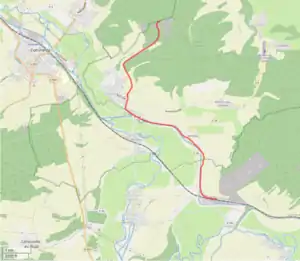
The Euville light railways (French: Réseaux des carrières Civet-Pommier & Cie et Fèvre & Cie) were an approximately 8.8 kilometres (5.5 mi) long light railway with a track gauge 1,000 mm (3 ft 3+3⁄8 in) and a narrow gauge with gauge of 600 mm (1 ft 11+5⁄8 in) near Euville in the département Meuse in the Grand Est region of France (until 2015 Lorraine).[1][2][3][4]
Operation
The so-called Tacot with a gauge of 1000 mm connected the quarries near Euville with a quai at the Canal de l'Est (today Canal de la Meuse) and the standard gauge railway station at Sorcy.
Workers, animals and a Decauville steam locomotive were used to push and pull the 600 mm gauge V-tip waggons in the quarries.
References
- ↑ René Maillard: Carrières et pierre d’Euville - Histoire, paysages, utilisations à Toul. Etudes Touloises, 2015, 152, p. 3–18.
- ↑ Inventaires Ferroviaires: Réseaux des carrières CIVET-POMMIER & Cie et FEVRE & Cie - Chemin de fer FEVRE & Cie, des carrières d’Euville au Canal de l’Est et à la gare de Sorcy. 15 November 2020.
- ↑ Carrières d'Euville (Meuse).
- ↑ Dans les traces des carriers - plan du site.
This article is issued from Wikipedia. The text is licensed under Creative Commons - Attribution - Sharealike. Additional terms may apply for the media files.

