Fort Hancock, Texas | |
|---|---|
 Abandoned buildings along State Highway 20 in Fort Hancock | |
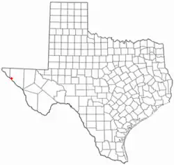
 Location of Fort Hancock, Texas | |
 | |
| Coordinates: 31°17′30″N 105°51′37″W / 31.29167°N 105.86028°W | |
| Country | United States |
| State | Texas |
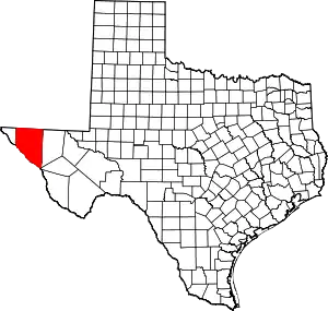
| County | Hudspeth |
| Area | |
| • Total | 19.2 sq mi (49.7 km2) |
| • Land | 19.0 sq mi (49.1 km2) |
| • Water | 0.3 sq mi (0.7 km2) |
| Elevation | 3,579 ft (1,091 m) |
| Population (2010) | |
| • Total | 1,750 |
| • Density | 92/sq mi (35.7/km2) |
| Time zone | UTC-7 (Mountain (MST)) |
| • Summer (DST) | UTC-6 (MDT) |
| ZIP code | 79839 |
| Area code | 915 |
| FIPS code | 48-26724[1] |
| GNIS feature ID | 1357587[2] |

Fort Hancock is an unincorporated community and census-designated place (CDP) in Hudspeth County, Texas, United States. Its population was 1,213 at the 2020: DEC Redistricting Data.[3]
Fort Hancock is situated on the Mexico–United States border, across from El Porvenir, Chihuahua. The Fort Hancock–El Porvenir International Bridge connects the two communities, and the Fort Hancock Port of Entry is located on the Texas side.
Texas State Highway 20 and the Union Pacific Railroad run through the town.
History
Camp Rice and Fort Hancock
Fort Hancock began as a military establishment named Camp Rice in 1882, along the San Antonio-El Paso Road. Camp Rice had formerly been located at Fort Quitman, and had been established by troops of the 10th U.S. Cavalry "buffalo soldiers". Camp Rice did not grow after moving to this community, and rarely hosted more than 60 men. It was renamed Fort Hancock in 1886 after the death of General Winfield Scott Hancock, a hero of the Battle of Gettysburg. The fort was damaged in a flood that year, but rebuilt. It was damaged again by fires in 1889, then abandoned in 1895.[4] The remains of the old fort are located in a cotton field about 1.5 miles (2.4 km) west of present-day Fort Hancock.
Town of Fort Hancock
A post office was established in 1886, with Albert Warren as postmaster. In 1887, a new railroad depot was built at Fort Hancock, and by 1890, a town had grown up around it and had a population of 200, a general store, a hotel, and a meat market.
By 1914, the population of the town had dropped to 50, though by 1940, it had increased to 500.[5]
Federal troops were sent to Fort Hancock in 1918 to contain Mexican "bandits and outlaws" operating along the border. The bandits were suspected of being directed by German agents.[6]
In 1995, a 13-year-old Ricardo Soto "trying to get toys for Christmas" fired three rifle shots at a semitrailer traveling along nearby Interstate 10, hoping to blow out a tire so the truck would spill its load. He instead hit the driver of a pickup truck, Alberto Tarango, fatally wounding him.[7] The man succumbed to his injuries two days later.
Officials in Fort Hancock raised the speed limit to 80 miles per hour (130 km/h) in 2006 along their portion of Interstate 10, making it the highest speed limit in the country.[8]
In 2006, CNN did a feature story about Fort Hancock, highlighting the close relationship between families living on the US and Mexican sides of the border. In the introduction, it described how "illegal immigrants risk their lives to cross the border, but not in Fort Hancock, Texas. A casual stroll across the foot bridge gets you in there." In an interview with Hudspeth County Deputy Sheriff Mike Doyal, he described the border as "just an open footway traffic for people coming across", and showed one of the four unguarded foot bridges that connect Fort Hancock to Mexico. Doyal spoke fondly of his Mexican neighbors, saying "those are not the people that we have a problem with, because I'm going to make it real clear that some of those people on the other side are some of the nicest people you would ever want to meet in your life." CNN described Fort Hancock as "a timeless place", adding, "for people who live here, the border barely exists. We found these Mexican cattle ranchers moving their herd along the river. A few times the cows [sic] would move into the U.S., the buckaroos rode across the dried-out river and collected their animals."[9]
The quiescent community described by CNN in 2006 had changed significantly by 2010 when residents became increasingly concerned that violence associated with the Mexican drug trade would spill across the border. In one instance, Deputy Sheriff Doyal announced to townspeople: "We just got word that the cartel has threatened to kill children in schools across the border unless parents paid 5000 pesos."[10] The county's sheriff, Arvin West, cautioned farmers to arm themselves.[11]
The newly erected Mexico–United States barrier is not a continuous wall, but rather a segmented one, at places no more than a fence. This has led many unauthorized migrants to traverse the barrier on the Mexican side in search of a break; breaks are often in remote desert areas like Fort Hancock. This "funnel effect" has contributed to the deaths of thousands of unauthorized migrants, who are frequently found dead in the hot Texas sun.[12] Journalist Joseph J. Kolb interviewed local rancher Lupe Dempsey, who described how "on her doorstep was a 25-year-old man named Juan who, thirsty and disoriented, told how he'd become lost after illegally crossing the border and had wandered the desert in 110-degree heat." Kolb added, "His story was not unique to Dempsey and others in this West Texas town, where the 18-foot-high U.S. border fence ends abruptly, giving way to a few strands of barbed wire."[13]
Geography
The Fort Hancock CDP is in southwestern Hudspeth County, bordered to the southwest by the Rio Grande and to the northeast by Interstate 10, with access from exits 68, 72, and 78. I-10 leads northwest 52 miles (84 km) to El Paso and east 67 miles (108 km) to Van Horn. According to the United States Census Bureau, the CDP has a total area of 19.2 square miles (49.7 km2), of which 19.0 square miles (49.1 km2) are land and 0.3 sq mi (0.7 km2), or 1.33%, are covered by water.[14]
Demographics
2020 census
| Race | Number | Percentage |
|---|---|---|
| White (NH) | 34 | 3.23% |
| Some Other Race (NH) | 1 | 0.1% |
| Mixed/Multi-Racial (NH) | 1 | 0.1% |
| Hispanic or Latino | 1,016 | 96.58% |
| Total | 1,052 |
As of the 2020 United States census, there were 1,052 people, 453 households, and 353 families residing in the CDP.
2019
As of the census of 2019, 1,213 people, 487 households, and 445 families resided in the CDP.[18] The population density was 45.5 people/sq mi (17.6/km2). The 579 housing units averaged 15.4/sq mi (5.9/km2). The racial makeup of the CDP was 94.51% White, 0.18% Native American, 4.03% from other races, and 1.28% from two or more races. Hispanics or Latinos of any race were 90.83% of the population.
Of the 486 households, 58.6% had children under 18 living with them, 66.7% were married couples living together, 14.0% had a female householder with no husband present, and 16.5% were not families. About 15.2% of all households were made up of individuals, and 8.2% had someone living alone who was 65 years of age or older. The average household size was 3.52 and the average family size was 3.97.
In the CDP, the population was distributed as 39.3% under 18, 9.3% from 18 to 24, 27.1% from 25 to 44, 16.3% from 45 to 64, and 7.9% who were 65 or older. The median age was 26 years. For every 100 females, there were 105.6 males. For every 100 females age 18 and over, there were 90.3 males.
The median income for a household was $17,525, and for a family was $18,560. Males had a median income of $17,411 versus $13,281 for females. The per capita income for the CDP was $7,037. About 44.6% of families and 46.7% of the population were below the poverty line, including 50.7% of those under age 18 and 57.6% of those age 65 or over.
Education
The community is served by the Fort Hancock Independent School District, and high school students attend Fort Hancock High School.[19] The high school competes in six-man football, and between 1986 and 1992, their team, the Mustangs, competed six times in the state championship, winning five (one streak lasted four years). The coach for the state-championship teams was Mr. Danny Medina, who is currently the principal of Fort Hancock Middle School. Mr. Jose Franco served as the team's assistant coach and is currently Fort Hancock ISD's Superintendent.[20] Mustang Stadium in Fort Hancock has a capacity of 800.[21]
Hudspeth County is in the official service area of El Paso Community College.[22]
Notable person
- Benito Martinez, who was born and raised in Fort Hancock, was awarded the Medal of Honor for his actions during the Korean War.
In popular culture
In the 1994 film The Shawshank Redemption, Ellis Boyd "Red" Redding crosses the U.S. border into Mexico at Fort Hancock to join his friend, Andy Dufresne, who earlier escaped from Shawshank Prison and fled to Zihuatanejo via Fort Hancock.[23]
See also
References
- ↑ "U.S. Census website". United States Census Bureau. Retrieved January 31, 2008.
- ↑ "US Board on Geographic Names". United States Geological Survey. October 25, 2007. Retrieved January 31, 2008.
- ↑ "2020: DEC Redistricting Data".
- ↑ Handbook of Texas Online, Bruce J. Dinges, "Fort Hancock," accessed July 28, 2016, https://tshaonline.org/handbook/online/articles/qbf24.
- ↑ Kohout, Martin Donell. "Fort Hancock, TX". Handbook of Texas Online.
- ↑ "Enemy Troops Mass on Border; Scent Enemy Plot". Middletown News-Signal. April 11, 1918.
- ↑ "Boy Accused of Firing Gun at Truck to Get Toys". Milwaukee Journal Sentinel. December 27, 1995.
- ↑ Stirling, Larry (October 18, 2006). "The 80th percentile". San Diego Source.
- ↑ "Bridging the Border". CNN. May 17, 2006.
- ↑ Barnes, Ed (March 31, 2010). "Texas Town on High Alert as Mexican Town Across Border Braces for Cartel Gun Battle". Fox News Channel.
- ↑ Burnett, John (April 9, 2010). "Sheriff To Texas Border Town: 'Arm Yourselves'". NPR.
- ↑ "A Continued Humanitarian Crisis at the Border: Undocumented Border Crosser Deaths Recorded by the Pima County Office of the Medical Examiner, 1990-2012" (PDF). University of Arizona. 2013. Archived from the original (PDF) on September 20, 2013.
- ↑ Kolb, Joseph J. (July 1, 2013). "Fort Hancock, Texas: Where a fence and hope for illegals ends". Fox News Channel.
- ↑ "United States Census Bureau: Fort Hancock CDP, Texas". American Factfinder. U.S. Census Bureau. Archived from the original on February 13, 2020. Retrieved March 19, 2018.
- ↑ "Explore Census Data". data.census.gov. Retrieved May 19, 2022.
- ↑ https://www.census.gov/
- ↑ "About the Hispanic Population and its Origin". www.census.gov. Retrieved May 18, 2022.
- ↑ "2019: ACS 5-Year Estimates Subject Tables".
- ↑ "Campuses - Fort Hancock Independent School District". www.fhisd.net. Retrieved March 26, 2019.
- ↑ Sixmanfootball.com
- ↑ "TexasBob.com - Mustang Stadium - Fort Hancock , Texas". texasbob.com. Retrieved March 26, 2019.
- ↑ Texas Education Code, Section 130.178, "El Paso County Community College District Service Area".
- ↑ "Readers suggest the 10 best ... Greyhound bus moments". The Guardian. May 9, 2014.
