Hohenfelde | |
|---|---|
 | |
Location of Hohenfelde in Hamburg 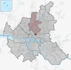 | |
 Hohenfelde 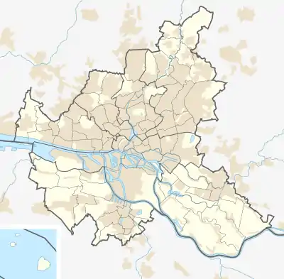 Hohenfelde | |
| Coordinates: 53°33′40″N 10°01′16″E / 53.561°N 10.021°E | |
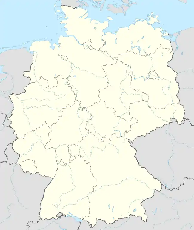
| Country | Germany |
| State | Hamburg |
| City | Hamburg |
| Borough | Hamburg-Nord |
| Area | |
| • Total | 1.1 km2 (0.4 sq mi) |
| Population (2020-12-31)[1] | |
| • Total | 9,853 |
| • Density | 9,000/km2 (23,000/sq mi) |
| Time zone | UTC+01:00 (CET) |
| • Summer (DST) | UTC+02:00 (CEST) |
| Dialling codes | 040 |
| Vehicle registration | HH |
Hohenfelde (German pronunciation: [hoːənˈfɛldə] ⓘ) is a quarter of Hamburg, Germany in the Hamburg-Nord borough.[2][3][4]
Geography
Hohenfelde borders the quarters Uhlenhorst, Eilbek, Borgfelde, and St. Georg.
Politics
These are the results of Hohenfelde in the Hamburg state election:
| Election | SPD | Greens | Left | CDU | FDP | AfD | Others |
|---|---|---|---|---|---|---|---|
| 2020 | 33,4 % | 33,0 % | 9,5 % | 8,5 % | 4,6 % | 4,4 % | 6,6 % |
| 2015 | 44,6 % | 14,4 % | 9,4 % | 12,9 % | 8,8 % | 5,4 % | 4,1 % |
| 2011 | 46,7 % | 14,6 % | 6,6 % | 19,2 % | 7,6 % | – | 5,3 % |
| 2008 | 33,0 % | 11,2 % | 4,9 % | 42,1 % | 6,9 % | – | 1,9 % |
| 2004 | 32,0 % | 15,0 % | – | 45,1 % | 3,3 % | – | 4,6 % |
| 2001 | 37,8 % | 11,5 % | 0,6 % | 26,0 % | 5,6 % | – | 18,5 % |
| 1997 | 34,8 % | 18,3 % | 0,8 % | 28,7 % | 3,9 % | – | 13,5 % |
| 1993 | 41,3 % | 15,6 % | – | 24,4 % | 4,2 % | – | 14,5 % |
| 1991 | 46,2 % | 8,9 % | 0,7 % | 34,9 % | 5,5 % | – | 3,8 % |
| 1987 | 42,2 % | 8,6 % | – | 41,8 % | 6,2 % | – | 1,2 % |
| 1986 | 36,4 % | 12,8 % | – | 44,5 % | 5,1 % | – | 1,2 % |
| Dec. 1982 | 45,6 % | 8,6 % | – | 41,9 % | 2,9 % | – | 1,0 % |
| June 1982 | 36,8 % | 9,7 % | – | 46,4 % | 4,8 % | – | 2,3 % |
| 1978 | 44,4 % | 4,5 % | – | 42,1 % | 6,5 % | – | 2,5 % |
| 1974 | 34,3 % | – | – | 48,7 % | 12,8 % | – | 3,8 % |
| 1970 | 47,6 % | – | – | 40,3 % | 7,0 % | – | 5,1 % |
| 1966 | 47,5 % | – | – | 39,7 % | 8,0 % | – | 4,8 % |
References
- ↑ "Bevölkerung in Hamburg am 31.12.2020" (PDF). Statistisches Amt für Hamburg und Schleswig-Holstein. 23 April 2021.
- ↑ "Das Ortliche". Das Ortliche. Retrieved 29 January 2019.
- ↑ "Katasteramt/Vermessungsamt Hamburg (Kataster)". Katasteramt. Retrieved 29 January 2019.
- ↑ "Germany: Hamburg, Boroughs and Quarters". City Population. Archived from the original on February 14, 2019. Retrieved February 14, 2019.
Freie und Hansestadt Hamburg | |
| Government and symbols | |
| History and culture | |
| Economy and transport | |
This article is issued from Wikipedia. The text is licensed under Creative Commons - Attribution - Sharealike. Additional terms may apply for the media files.