| J C Slaughter Falls | |
|---|---|
 J C Slaughter Falls | |
 | |
| Location | Brisbane, Queensland |
| Coordinates | 27°28′33″S 152°57′42″E / 27.4758°S 152.9617°E[1][2] |
| Type | Cascade |
| Watercourse | Ithaca Creek |
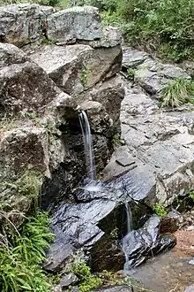
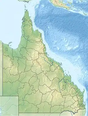
The J C Slaughter Falls is a cascade waterfall on the Ithaca Creek lin the suburb of Mount Coot-tha, approximately 10 kilometres (6.2 mi) west of the Brisbane central business district in Queensland, Australia.[3]
History
During World War II, large parts of Mount Coot-tha Forest were used as a munitions store for the United States Navy.[4] Some of the local creeks were redirected to provide water for the military's use, in addition to the two dams that previously existed on Mount Coot-tha.[5] The dams altered the natural supply of water to Slaughter Falls.[6] Subsequent landscaping to establish the JC Slaughter Falls Picnic area occurred during the 1960s.[7]
Location and features
The falls are situated within Mount Coot-tha Forest park, where there is a picnic area and parking area.[8]
The Mount Coot-tha summit track travels from the J C Slaughter Falls Picnic Area through open eucalyptus forest. The grade is steep over short sections. Mount Coot-tha Lookout offers sweeping views of the city, Moreton Bay, Stradbroke Island and the southern ranges. The track is classified as an easy walk and takes about one hour and is 3.8 kilometres (2.4 mi) return in distance. Mount Coot-tha Forest is 5 kilometres (3 mi) west of Brisbane Central Business District. Access is via Sir Samuel Griffith Drive or Gap Creek Road, Mount Coot-tha.[9]
See also
References
- ↑ "J C Slaughter Falls (QLD)". Gazetteer of Australia online. Geoscience Australia, Australian Government.
- ↑ "J C Slaughter Falls (entry 16910)". Queensland Place Names. Queensland Government. Retrieved 13 September 2015.
- ↑ "J C Slaughter Falls – waterfall in the City of Brisbane (entry 16910)". Queensland Place Names. Queensland Government. Retrieved 2 May 2020.
- ↑ "US Naval Magazine and Mine Assembly Depot at Camp Coot-tha at J.C. Slaughter Falls, Mount Coot-tha, Brisbane". www.ozatwar.com. Retrieved 27 January 2020.
- ↑ "Mt. Coot-tha Dams". Brisbane Courier (Qld. : 1864 - 1933). 5 October 1927. p. 14. Retrieved 27 January 2020.
- ↑ Wood, Edith and Lovelock, Barbara (2005). The Wood family of Mt Coot-tha. In Chamberlain, Leigh. Toowong: Snapshots in time. Toowong, Queensland: Toowong and District Historical Society Inc. pp. 39–45. ISBN 0975798006.
{{cite book}}: CS1 maint: multiple names: authors list (link) - ↑ Spillman, Janet. "Brisbane's breathing space: Mt Coot-tha". espace.library.uq.edu.au. Retrieved 27 January 2020.
- ↑ "Mt Coot-tha Reserve (Mt Coot-tha Forest)". Brisbane City Council. Retrieved 2 May 2020.
- ↑ "Summit Track". Queensland Holidays: Things To See and Do. Tourism and Events Queensland. 2014. Retrieved 23 May 2014.
External links
- "J.C. Slaughter Falls - Mt Coot-tha Reserve designated booking sites". Facilities and recreation: Parks and venues: Parks: Booking parks for special events: Designated sites for park bookings. Brisbane City Council. Retrieved 23 May 2014.
- "Mount Coot-tha Reserve (JC Slaughter Falls Picnic Area)". The National Public Toilet Map. Commonwealth of Australia. 2013. Retrieved 23 May 2014.