| Jackfish Lake | |
|---|---|
.jpg.webp) Dusk at Jackfish Lake | |
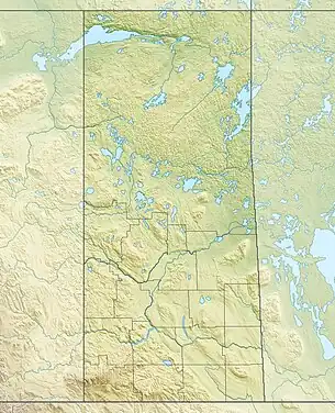
 Jackfish Lake Location in Saskatchewan  Jackfish Lake Jackfish Lake (Canada) | |
| Location | RM of Meota No. 468, |
| Coordinates | 53°08′34″N 108°29′27″W / 53.14278°N 108.49083°W |
| Primary inflows | Jackfish Creek |
| Primary outflows | Jackfish River |
| Catchment area | North Saskatchewan River |
| Basin countries | |
| Surface area | 7,212.6 ha (17,823 acres) |
| Average depth | 2.4 m (7 ft 10 in) |
| Max. depth | 7.1 m (23 ft) |
| Surface elevation | 642 m (2,106 ft) |
| Settlements | |
Jackfish Lake[1] is a large body of shallow water in central Saskatchewan, Canada. It is located about 48 kilometres (30 mi) south of the village of Edam on Highway 26. Communities on or near the lake shore include Meota, Metinota, Cochin, and Aquadeo. The lake is accessed from Highways 4, 26, 697, 674, 769, and 204.
Jackfish River, located at the lake's southern end, is the primary outflow. It exits the lake at the southern end and flows south into the North Saskatchewan River. Charette Creek, Jackfish Creek, and a short stream from Murry Lake at Cochin are the primary inflows.[2]
Parks and recreation
The lake is surrounded by several beaches, with three campgrounds, over 300 campsites and several hiking trails at The Battlefords Provincial Park.[3] Meota Regional Park is located at the southern end of the lake beside the village of Meota.[4]
Fishing
Fish commonly found in the lake include perch, walleye, pike, burbot, and whitefish.[5]
Gallery
.jpg.webp) Pier at Jackfish Lake
Pier at Jackfish Lake.jpg.webp)
.jpg.webp)
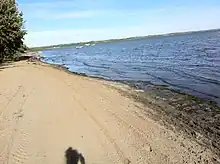
 View of Jackfish Lake from Martinson's Beach.
See also
References
- ↑ "Jackfish Lake". Canadian Geographical Names Database. Government of Canada. Retrieved 7 June 2022.
- ↑ "Jackfish Lake Fishing Map | Nautical Charts App".
- ↑ "Saskatchewan Provincial Parks - Tourism Saskatchewan". Tourismsaskatchewan.com. Retrieved 13 December 2018.
- ↑ "Meota".
- ↑ "Angler's Atlas".
External links
![]() Media related to Jackfish Lake (Saskatchewan) at Wikimedia Commons
Media related to Jackfish Lake (Saskatchewan) at Wikimedia Commons