Kenton-on-Sea | |
|---|---|
 Kenton-on-Sea  Kenton-on-Sea  Kenton-on-Sea | |
| Coordinates: 33°40′59″S 26°39′32″E / 33.683°S 26.659°E | |
| Country | South Africa |
| Province | Eastern Cape |
| District | Sarah Baartman |
| Municipality | Ndlambe |
| Area | |
| • Total | 5.18 km2 (2.00 sq mi) |
| Population (2011)[1] | |
| • Total | 5,154 |
| • Density | 990/km2 (2,600/sq mi) |
| Racial makeup (2011) | |
| • Black African | 80.5% |
| • Coloured | 1.4% |
| • Indian/Asian | 0.2% |
| • White | 17.4% |
| • Other | 0.6% |
| First languages (2011) | |
| • Xhosa | 71.4% |
| • English | 20.2% |
| • Afrikaans | 5.7% |
| • Other | 2.7% |
| Time zone | UTC+2 (SAST) |
| Postal code (street) | 6191 |
| Website | www.kenton.co.za |
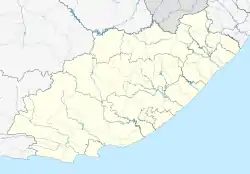
Kenton-on-Sea, more commonly known as Kenton, is a small coastal town on the Sunshine Coast, in the Eastern Cape of South Africa. It is situated between the Bushmans and the Kariega Rivers, and lies approximately halfway between the industrial centres of East London (180 kilometres (110 mi)) and Gqeberha (130 kilometres (81 mi)). Kenton is part of the Ndlambe Local Municipality in the Sarah Baartman District Municipality of the Eastern Cape.
The town has a population of just over 5000 people.[2] The centre of Kenton is predominantly English-speaking, while the township of Ekuphumleni, which has a population of about 3600 people, is almost exclusively Xhosa-speaking.[3]
References
- 1 2 3 4 "Main Place Kenton-on-Sea". Census 2011.
- ↑ "Census 2011: Main Place: Kenton on Sea".
- ↑ "Census 2001 — Main Place "Ekuphumleni"". Archived from the original on 16 January 2014.
External links
Wikivoyage has a travel guide for Kenton-on-Sea.
This article is issued from Wikipedia. The text is licensed under Creative Commons - Attribution - Sharealike. Additional terms may apply for the media files.
.svg.png.webp)