Walyalup Koort, formerly known as Kings Square (or King's Square), is a town square in Fremantle, Western Australia. It is bounded by Queen, Newman, William, and Adelaide Streets. Though the square was originally a public reserve, it has been the site of Saint John's Church of England since 1843, and the Fremantle Town Hall since 1887. High Street was extended through and beyond the square in the 1880s, but the portion through the square was closed off in the 1960s. Today Kings Square functions as a civic and cultural centre of Fremantle, with modern events taking place adjacent to the historic buildings.
History

The square began as an open space[1][2][3] on John Septimus Roe's original town plan of Fremantle, drawn in 1833.[1] In 1839, property owners around the square petitioned the State Governor for a church to be built in the square.[2] This was approved in 1840,[2] and construction works began with the foundation stone being laid on 6 April 1842.[3][4] Saint John's Church of England opened on 4 August 1843,[5][6] and was consecrated on 16 November 1848.[6]
In 1876, the church applied to the Fremantle City Council for a strip of land, adjacent to the church wall, to be granted to the Church of England, for the purpose of building a new church on the site and to improve the amenity of Kings Square.[7] In this application, all of the land in Kings Square was claimed to have been previously granted to the Church of England,[7] though in later years this was seen to be controversial.[2][3][8] This application was refused, as the strip was used for storing and preparing stone (for use in road works), and some councillors believed the church had enough land already.[7] One year later, the church made a second proposal, offering the council the south-western corner of the square, and a right of way for the extension of High Street through the square, in return for the strip of land and 500 pounds.[9] The council accepted, subject to minor modification.[9]
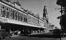
The new church was constructed and consecrated in 1882.[10] It was funded in part by sale of the south-western corner to the Fremantle Council, and the sale of south-eastern portion, which was divided into lots.[8][10] The council constructed the Fremantle Town Hall on the site it had purchased, between 1885[11] and 1887,[12][13] whilst private enterprises constructed buildings in the south east of the square during the 1880s.[8] These building were later demolished in 1929 to make room for an extension to the town hall.[8] In 1881, High Street was extended along the right of way through Kings Square.[14]
In the 1960s, Kings Square was reinstated as a town square with the closure of High Street, between Queen Street, at the eastern edge of the square, and Market Street, 100 metres (330 ft)[15] west of the square.[2] This was carried out as part of a traffic management plan for Fremantle, which included turning the streets around the square into a one way rotary.[2]
In July 2021, the name Kings Square was formally changed to Walyalup Koort following approval of the new name by the Minister for Lands.[16] The new name, which means 'Heart of Fremantle' in the local Whadjuk Nyoongar language, was selected by Fremantle Council in June 2021 following a community engagement process.[17] The name changed occurred despite community opposition and a written submission from the Fremantle History Society stating that they did not support the renaming of this historical site.[18]
Current usage

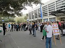
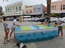
Walyalup Koort is now a paved and landscaped civic centre of Fremantle.[19] As well as the church and town hall, the square also features a giant chess board, various public artworks, and facilities such as toilets,[20] seating, and children's play equipment.[19] Cultural events take place in the square, including movie, music, and arts festivals,[21][22][23][24][25][26] as well as group activities such as yoga[27] and drum circles.[28]
Public artworks and statues on display in Walyalup Koort include:[29]
- Pietro Giacomo Porcelli (1993) – sculptor Greg James
- Hughie Edwards statue and seat (2002) – artist Andrew Kay
- Chess table and chairs – artist Coral Lowry
- John Curtin (artwork alongside the Town Hall building) – artists Charles Smith and Joan Walsh Smith
- Tom Edwards Memorial (1919) – sculptor Pietro Giacomo Porcelli
References
- 1 2 "Statement of Significance". King's Square. State Heritage Office. Government of Western Australia. 23 December 2011. Retrieved 16 November 2012.
- 1 2 3 4 5 6 Ewers, John K. (1971). The Western Gateway: A History of Fremantle (2nd ed.). Nedlands, Western Australia: University of Western Australia Press for the Fremantle City Council. pp. 30, 184. ISBN 085564-050-2.
- 1 2 3 "OLD FREMANTLE". Western Mail. Perth. 21 April 1927. p. 29. Retrieved 18 November 2012 – via National Library of Australia.
- ↑ "HISTORY OF FREMANTLE". The West Australian. Perth. 4 June 1929. p. 18. Retrieved 18 November 2012 – via National Library of Australia.
- ↑ "OPENING OF THE CHURCH AT FREMANTLE". The Inquirer. Perth. 9 August 1843. p. 3. Retrieved 18 November 2012 – via National Library of Australia.
- 1 2 "NEWS AND NOTES". The West Australian. Perth. 18 November 1913. p. 6. Retrieved 18 November 2012 – via National Library of Australia.
- 1 2 3 "PREMANTLE—PORT COUNCIL". The Western Australian Times. Perth. 4 August 1876. p. 2. Retrieved 18 November 2012 – via National Library of Australia.
- 1 2 3 4 "AN HISTORIC SITE". The West Australian. Perth. 24 May 1929. p. 18. Retrieved 18 November 2012 – via National Library of Australia.
- 1 2 "MUNICIPAL MEETING". The Western Australian Times. Perth. 19 June 1877. p. 2. Retrieved 18 November 2012 – via National Library of Australia.
- 1 2 "ST. JOHN'S CHURCH, FREMANTLE". Western Mail. Perth. 27 March 1914. p. 33. Retrieved 19 November 2012 – via National Library of Australia.
- ↑ "NEWS OF THE WEEK". The West Australian. Perth. 27 June 1885. p. 6. Retrieved 19 November 2012 – via National Library of Australia.
- ↑ "General News". The Inquirer & Commercial News (Perth, WA : 1855–1901). Perth. 16 March 1887. p. 3. Retrieved 19 November 2012 – via National Library of Australia.
- ↑ "JUBILEE DAY". The Inquirer & Commercial News (Perth, WA : 1855–1901). Perth. 29 June 1887. p. 2. Retrieved 19 November 2012 – via National Library of Australia.
- ↑ "High St. marches with history". The Sunday Times. Perth. 21 March 1954. p. 19 Section: FIRST SECTION. Retrieved 19 November 2012 – via National Library of Australia.
- ↑ Google (17 November 2012). "Walking directions Market Street to Adelaide Street" (Map). Google Maps. Google. Retrieved 17 November 2012.
- ↑ Oval, Fremantle; Street, 70 Parry; Fremantle; Myfreo (1300 693 736), T. 1300; TTY (Teletypewriter) 08 9432 9777; info@fremantle.wa.gov.au, E. (2 July 2021). "Heart of Fremantle now officially Walyalup Koort". City of Fremantle. Retrieved 20 August 2021.
{{cite web}}: CS1 maint: numeric names: authors list (link) - ↑ "What's in a name? Exploring the idea of renaming Kings Square". My Say Freo. Retrieved 20 August 2021.
- ↑ "What's in a name? Exploring the idea of renaming Kings Square".
- 1 2 "Physical Description". King's Square. State Heritage Office. Government of Western Australia. 23 December 2011. Retrieved 16 November 2012.
- ↑ "Kings Square gets its own flushing meadows". City of Fremantle. Retrieved 19 November 2012.
- ↑ "Family Movies in the Square". City of Fremantle. Retrieved 19 November 2012.
- ↑ "Summer Movies in the Square". City of Fremantle. Retrieved 19 November 2012.
- ↑ "'Kings Square Sounds' to welcome CHOGM youth delegates to Fremantle". City of fremantle. Retrieved 19 November 2012.
- ↑ "King's Square Sounds". City of Fremantle. Retrieved 19 November 2012.
- ↑ "CYF Delegates arrive in Fremantle". Australian Government. Retrieved 19 November 2012.
- ↑ "City of Fremantle presents INCUBATE". City of Fremantle presents. Retrieved 19 November 2012.
- ↑ "Yoga in the square". City of Fremantle. Retrieved 19 November 2012.
- ↑ "Community Drum Circles". City of Fremantle. Retrieved 19 November 2012.
- ↑ "Art & Culture Trail" (PDF). Fremantle Trails. Fremantle Visitor Centre. Retrieved 26 November 2012.