La Patrie | |
|---|---|
 | |
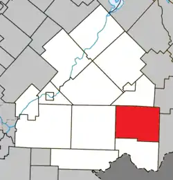 Location within Le Haut-Saint-François RCM. | |
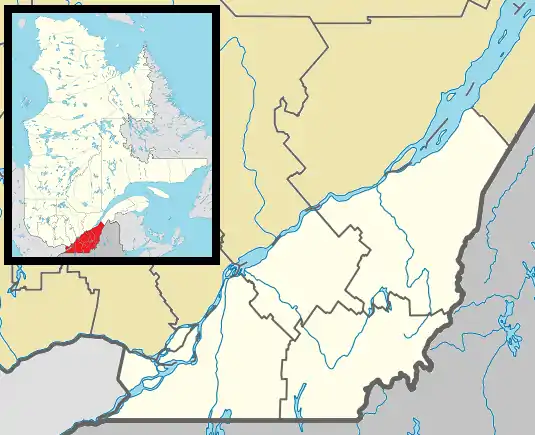 La Patrie Location in southern Quebec. | |
| Coordinates: 45°24′N 71°15′W / 45.400°N 71.250°W[1] | |
| Country | |
| Province | |
| Region | Estrie |
| RCM | Le Haut-Saint-François |
| Constituted | December 24, 1997 |
| Government | |
| • Mayor | Jacques Blais |
| • Federal riding | Compton—Stanstead |
| • Prov. riding | Mégantic |
| Area | |
| • Total | 206.70 km2 (79.81 sq mi) |
| • Land | 204.61 km2 (79.00 sq mi) |
| Population | |
| • Total | 815 |
| • Density | 3.9/km2 (10/sq mi) |
| • Pop 2016-2021 | |
| Time zone | UTC−5 (EST) |
| • Summer (DST) | UTC−4 (EDT) |
| Postal code(s) | |
| Area code | 819 |
| Highways | |
| Website | www |
La Patrie is a municipality of about 815 people in Le Haut-Saint-François Regional County Municipality, in Quebec, Canada. It is located at the base of Mont Mégantic.
Some industries specializing in the field of forestry have settled in La Patrie. The company Guitabec, which produces guitars under the label Godin, has a manufacturing facility in La Patrie.
Light pollution
Participating in a program initiated and established by the Mont-Mégantic National Park in collaboration with Hydro-Québec, the village of La Patrie has greatly reduced its light pollution, which strongly affects the Mont Mégantic Observatory.
References
- ↑ "Banque de noms de lieux du Québec: Reference number 339393". toponymie.gouv.qc.ca (in French). Commission de toponymie du Québec.
- 1 2 "Répertoire des municipalités: Geographic code 41027". www.mamh.gouv.qc.ca (in French). Ministère des Affaires municipales et de l'Habitation.
- 1 2 "Census Profile, 2021 Census, Statistics Canada - Validation Error".
External links
 Media related to La Patrie at Wikimedia Commons
Places adjacent to La Patrie, Quebec | ||||||||||||||||
|---|---|---|---|---|---|---|---|---|---|---|---|---|---|---|---|---|
| ||||||||||||||||
| Cities & Towns | |
|---|---|
| Municipalities | |
| Townships | |
| |
This article is issued from Wikipedia. The text is licensed under Creative Commons - Attribution - Sharealike. Additional terms may apply for the media files.