This is a complete list of current bridges and other crossings of Cameron Run from its mouth at the Potomac River to the sources of its two main tributaries, Holmes Run and Backlick Run.
All locations are in Virginia. Pedestrian-only bridges are marked in italics.
Cameron Run
| Image | Crossing | Opened | Coordinates | Notes |
|---|---|---|---|---|
| Alexandria–Fairfax County | ||||
 |
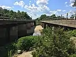
Mount Vernon Trail George Washington Memorial Parkway |
1932[1] | 38°47′24″N 77°03′05″W / 38.7899°N 77.0514°W | |
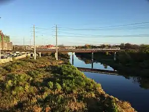
.jpg.webp) |
2002–2007[1][2] | 38°47′33″N 77°03′24″W / 38.7925°N 77.0568°W | Includes flanking bridges for interchange with | |
 |
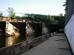
WMATA Yellow Line | 38°47′55″N 77°04′24″W / 38.7985°N 77.0734°W | ||
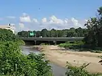
_from_the_overpass_for_the_ramp_from_southbound_Virginia_State_Route_241_to_Huntington_Avenue_on_the_edge_of_Rose_Hill_and_Huntington_in_Fairfax_County%252C_Virginia.jpg.webp) |
2011[1] | 38°47′56″N 77°04′46″W / 38.7990°N 77.0795°W | ||
 |
2010[1] | 38°48′05″N 77°05′03″W / 38.8013°N 77.0842°W | ||
| Alexandria | ||||
 |
Eisenhower Avenue | 1986[2] | 38°48′16″N 77°06′22″W / 38.8044°N 77.1060°W | |
 |
WMATA Blue Line | 38°48′19″N 77°06′27″W / 38.8053°N 77.1075°W | ||
 |
CSX Transportation RF&P Subdivision | 38°48′20″N 77°06′29″W / 38.8055°N 77.1080°W | ||
 |
Norfolk Southern Railway Washington District | 38°48′24″N 77°06′35″W / 38.8066°N 77.1096°W | ||
| River splits into Holmes Run and Backlick Run | ||||
Holmes Run
| Image | Crossing | Opened | Coordinates | Notes |
|---|---|---|---|---|
| Alexandria | ||||
 |
Ben Brenman Park footbridge | 38°48′32″N 77°06′44″W / 38.8090°N 77.1122°W | ||
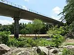
_from_the_overpass_for_Deer_Run_Court_in_Alexandria%252C_Virginia.jpg.webp) |
1970[2] | 38°48′42″N 77°06′48″W / 38.8117°N 77.1134°W | ||
 |
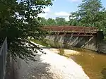
Charles Beatley Bridge | 38°48′54″N 77°07′08″W / 38.8149°N 77.1189°W | Connects segments of N. Pickett Street | |
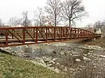 |
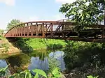
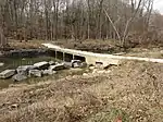
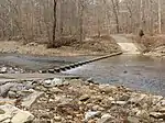
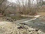
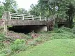
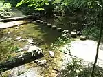
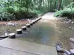
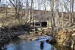
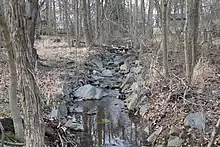
Holmes Run Trail | 2018[3] | Replaced older fair-weather crossing[3][4] | |
 |
1963[2] | |||
 |
1950[2] | |||
 |
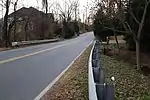
Beauregard Street | 1958[2] | ||
 |
Holmes Run Trail | |||
| Alexandria–Fairfax County | ||||
 |
Holmes Run Trail | 2013[5] | ||
| Fairfax County | ||||
 |
Holmes Run Trail | |||
 |
Holmes Run Trail | |||
 |
Holmes Run Trail | |||
 |
Holmes Run Trail | |||
 |
Holmes Run Trail | |||
 |
1961[1] | |||
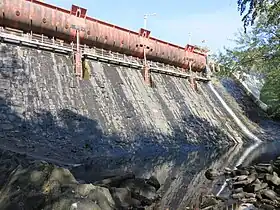 |
Barcroft Dam | 1915[6] | No crossing | |
 |
Lakeview Causeway | |||
 |
1960[1] | |||
 |
Rose Lane Park footbridge | |||
 |
Rose Lane Park footbridge | |||
 |
Roundtree Park footbridge | |||
 |
1926[1] | |||
 |
Luria Park footbridges | Holmes Run splits into two channels at this location, both of which are crossed by footbridges | ||
 |
Footbridge between Holly Berry Court and Camp Alger Avenue | |||
 |
Providence Recreation Center footbridge | |||
 |
1932, 1986[1] | |||
| Defense Health Agency driveway | ||||
| Fairview Lake dam | No crossing | |||
| Fairview Park Drive | ||||
_from_the_overpass_for_the_ramp_from_Interstate_66_eastbound_to_Interstate_495_northbound_on_the_edge_of_Idylwood_and_Merrifield_in_Fairfax_County%252C_Virginia.jpg.webp) |
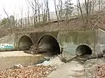
Shreve Road WMATA Orange, Blue, and Silver Lines Washington & Old Dominion Trail |
1963, 1982[1] | multiple culverts under interchange | |
 |
||||
 |
Morgan Lane Dam | no crossing | ||
 |
Railroad Street Dam | |||
 |
footbridge | |||
Backlick Run
| Image | Crossing | Opened | Coordinates | Notes |
|---|---|---|---|---|
| Alexandria | ||||
 |
Ben Brenman Park footbridge | 38°48′27″N 77°06′46″W / 38.8074°N 77.1129°W | ||
 |
Ben Brenman Park footbridge | 38°48′23″N 77°07′01″W / 38.8064°N 77.1170°W | ||
| 1932[2] | 38°48′12″N 77°08′02″W / 38.8032°N 77.1339°W | |||
| Fairfax County | ||||
| rail siding | ||||
| Norfolk Southern Railway Washington District | ||||
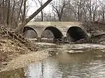
_from_the_overpass_for_Interstate_95_southbound_on_the_edge_of_Springfield_and_Lincolnia_in_Fairfax_County%252C_Virginia.jpg.webp) |
1961, 1962[1] | Crosses | ||
 |
Versar Center driveway | |||
 |
Norfolk Southern Railway Washington District | |||
 |
1966[1] | |||
 |
Leesville Boulevard | 1970[1] | ||
 |
1963[1] | |||
| driveway | ||||
| Ravensworth Road | ||||
References
- 1 2 3 4 5 6 7 8 9 10 11 12 13 "Fairfax County, Virginia". National Bridge Inventory. Retrieved 2020-12-31 – via BridgeReports.com.
- 1 2 3 4 5 6 7 "Alexandria, Virginia". National Bridge Inventory. Retrieved 2020-12-31 – via BridgeReports.com.
- 1 2 Wadl, Mary (2018-11-08). "It's Official: Holmes Run Trail Pedestrian/Bicycle Bridge Opens with Free Safety Gear". The Zebra. Retrieved 2020-08-07.
- ↑ "Holmes Run Trail work progressing well, detour may end ahead of schedule". TheWashCycle. Retrieved 2020-08-07.
- ↑ "Holmes Run Chambliss Study". City of Alexandria. Retrieved 2020-08-07.
- ↑ "Cameron Run Watershed Management Plan". Fairfax County. August 2007. pp. 2–5. Retrieved 2020-08-07.
This article is issued from Wikipedia. The text is licensed under Creative Commons - Attribution - Sharealike. Additional terms may apply for the media files.