This is an incomplete list of ghost towns in Alaska. Ghost towns can include sites in various states of disrepair and abandonment. Some sites no longer have any trace of civilization and have reverted to wilderness. Other sites are unpopulated but still have standing buildings. Some sites may even have a sizable, though small population, but there are far fewer citizens than in its grander historic past.
Classification
Barren site
- Sites no longer in existence
- Sites that have been destroyed
- Covered with water
- Reverted to pasture
- May have a few difficult to find foundations/footings at most

One of the few remaining structures in Dyea
Neglected site
- Only rubble left
- Roofless building ruins
- Buildings or houses still standing, but majority are roofless
Abandoned site
- Building or houses still standing
- Buildings and houses all abandoned
- No population, except caretaker
- Site no longer in existence except for one or two buildings, for example old church, grocery store
Semi-abandoned site
- Building or houses still standing
- Buildings and houses largely abandoned
- Few residents
- Many abandoned buildings
- Small population
Historic community
- Building or houses still standing
- Still a busy community
- Smaller than its boom years
- Population has decreased dramatically, to one fifth or less.
Table
| Name | Other names | Borough/census area | Location | Settled | Abandoned | Current status | Remarks |
|---|---|---|---|---|---|---|---|
| Afognak | Kodiak Island Borough | ~5,500 B.C.E.[1] | A native Alutiiq village, first settled by Russia in 1784, the community never recovered from the 1964 Good Friday earthquake. | ||||
| Akulurak | Kusilvak Census Area | 62 ° 33' 8" N, 164 ° 33' 10" W | An Alaska Native village which has been largely abandoned due to runoff from a nearby mountain pass.[2] | ||||
| Amalga | Juneau Borough | ||||||
| Apollo | |||||||
| Attu | Aleutians West Census Area | Location of the only land battle to be fought in the United States during World War II.[3] | |||||
| Aurora | Kenai Peninsula Borough | At Kachemak Bay near Homer | 1901 | Barren | An elaborate failed hoax built by wealthy businessman Thomas C. Dunn.[4] | ||
| Ayak | Ahyak, Ayaaq, Asaaq | Nome Census Area | Sledge Island | c. 1918 | Abandoned during the 1918 flu pandemic. | ||
| Belkofski | Selo Belkovskoe[5] | Aleutians East Borough | 12 miles southeast of King Cove | 1980s | Barren[6] | ||
| Bettles | Old Bettles | Yukon-Koyukuk Census Area | 1930[7] | 1997 | Neglected | ||
| Big Port Walter | A former fishing community.[8] | ||||||
| Biorka | Aleutians West Census Area | Vicinity of Unalaska | Barren | A native Aleut village.[9] | |||
| Bluff | Nome Census Area | 1900 | Former mining town | ||||
| Caniliaq | [9] | ||||||
| Cape Fanshaw | [10] | ||||||
| Caro | Historic | [11] | |||||
| Chatanika | Fairbanks North Star Borough | 1904 | Historic | A former gold rush boom town, the population of Chatanika is sparse. | |||
| Chena | Fairbanks North Star Borough | Barren | A boom town that was never properly surveyed, the exact location of Chena was lost until it was found buried beneath a suburb of Fairbanks.[12] | ||||
| Chenega | Chugach Census Area | 1964 | The old village was destroyed in a Tsunami caused by the Good Friday earthquake in 1964 and was resettled at a different location as Chenega Bay.[13] | ||||
| Chernofski | Aleutians West Census Area | Vicinity of Unalaska | 1928 | A native Aleut village.[9] | |||
| Chisana | Copper River Census Area | ||||||
| Chisna | |||||||
| Chomly | |||||||
| Coldfoot | A mining boom town until the mines ran dry in 1912[14] | ||||||
| Copper City | |||||||
| Coppermount | |||||||
| Council | Nome Census Area | ||||||
| Curry | Matanuska-Susitna Borough | ||||||
| Dickson | Nome Census Area | ||||||
| Dunbar | Yukon-Koyukuk Census Area | 64.759093, -148.787643 | Barren | A former railroad town Dunbar, Ak (site)
Wikimapia[15] | |||
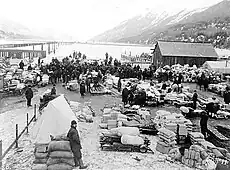
| Dyea | Municipality of Skagway Borough | Neglected | Known for containing "The Slide", a cemetery in which almost everyone interred died in the same avalanche on April 3, 1898.[16] | ||||
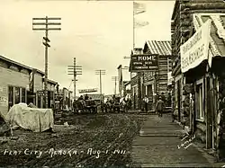
| Flat | Flat City | Yukon-Koyukuk Census Area | `1909 | 2004 | A gold rush town that never recovered from a large fire in 1924. | ||
| Fort Egbert | Southeast Fairbanks Census Area | [17] | |||||
| Funter Bay | |||||||
| Gilmore | |||||||
| Hamilton | Nunapiggluugaq | [9] | |||||
| Iditarod | Yukon-Koyukuk Census Area | ||||||
| Independence Mines | Matanuska-Susitna Borough | Historic | |||||
| Kaguyak | |||||||
| Kalakaket | |||||||
| Kashega | Aleutians West Census Area | Vicinity of Unalaska | A native Aleut village.[9] | ||||
| Katalla | Valdez-Cordova Census Area | 1943 | |||||
| Katmai | Kodiak Island Borough | 1912 | Buried in ash by the 1912 eruption of Mount Katmai.[13] | ||||
| Kauwerak | Nome Census Area | An Inupiat village abandoned when most of the residents left for Mary's Igloo. | |||||
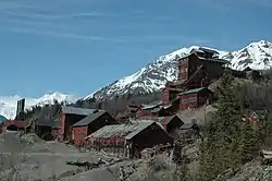
| Kennicott | Copper River Census Area | 4.5 miles from McCarthy | 1938 | Abandoned/historic | [18] | ||
| Kern | Kenai Peninsula Borough | ||||||
| Kijik | Lake Clark Village, Nijik, Nikhkak, Nikhak, Old Keegik | Lake and Peninsula Borough | 1909 | A native Athabascan village.[19] | |||
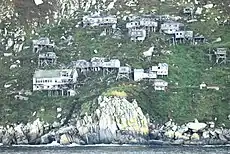
| King Island | Ugiuvak | Nome Census Area | 1970 | Abandoned | Once home to a tribe of Inupiat people known as the Ugiuvaŋmiut, the Bureau of Indian Affairs closed the island's school in the mid 20th century, forcing the children to move to the mainland for school and leaving the adults and elders unable to maintain their lifestyle. | ||
| Knik | K'enakatnu, Old Knik Townsite | Matanuska-Susitna Borough | |||||
| Loring | Ketchikan Gateway Borough | Semi-abandoned | |||||
| Makushin | Aleutians West Census Area | Vicinity of Unalaska | A native Aleut village.[9] | ||||
| Mary's Igloo | Aukvaunlook | Nome Census Area | |||||
| Meehan | |||||||
| Mumtrak | Bethel Census Area | Repeat flooding caused the residents to abandon the site for Goodnews Bay.[13] | |||||
| Ohagamiut | Bethel Census Area | ||||||
| Old Minto | Old Minto was abandoned due to repeat flooding.[13] | ||||||
| Olnes | |||||||
| Ophir | Yukon-Koyukuk Census Area | ||||||
| Otter | Yukon-Koyukuk Census Area | A former mining village near Flat and Iditarod.[20] | |||||
| Pastuliq | [9] | ||||||
| Pedro | |||||||
| Pilgrim Springs | Pilgrim Hot Springs, Kruzgamepa[17] | A mission that once contained an orphanage for children orphaned by the Influenza epidemic of 1918.[13] | |||||
| Poorman | Yukon-Koyukuk Census Area | ||||||
| Port Alexander | Historic[8] | ||||||
| Port Wakefield | Kodiak Island Borough | ||||||
| Portage | Anchorage | ||||||
| Portlock | Kenai Peninsula Borough | ||||||
| Prospect Creek | Yukon-Koyukuk Census Area | ||||||
| Seaside | |||||||
| Snettisham | Juneau Borough | ||||||
| Speel River | |||||||
| Sulzer | Prince of Wales-Hyder Census Area | ||||||
| Three Saints Bay | Kodiak Island Borough | ||||||
| Tikigaq | Point Hope | Tikigaq, the Tikigagamiut village which existed before the current settlement of Point Hope, was abandoned due to erosion. | |||||
| Tin City | Nome Census Area | ||||||
| Toklat | |||||||
| Treadwell | Juneau | [17] | |||||
| Unga | Aleutians East Borough | ||||||
| White Eye | Yukon-Koyukuk Census Area | [13] | |||||
| York | Nome Census Area | West of Wales | Every resident of York died during the Influenza epidemic of 1918.[13] |
Gallery
 Ugiuvak, abandoned Inupiat stilt village, in 2010. The large white building near the bottom of the slope is the former Bureau of Indian Affairs school.
.jpg.webp)
 Flat, August 1, 1911
 The waterfront at Dyea during the Klondike Gold Rush
References
- ↑ Native Village of Afognak. Native Village of Afognak, n.d. Web. Retrieved 23 July 2013.
- ↑ "Akulurak". Alaska Guide. Retrieved February 28, 2023.
- ↑ "Battle of the Aleutian Islands". history.com. June 30, 2020. Archived from the original on November 12, 2021. Retrieved November 12, 2021.
- ↑ "Aurora - Ghost Town". www.ghosttowns.com. Retrieved February 28, 2023.
- ↑ "Domestic Names".
- ↑ "Historic Alaskan village destroyed by fire". May 2013.
- ↑ "Population - Alaska" (PDF). United States Census Bureau. 1930.
- 1 2 KCAW Staff (December 3, 2010). "Port Alexander museum preserves coastal history". KCAW. Retrieved May 10, 2023.
- 1 2 3 4 5 6 7 Dunham, Mike (July 1, 2015). "Alaska ghost villages are recalled by Native elders and scholars in two new books". Anchorage Daily News. Retrieved May 10, 2023.
- ↑ "CBJ Cover Letter and Responsive Brief" (PDF). commerce.alaska.gov. p. 34.
- ↑ "William Sulzer". alaskamininghalloffame.org. Retrieved May 10, 2023.
- ↑ Gutoski, Martin (2013). "Where is Chena?" (PDF). The American Surveyor. 10.
- 1 2 3 4 5 6 7 "Ghost towns scattered across Alaska map | Geophysical Institute". www.gi.alaska.edu. Retrieved May 9, 2023.
- ↑ Alaska almanac, 1909. The Harrison Publishing Company. 1909. p. 39.
- ↑ "Dunbar, Ak (site)". wikimapia.org. Retrieved October 20, 2023.
- ↑ "The Slide Cemetery". Atlas Obscura. Retrieved May 10, 2023.
- 1 2 3 "12 Ghost Towns In Alaska You May Have Never Heard Of". September 11, 2022. Retrieved May 10, 2023.
- ↑ "Kennicott Ghost Town". Atlas Obscura. Retrieved May 10, 2023.
- ↑ Vanstone, James; Townsend, Joan (January 16, 1970). "Kijik: An Historic Tanaina Settlement". Fieldiana: Anthropology. 15: 1–202. JSTOR 29782443.
- ↑ "Geological Survey Professional Paper". U.S. Government Printing Office. January 20, 2019. Retrieved January 20, 2019 – via Google Books.
External links
This article is issued from Wikipedia. The text is licensed under Creative Commons - Attribution - Sharealike. Additional terms may apply for the media files.
.jpg.webp)

