| Mana | |
|---|---|
 | |
 | |
| Location | |
| Country | France |
| Region | French Guiana |
| Physical characteristics | |
| Source | Mount Galbao |
| • location | 3°37′03″N 53°16′57″W / 3.6175°N 53.2825°W |
| Mouth | Atlantic Ocean |
• location | Mana |
• coordinates | 5°43′44″N 53°50′17″W / 5.7289°N 53.8381°W |
| Length | 462 km (287 mi) |
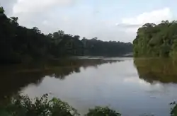
The Mana (French pronunciation: [mana]) is a river in western French Guiana. It runs north from central French Guiana to the town of Mana, where it flows into the Atlantic Ocean. It is 462 km (287 mi) long.[1]
References
This article is issued from Wikipedia. The text is licensed under Creative Commons - Attribution - Sharealike. Additional terms may apply for the media files.