| Markham Heights | |
|---|---|
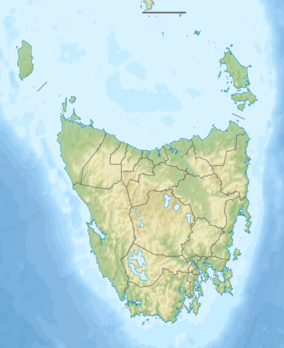
 Markham Heights Location in Tasmania | |
| Highest point | |
| Elevation | 1,542 m (5,059 ft)AHD [1] |
| Prominence | 52 m (171 ft)[1] |
| Parent peak | Legges Tor |
| Isolation | 2.13 km (1.32 mi)[1] |
| Listing | Highest mountains of Tasmania |
| Coordinates | 41°31′S 147°39′E / 41.51°S 147.65°E |
| Naming | |
| Etymology | Sir Albert Markham |
| Geography | |
| Location | Tasmania, Australia |
| Parent range | Ben Lomond |
Markham Heights is a mountain peak that forms part of the Ben Lomond Range, in the northeast of Tasmania, Australia.[2]
Markham Heights is located 1,542 metres (5,059 ft) above sea level,[1][3] and is the seventh highest peak in Tasmania.
It is named for Sir Albert Markham, an Arctic explorer.[4]
See also
References
- 1 2 3 4 "King Davids Peak, Australia". Peakbagger.com. Retrieved 5 June 2017.
- ↑ "Markham Heights, Tasmania". Australia Geographic Names Database. Retrieved 20 March 2016.
- ↑ "Land Information System Tasmania". Tasmanian Government. Retrieved 21 March 2016. (Search for 'Markham Heights').
- ↑ "Ben Lomond National Park: Management Plan 1998". Parks and Wildlife Service, Tasmania. p. 68. Retrieved 21 March 2016.
This article is issued from Wikipedia. The text is licensed under Creative Commons - Attribution - Sharealike. Additional terms may apply for the media files.