Milejovice | |
|---|---|
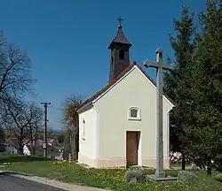
 Chapel | |
 Milejovice Location in the Czech Republic | |
| Coordinates: 49°11′17″N 13°55′48″E / 49.18806°N 13.93000°E | |
| Country | |
| Region | South Bohemian |
| District | Strakonice |
| First mentioned | 1315 |
| Area | |
| • Total | 6.24 km2 (2.41 sq mi) |
| Elevation | 530 m (1,740 ft) |
| Population (2023-01-01)[1] | |
| • Total | 65 |
| • Density | 10/km2 (27/sq mi) |
| Time zone | UTC+1 (CET) |
| • Summer (DST) | UTC+2 (CEST) |
| Postal code | 387 01 |
| Website | www |
Milejovice is a municipality and village in Strakonice District in the South Bohemian Region of the Czech Republic. It has about 70 inhabitants.
Geography
Milejovice is located about 8 kilometres (5 mi) south of Strakonice and 45 km (28 mi) northwest of České Budějovice. It lies in the Bohemian Forest Foothills. The highest point is the hill Vráž at 645 m (2,116 ft) above sea level.
History

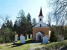
Dobrá voda pilgrimage site
The first written mention of Milejovice is from 1315.[2]
Sights
In the centre of Milejovice is a chapel.[3]
In the eastern part of the municipal territory is Dobrá voda, a pilgrimage site with the Chapel of the Most Blessed Virgin Mary, Stations of the Cross. The chapel was built in 1889–1891 next to a well with a supposedly healing spring.[2][4]
References
- ↑ "Population of Municipalities – 1 January 2023". Czech Statistical Office. 2023-05-23.
- 1 2 "Milejovice, to není jen poutní místo Dobrá Voda" (in Czech). Deník.cz. 2013-11-27. Retrieved 2023-02-12.
- ↑ "O obci Milejovice" (in Czech). Obec Milejovice. Retrieved 2023-02-11.
- ↑ "Kaple Nejblahoslavenější Panny Marie" (in Czech). National Heritage Institute. Retrieved 2023-02-11.
External links
Wikimedia Commons has media related to Milejovice.
This article is issued from Wikipedia. The text is licensed under Creative Commons - Attribution - Sharealike. Additional terms may apply for the media files.