| Monkwood | |
|---|---|
 Monkwood Mission Hall | |
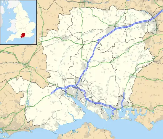
 Monkwood Location within Hampshire | |
| OS grid reference | SU667309 |
| Civil parish | |
| District | |
| Shire county | |
| Region | |
| Country | England |
| Sovereign state | United Kingdom |
| Post town | Alresford |
| Postcode district | SO24 |
| Police | Hampshire and Isle of Wight |
| Fire | Hampshire and Isle of Wight |
| Ambulance | South Central |
| UK Parliament | |
Monkwood is a Hamlet in the south of Ropley parish. Although currently it is spread between Petersfield Road and Hill Farm Road, historically it referred to the settlement on the south side of Smugglers Lane (SU 6605630920) containing the 15th Century Smugglers, the 16th Century The Old Farmhouse and the C18th century cottage between the two. The more recent settlement between Petersfield Road and Hill Farm Lane originates from around the late 1800s, with only two settlements; Hill Farm and Ropley Common Farm visible in the 1870s OS Map.[1]
Etymology
The first mention of Monkwood is in 1550 as Monkwodd (see below)[2] and suggests a monastical connection, possibly with Selbourne Priory who held a lot of land in West Tisted until 1482 when it was dissolved. However the name may come from 'William le Monek' who was recorded living in Ropley in 1327, whose name directly translates to William the Monk. The Woodland specifically referred to is preserved in the 1839 Ropley Parish Tithe Map which lists a series of names focused around the junction of Smugglers Lane and Petersfield Road (SU6595131170);
| Tithe Map Number | Tithe Map Name |
|---|---|
| 485 | Monks Wood |
| 486 | Great Monks |
| 487 | Part of Monks Wood |
| 488 | Upper Monks |
| 563 | Upper Monks |
| 564 | Middle Monks |
| 565 | Lower Monks |
| 585 | Part of Monks Wood |

Smugglers Lane
The historical settlement of Monkwood was centred around Smugglers Lane, this name likely is a late 18th century or early 19th century creation as historically it was known as "Munkdean Lane" [3] from the Old English Dene meaning valley.[4] Smuggling was rife in Ropley in the later 1700s and stories of plotted murder, hiding contraband and people, although some are possibly folklore, are nonetheless reflective of smuggling in this village and area.[5]
References
- ↑ "View map: Hampshire & Isle of Wight XLIII (Includes: Colemore and Priors Dean; East Tisted... - Ordnance Survey Six-inch England and Wales, 1842-1952".
- ↑ 1550 terrier of lands in Ropley held in Hampshire Records Office
- ↑ mentioned in the Survey of Lands in Ropley 'Ropley View' in Hampshire Records Office No. 11M59/A1/2/36
- ↑ "Dene". 18 March 2023.
- ↑ https://www.alresfordhistandlit.co.uk/084%20Ropley%20in%20the%20Age%20of%20Smuggling.pdf
Further reading
Hoggarth, P., Ropley in the Age of Smuggling, Alresford Papers (1993)
External links
![]() Media related to Monkwood at Wikimedia Commons
Media related to Monkwood at Wikimedia Commons
