| Mount Redfield | |
|---|---|
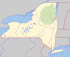
 Mount Redfield Location of Mount Redfield within New York  Mount Redfield Mount Redfield (the United States) | |
| Highest point | |
| Elevation | 4,606 ft (1,404 m)[1] |
| Prominence | 242 ft (74 m)[1] |
| Listing | Adirondack High Peaks 15th |
| Coordinates | 44°05′41″N 73°57′00″W / 44.094777°N 73.949866°W[2] |
| Geography | |
| Location | Keene, Essex County, New York |
| Parent range | Marcy Group of the Great Range |
| Topo map | USGS Mount Marcy |
Mount Redfield is a mountain located in Essex County, New York. The mountain is part of the Marcy Group of the Great Range of the Adirondack Mountains. Mount Redfield is flanked to the northwest by Cliff Mountain, and to the northeast by Mount Skylight.
Verplanck Colvin (1847–1920) named Mount Redfield for William C. Redfield (1789–1857), organizer and member of the first expedition to Mount Marcy in 1837, and the first to guess that Marcy was the highest peak in the Adirondacks, and therefore in New York.
Mount Redfield stands within the watershed of the Opalescent River, a tributary of the Hudson River, which in turn drains into New York Bay. The northeast and north sides of Mt. Redfield drain into Uphill Brook, thence into the Opalescent River. The west end of Redfield drains into Upper Twin Brook, thence into the Opalescent River. The south side of Redfield drains into Skylight Brook, thence into Dudley Brook and the Opalescent River.
Mount Redfield is within the High Peaks Wilderness Area of Adirondack State Park.
See also
References
- 1 2 "Mount Redfield, New York". Peakbagger.com. Retrieved 2013-02-08.
- ↑ "Mount Redfield". Geographic Names Information System. United States Geological Survey, United States Department of the Interior. Retrieved 2013-02-08.
External links
- "Mount Redfield". SummitPost.org.