| Naltar Peak نلتر چوٹی | |
|---|---|
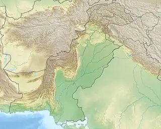 Naltar Peak نلتر چوٹی Location in Pakistan | |
| Highest point | |
| Elevation | 4,678 m (15,348 ft) |
| Listing | List of mountains in Pakistan |
| Coordinates | 36°06′23″N 74°11′45″E / 36.10639°N 74.19583°E[1] |
| Geography | |
| Location | Naltar Valley, Pakistan |
| Parent range | Karakoram |
Naltar ski resort is an hour's drive from Gilgit. It serves as the main facility for the Ski federation of Pakistan and hosted the 2016 Karakoram Alpine Ski Cup.
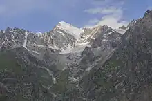
Naltar Peak (Urdu: نلتر چوٹی) is a mountain in Naltar Valley in the Gilgit District of Gilgit-Baltistan, Pakistan. It lies to the southeast of Mehrbani Peak (5,639 m).
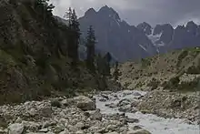
Naltar is a valley near Gilgit, Hunza and Nomal, Gilgit Baltistan in the Gilgit–Baltistan province of Pakistan. Naltar is 40 km (25 mi) from Gilgit and can be reached by jeeps.

Vehicles such as the one shown are very common on the tough and rocky roads of this area. Tourists in particular like to plan their trips on similar 4x4 vehicles.
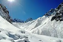
Mountains of Naltar, on the foothills of which, Skiing is a popular sport.
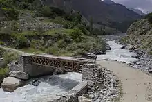
Naltar is a valley near Gilgit, Hunza and Nomal, Gilgit Baltistan in the Gilgit–Baltistan province of Pakistan. Naltar is 40 km (25 mi) from Gilgit and can be reached by jeeps. Here is a tight bridge that one has to pass in order to get to the skiing resort ahead.
References
- ↑ "Northern Pakistan detailed placemarks in Google Earth". Retrieved 2009-03-26.
External links
This article is issued from Wikipedia. The text is licensed under Creative Commons - Attribution - Sharealike. Additional terms may apply for the media files.