| Nangeenan Western Australia | |
|---|---|
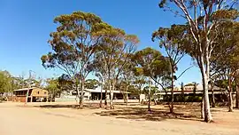
 View of the Marleys Transport depot at Nangeenan in December 2014 | |
 Nangeenan | |
| Coordinates | 31°32′S 118°10′E / 31.533°S 118.167°E |
| Population | 75 (SAL 2021)[1] |
| Postcode(s) | 6414 |
| Area | 184.6 km2 (71.3 sq mi) |
| LGA(s) | Shire of Merredin |
| State electorate(s) | Central Wheatbelt |
| Federal division(s) | Durack |
Nangeenan is a small townsite west of Merredin on Great Eastern Highway, in the Wheatbelt region of Western Australia (WA).
It has a local hall which has been in use since around the time of World War I.[2][3] During the same era, Nangeenan was the site of a "state farm",[4] a term used at the time for a research station of the WA Department of Agriculture.[5]
References
- ↑ Australian Bureau of Statistics (28 June 2022). "Nangeenan (suburb and locality)". Australian Census 2021 QuickStats. Retrieved 28 June 2022.
- ↑ "Nangeenan". Merredin Mercury. Vol. IV, no. 193. Western Australia. 4 May 1916. p. 2. Retrieved 29 October 2017 – via National Library of Australia.
- ↑ "Nangeenan". Merredin Mercury. Vol. III, no. 141. Western Australia. 28 April 1915. p. 2. Retrieved 29 October 2017 – via National Library of Australia.
- ↑ "NANGEENAN". Western Mail. Vol. XXIX, no. 1, 493. Western Australia. 7 August 1914. p. 22. Retrieved 29 October 2017 – via National Library of Australia.
- ↑ Cyril and Ethel Peet Memorial Fund (1908), Nangeenan State Farm homestead, retrieved 4 October 2022
This article is issued from Wikipedia. The text is licensed under Creative Commons - Attribution - Sharealike. Additional terms may apply for the media files.