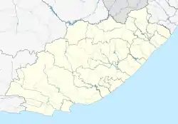
Rosmead | |
|---|---|
 Rosmead  Rosmead | |
| Coordinates: 31°29′02″S 25°07′05″E / 31.484°S 25.118°E | |
| Country | South Africa |
| Province | Eastern Cape |
| District | Chris Hani |
| Municipality | Inxuba Yethemba |
| Time zone | UTC+2 (SAST) |
| PO box | 5900 |
Rosmead is a village 12 km east of Middelburg and 75 km west-south-west of Steynsburg. It was founded in 1880 and at first named Middelburg Road, but renamed in 1883 after Sir Hercules George Robinson, Lord Rosmead (1824–1897), who was Governor of the Cape Colony from 1880 to 1889.[1]
References
- ↑ Raper, Peter E. (1987). Dictionary of Southern African Place Names. Internet Archive. p. 393. Retrieved 28 August 2013.
This article is issued from Wikipedia. The text is licensed under Creative Commons - Attribution - Sharealike. Additional terms may apply for the media files.
.svg.png.webp)