Saint-Hilaire | |
|---|---|
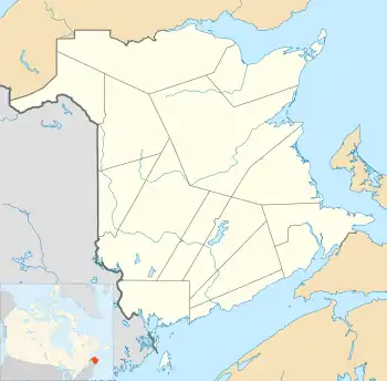
 Saint-Hilaire Location within New Brunswick. | |
| Coordinates: 47°17′33″N 68°23′33″W / 47.2925°N 68.3925°W | |
| Country | |
| Province | |
| County | Madawaska |
| Parish | Saint-Hilaire |
| Village Status | 1967 |
| Electoral Districts Federal | Madawaska—Restigouche |
| Provincial | Madawaska-les-Lacs |
| Government | |
| • Type | Village Council |
| • Mayor | Roland Dubé |
| • Councillors | List of Members
|
| Area | |
| • Total | 5.68 km2 (2.19 sq mi) |
| Population (2016)[2] | |
| • Total | 252 |
| • Density | 44.4/km2 (115/sq mi) |
| • Change 2011-2016 | |
| • Dwellings | 101 |
| Time zone | UTC-4 (AST) |
| • Summer (DST) | UTC-3 (ADT) |
| Area code | 506 |
| Access Routes | |
Saint-Hilaire (2016 population: 252[2]) is a former Canadian village in Madawaska County, New Brunswick.[3] It is now part of Haut-Madawaska.
The legal spelling of the name was St. Hilaire but this was used only sporadically by the provincial government.
The largest employer is a composting plant.
History and geography
The municipality was constituted on 2 October 1967. It consists of a mayor and three councillors.
The Saint John river valley is cut between two sets of peaks. The town is roughly 200m above sea level, while a peak of roughly 1000m is seen nearby. Frenchville, Maine is across the river. The steel truss Clair – Fort Kent Bridge is upriver about five miles, while downstream the next border crossing is the Edmundston–Madawaska Bridge (also a steel truss).
Economy
The nearest post office is upriver in Baker Brook. A railway and NB Route 120 go through town, as well as the Saint John River. The elementary school closed in 1996 due to lack of students. The Caisse Populaire Trois-Rives maintains a branch. The nearest Royal Canadian Mounted Police detachment is in Clair, New Brunswick, while the nearest hospital is located in Edmundston.
Demographics
Population
| 2016 | 2011 | |
|---|---|---|
| Population | 252 (-16.8% from 2011) | 303 (+31.2% from 2006) |
| Land area | 5.68 km2 (2.19 sq mi) | 5.67 km2 (2.19 sq mi) |
| Population density | 44.4/km2 (115/sq mi) | 53.4/km2 (138/sq mi) |
| Median age | 37.6 (M: 38.5, F: 36.5) | 35.7 (M: 35.6, F: 36.0) |
| Private dwellings | 101 (total) | 96 (total) |
| Median household income | $63,360 | $.N/A |
|
|
| |||||||||||||||||||||||||||
| [8][9][2] | |||||||||||||||||||||||||||||
Language
| Canada Census Mother Tongue - Saint-Hilaire, New Brunswick 2011 language data for this area has been suppressed for data quality or confidentiality reasons.[8] | ||||||||||||||||||
|---|---|---|---|---|---|---|---|---|---|---|---|---|---|---|---|---|---|---|
| Census | Total | French |
English |
French & English |
Other | |||||||||||||
| Year | Responses | Count | Trend | Pop % | Count | Trend | Pop % | Count | Trend | Pop % | Count | Trend | Pop % | |||||
2016 |
240 |
235 | 95.92% | 5 | 2.04% | 0 | 0.00% | 5 | 2.04% | |||||||||
2011 |
n/a |
n/a | 0.00% | n/a | 0.00% | n/a | 0.00% | n/a | 0.00% | |||||||||
2006 |
250 |
250 | 100.00% | 0 | 0.00% | 0 | 0.00% | 0 | 0.00% | |||||||||
2001 |
235 |
215 | 91.49% | 10 | 4.26% | 10 | 4.26% | 0 | 0.00% | |||||||||
1996 |
250 |
240 | n/a | 96.00% | 0 | n/a | 0.00% | 10 | n/a | 4.00% | 0 | n/a | 0.00% | |||||
Notable people
See also
References
- ↑ Government of New Brunswick website: Saint-Hilaire Archived 2011-06-11 at the Wayback Machine
- 1 2 3 4 "Census Profile, 2016 Census: St. Hilaire, Village [Census subdivision], New Brunswick". Statistics Canada. Retrieved September 21, 2016.
- ↑ New Brunswick Provincial Archives - Saint-Hilaire
- ↑ "2016 Community Profiles". 2016 Canadian Census. Statistics Canada. August 12, 2021. Retrieved 2019-09-21.
- ↑ "2011 Community Profiles". 2011 Canadian Census. Statistics Canada. March 21, 2019. Retrieved 2014-03-25.
- ↑ "2006 Community Profiles". 2006 Canadian Census. Statistics Canada. August 20, 2019.
- ↑ "2001 Community Profiles". 2001 Canadian Census. Statistics Canada. July 18, 2021.
- 1 2 Statistics Canada: 1996, 2001, 2006, 2011 census
- ↑ "Corrections and updates: Population and dwelling count amendments, 2011 Census". Statistics Canada. February 14, 2013. Retrieved February 15, 2013.