| Sierra Fría | |
|---|---|
 | |
| Highest point | |
| Peak | Cerro de la Ardilla |
| Elevation | 3,050 m (10,010 ft) |
| Coordinates | 22°12′58″N 102°37′8″W / 22.21611°N 102.61889°W |
| Geography | |
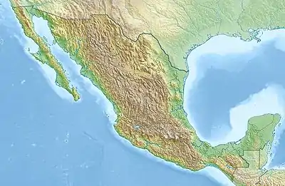
 Sierra Fría location of the Sierra Fría in Mexico | |
| Location | Sierra Madre Occidental |
| Country | Mexico |
| States | Aguascalientes and Zacatecas |
The Sierra Fría is a mountain range in central Mexico. It forms the northwestern border of Aguascalientes state and extends into adjacent Zacatecas, west of the city of Aguascalientes.
Geography
The Sierra Fría is the southeasternmost range of the Sierra Madre Occidental. The highest peak is Cerro de la Ardilla (3050 m).[1] The Sierra extends north and south, and divides the upper basins of the Juchipila River to the west from the Río Verde to the east.
The municipalities of San José de Gracia, Calvillo, Rincón de Romos, Jesús María and Pabellón de Arteaga extend across the range.[1]
Flora and fauna
Higher elevations of the range are covered in pine–oak woodland, with pines and/or oaks as the dominant trees, with manzanillo (Arbutus spp.) and juniper. Areas that have been logged are covered in thickets of manzanillo, and montane grasslands occur on canyon slopes. Matorral (dry shrubland) surrounds the Sierra at lower elevations.[2]
The area is rich in wildlife. Native mammals include white-tailed deer (Odocoileus virginianus), puma (Puma concolor), collared peccary (Dicotyles tajacu), ringtail (Bassariscus astutus), and gray fox (Urocyon cinereoargenteus).[1]
109 species of birds have been recorded in the range, of which 67% are year-round residents and 33% are winter visitors. These include the golden eagle (Aquila chrysaetos) peregrine falcon (Falco peregrinus) Harris's hawk (Parabuteo unicinctus), Mexican spotted owl (Strix occidentalis lucida), great horned owl (Bubo virginianus), eared quetzal (Euptilotis neoxenus), Montezuma quail (Cyrtonyx montezumae), lesser scaup (Aythya affinis), and northern pintail (Anas acuta). The Sierra is designated and Important Bird Area.[3]
Conservation and tourism
Much of the range is in protected areas, including the Cuenca Alimentadora del Distrito Nacional de Riego 043 Estado de Nayarit and Cuenca Alimentadora del Distrito Nacional de Riego 01 Pabellón. Camping, hiking, nature walks, horseback riding, and mountain biking are permitted, and hunting and sport fishing are permitted with prior permission.[1]
References
- 1 2 3 4 "Sierra Fría, Aguascalientes". turimexico.com. Accessed 6 September 2021.
- ↑ Wilson, Larry David, and James R. McCranie. (1979) “Notes on the Herpetofauna of Two Mountain Ranges in México (Sierra Fría, Aguascalientes, and Sierra Morones, Zacatecas).” Journal of Herpetology, vol. 13, no. 3, 1979, pp. 271–278. JSTOR, www.jstor.org/stable/1563318. Accessed 6 Sept. 2021.
- ↑ BirdLife International (2021). Important Bird Areas factsheet: Sierra Fría. Accessed 6 September 2021.