| Terazawa Dam | |
|---|---|
 | |
 Location of Terazawa Dam in Japan | |
| Location | Gunma Prefecture, Japan |
| Coordinates | 36°27′37″N 139°8′06″E / 36.46028°N 139.13500°E |
| Opening date | 1952 |
| Dam and spillways | |
| Height | 15.5m |
| Length | 140m |
| Reservoir | |
| Total capacity | 137 thousand cubic meters |
| Catchment area | 1.7 sq. km |
| Surface area | 3 hectares |
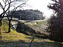
Terazawa Dam is an earthfill dam located in Gunma Prefecture in Japan. The dam is used for irrigation. The catchment area of the dam is 1.7 km2. The dam impounds about 3 ha of land when full and can store 137 thousand cubic meters of water. The construction of the dam was completed in 1952.[1]
References
- ↑ "Terazawa Dam - Dams in Japan". Retrieved 2022-02-22.
This article is issued from Wikipedia. The text is licensed under Creative Commons - Attribution - Sharealike. Additional terms may apply for the media files.