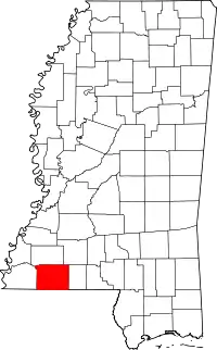
Location of Amite County in Mississippi
This is a list of the National Register of Historic Places listings in Amite County, Mississippi.
This is intended to be a complete list of the properties on the National Register of Historic Places in Amite County, Mississippi, United States. Latitude and longitude coordinates are provided for many National Register properties; these locations may be seen together in a map.[1]
There are 19 properties listed on the National Register in the county. Another property was once listed but has been removed.
This National Park Service list is complete through NPS recent listings posted January 12, 2024.[2]
Current listings


Former listing
| [3] | Name on the Register | Image | Date listed | Date removed | Location | City or town | Description |
|---|---|---|---|---|---|---|---|
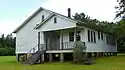
| 1 | Talbert-Cassels House | March 1, 1984 (#84002125) | July 16, 2008 | Off Mississippi Highway 574 |
Gloster vicinity | Destroyed by fire on December 15, 2006 [7][8] |
See also
Wikimedia Commons has media related to National Register of Historic Places in Amite County, Mississippi.
References
- ↑ The latitude and longitude information provided in this table was derived originally from the National Register Information System, which has been found to be fairly accurate for about 99% of listings. Some locations in this table may have been corrected to current GPS standards.
- ↑ National Park Service, United States Department of the Interior, "National Register of Historic Places: Weekly List Actions", retrieved January 12, 2024.
- 1 2 Numbers represent an alphabetical ordering by significant words. Various colorings, defined here, differentiate National Historic Landmarks and historic districts from other NRHP buildings, structures, sites or objects.
- ↑ "National Register Information System". National Register of Historic Places. National Park Service. March 13, 2009.
- ↑ The eight-digit number below each date is the number assigned to each location in the National Register Information System database, which can be viewed by clicking the number.
- ↑ Federal and state laws and practices restrict general public access to information regarding the specific location of this resource. In some cases, this is to protect archeological sites from vandalism, while in other cases it is restricted at the request of the owner. See: Knoerl, John; Miller, Diane; Shrimpton, Rebecca H. (1990), Guidelines for Restricting Information about Historic and Prehistoric Resources, National Register Bulletin, National Park Service, U.S. Department of the Interior, OCLC 20706997.
- ↑ MDAH
- ↑ "Fire destroys Amite antebellum home". Enterprise-Journal (McComb, MS). December 17, 2006. p. A6. Retrieved July 31, 2022 – via Newspapers.com.
| Topics | |
|---|---|
| Lists by state |
|
| Lists by insular areas | |
| Lists by associated state | |
| Other areas | |
| Related | |
Municipalities and communities of Amite County, Mississippi, United States | ||
|---|---|---|
| Towns | Map of Mississippi highlighting Amite County | |
| Unincorporated communities | ||
| Ghost town | ||
| Footnotes | ‡This populated place also has portions in an adjacent county or counties | |
This article is issued from Wikipedia. The text is licensed under Creative Commons - Attribution - Sharealike. Additional terms may apply for the media files.