Pressins | |
|---|---|
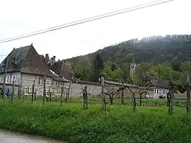 A general view of Pressins | |
.svg.png.webp) Coat of arms | |
Location of Pressins | |
 Pressins 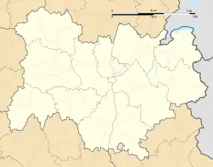 Pressins | |
| Coordinates: 45°31′35″N 5°37′40″E / 45.5264°N 5.6278°E | |
| Country | France |
| Region | Auvergne-Rhône-Alpes |
| Department | Isère |
| Arrondissement | La Tour-du-Pin |
| Canton | Chartreuse-Guiers |
| Government | |
| • Mayor (2020–2026) | Jean-Louis Reynaud[1] |
| Area 1 | 10.1 km2 (3.9 sq mi) |
| Population | 1,169 |
| • Density | 120/km2 (300/sq mi) |
| Time zone | UTC+01:00 (CET) |
| • Summer (DST) | UTC+02:00 (CEST) |
| INSEE/Postal code | 38323 /38480 |
| Elevation | 262–532 m (860–1,745 ft) (avg. 377 m or 1,237 ft) |
| 1 French Land Register data, which excludes lakes, ponds, glaciers > 1 km2 (0.386 sq mi or 247 acres) and river estuaries. | |
Pressins (French pronunciation: [pʁesɛ̃]) is a commune in the Isère department in southeastern France.[3]
Population
| Year | Pop. | ±% p.a. |
|---|---|---|
| 1968 | 568 | — |
| 1975 | 544 | −0.61% |
| 1982 | 687 | +3.39% |
| 1990 | 762 | +1.30% |
| 1999 | 832 | +0.98% |
| 2009 | 1,088 | +2.72% |
| 2014 | 1,143 | +0.99% |
| 2020 | 1,156 | +0.19% |
| Source: INSEE[4] | ||
See also
References
- ↑ "Répertoire national des élus: les maires". data.gouv.fr, Plateforme ouverte des données publiques françaises (in French). 2 December 2020.
- ↑ "Populations légales 2021". The National Institute of Statistics and Economic Studies. 28 December 2023.
- ↑ INSEE commune file
- ↑ Population en historique depuis 1968, INSEE
Wikimedia Commons has media related to Pressins.
This article is issued from Wikipedia. The text is licensed under Creative Commons - Attribution - Sharealike. Additional terms may apply for the media files.