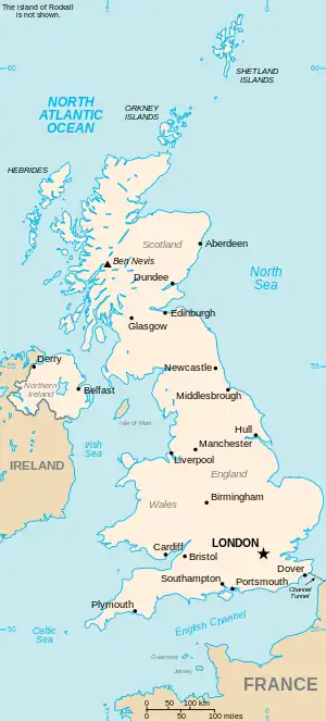
The United Kingdom

This is part of the list of United Kingdom locations: a gazetteer of place names in the United Kingdom showing each place's locality and geographical coordinates.

Co (continued)

Cos

Location Locality Coordinates
(links to map & photo sources)
OS grid
reference
Cosby Leicestershire 52°33′N 1°12′W / 52.55°N 01.20°W / 52.55; -01.20 SP5495
Coscote Oxfordshire 51°35′N 1°16′W / 51.58°N 01.26°W / 51.58; -01.26 SU5188
Coseley Dudley 52°32′N 2°05′W / 52.54°N 02.08°W / 52.54; -02.08 SO9494
Cosford Warwickshire 52°24′N 1°17′W / 52.40°N 01.28°W / 52.40; -01.28 SP4979
Cosgrove Northamptonshire 52°04′N 0°50′W / 52.07°N 00.84°W / 52.07; -00.84 SP7942
Cosham City of Portsmouth 50°50′N 1°04′W / 50.84°N 01.06°W / 50.84; -01.06 SU6605
Coshandrochaid Argyll and Bute 55°58′N 5°41′W / 55.97°N 05.68°W / 55.97; -05.68 NR7082
Cosheston Pembrokeshire 51°41′N 4°53′W / 51.69°N 04.89°W / 51.69; -04.89 SN0003
Cosmeston The Vale Of Glamorgan 51°25′N 3°11′W / 51.41°N 03.18°W / 51.41; -03.18 ST1869
Cosmore Dorset 50°50′N 2°28′W / 50.84°N 02.47°W / 50.84; -02.47 ST6705
Cossall Nottinghamshire 52°58′N 1°17′W / 52.97°N 01.28°W / 52.97; -01.28 SK4842
Cossall Marsh Nottinghamshire 52°58′N 1°17′W / 52.97°N 01.28°W / 52.97; -01.28 SK4842
Cossington Somerset 51°09′N 2°56′W / 51.15°N 02.93°W / 51.15; -02.93 ST3540
Cossington Leicestershire 52°43′N 1°07′W / 52.71°N 01.11°W / 52.71; -01.11 SK6013
Costa Orkney Islands 59°08′N 3°11′W / 59.13°N 03.19°W / 59.13; -03.19 HY3228
Costessey Norfolk 52°40′N 1°12′E / 52.66°N 01.20°E / 52.66; 01.20 TG1712
Costessey Park Norfolk 52°39′N 1°11′E / 52.65°N 01.19°E / 52.65; 01.19 TG1611
Costhorpe Nottinghamshire 53°22′N 1°07′W / 53.36°N 01.12°W / 53.36; -01.12 SK5886
Costislost Cornwall 50°29′N 4°47′W / 50.49°N 04.79°W / 50.49; -04.79 SX0270
Costock Nottinghamshire 52°49′N 1°09′W / 52.82°N 01.15°W / 52.82; -01.15 SK5726
Coston Norfolk 52°37′N 1°02′E / 52.61°N 01.04°E / 52.61; 01.04 TG0606
Coston Leicestershire 52°47′N 0°45′W / 52.78°N 00.75°W / 52.78; -00.75 SK8422
Coswinsawsin Cornwall 50°11′N 5°20′W / 50.19°N 05.33°W / 50.19; -05.33 SW6238

Cot

Location Locality Coordinates
(links to map & photo sources)
OS grid
reference
Cote Somerset 51°11′N 2°56′W / 51.19°N 02.94°W / 51.19; -02.94 ST3444
Cote West Sussex 50°50′N 0°25′W / 50.83°N 00.42°W / 50.83; -00.42 TQ1105
Cote Oxfordshire 51°43′N 1°29′W / 51.71°N 01.49°W / 51.71; -01.49 SP3502
Cotebrook Cheshire 53°11′N 2°38′W / 53.18°N 02.64°W / 53.18; -02.64 SJ5765
Cotehill Cumbria 54°50′N 2°50′W / 54.84°N 02.84°W / 54.84; -02.84 NY4650
Cotes Cumbria 54°16′N 2°47′W / 54.26°N 02.79°W / 54.26; -02.79 SD4886
Cotes Leicestershire 52°46′N 1°11′W / 52.77°N 01.18°W / 52.77; -01.18 SK5520
Cotes Staffordshire 52°54′N 2°14′W / 52.90°N 02.23°W / 52.90; -02.23 SJ8434
Cotesbach Leicestershire 52°26′N 1°13′W / 52.43°N 01.22°W / 52.43; -01.22 SP5382
Cotes Heath Staffordshire 52°54′N 2°15′W / 52.90°N 02.25°W / 52.90; -02.25 SJ8334
Cotes Park Derbyshire 53°05′N 1°22′W / 53.08°N 01.37°W / 53.08; -01.37 SK4254
Cotford Devon 50°43′N 3°13′W / 50.72°N 03.21°W / 50.72; -03.21 SY1492
Cotford St Luke Somerset 51°02′N 3°11′W / 51.04°N 03.19°W / 51.04; -03.19 ST1727
Cotgrave Nottinghamshire 52°54′N 1°02′W / 52.90°N 01.04°W / 52.90; -01.04 SK6435
Cotham City of Bristol 51°28′N 2°36′W / 51.46°N 02.60°W / 51.46; -02.60 ST5874
Cotham Nottinghamshire 53°01′N 0°49′W / 53.01°N 00.82°W / 53.01; -00.82 SK7947
Cothelstone Somerset 51°04′N 3°10′W / 51.07°N 03.17°W / 51.07; -03.17 ST1831
Cotheridge Worcestershire 52°11′N 2°19′W / 52.18°N 02.32°W / 52.18; -02.32 SO7854
Cotherstone Durham 54°34′N 1°59′W / 54.56°N 01.98°W / 54.56; -01.98 NZ0119
Cothill Oxfordshire 51°41′N 1°20′W / 51.68°N 01.33°W / 51.68; -01.33 SU4699
Cotland Monmouthshire 51°44′N 2°43′W / 51.73°N 02.72°W / 51.73; -02.72 SO5004
Cotleigh Devon 50°49′N 3°08′W / 50.81°N 03.13°W / 50.81; -03.13 ST2002
Cotmanhay Derbyshire 52°59′N 1°19′W / 52.98°N 01.31°W / 52.98; -01.31 SK4643
Cotmarsh Wiltshire 51°31′N 1°52′W / 51.51°N 01.87°W / 51.51; -01.87 SU0979
Cotmaton Devon 50°40′N 3°16′W / 50.67°N 03.26°W / 50.67; -03.26 SY1187
Cotness East Riding of Yorkshire 53°43′N 0°47′W / 53.71°N 00.79°W / 53.71; -00.79 SE7924
Coton Northamptonshire 52°20′N 1°01′W / 52.33°N 01.01°W / 52.33; -01.01 SP6771
Coton Cambridgeshire 52°12′N 0°02′E / 52.20°N 00.04°E / 52.20; 00.04 TL4058
Coton Shropshire 52°54′N 2°42′W / 52.90°N 02.70°W / 52.90; -02.70 SJ5334
Coton (Tamworth) Staffordshire 52°38′N 1°44′W / 52.64°N 01.73°W / 52.64; -01.73 SK1805
Coton (Gnosall) Staffordshire 52°46′N 2°17′W / 52.77°N 02.28°W / 52.77; -02.28 SJ8120
Coton (Milwich) Staffordshire 52°52′N 2°02′W / 52.87°N 02.04°W / 52.87; -02.04 SJ9731
Coton Clanford Staffordshire 52°48′N 2°11′W / 52.80°N 02.19°W / 52.80; -02.19 SJ8723
Coton Hayes Staffordshire 52°53′N 2°01′W / 52.88°N 02.01°W / 52.88; -02.01 SJ9932
Coton Hill Shropshire 52°43′N 2°46′W / 52.71°N 02.77°W / 52.71; -02.77 SJ4813
Coton Hill Staffordshire 52°53′N 2°02′W / 52.88°N 02.03°W / 52.88; -02.03 SJ9832
Coton in the Clay Staffordshire 52°51′N 1°46′W / 52.85°N 01.76°W / 52.85; -01.76 SK1629
Coton in the Elms Derbyshire 52°44′N 1°38′W / 52.73°N 01.64°W / 52.73; -01.64 SK2415
Coton Park Derbyshire 52°45′N 1°36′W / 52.75°N 01.60°W / 52.75; -01.60 SK2717
Cotonwood Shropshire 52°55′N 2°42′W / 52.91°N 02.70°W / 52.91; -02.70 SJ5336
Cotonwood Staffordshire 52°46′N 2°17′W / 52.77°N 02.29°W / 52.77; -02.29 SJ8020
Cotswold Community Wiltshire 51°39′N 1°57′W / 51.65°N 01.95°W / 51.65; -01.95 SU0395
Cott Devon 50°26′N 3°43′W / 50.43°N 03.71°W / 50.43; -03.71 SX7861
Cottam Lancashire 53°47′N 2°46′W / 53.78°N 02.76°W / 53.78; -02.76 SD5032
Cottam Nottinghamshire 53°18′N 0°47′W / 53.30°N 00.78°W / 53.30; -00.78 SK8179
Cottenham Cambridgeshire 52°17′N 0°07′E / 52.28°N 00.12°E / 52.28; 00.12 TL4567
Cottenham Park Kingston upon Thames 51°24′N 0°14′W / 51.40°N 00.24°W / 51.40; -00.24 TQ2269
Cotterdale North Yorkshire 54°20′N 2°16′W / 54.33°N 02.26°W / 54.33; -02.26 SD8393
Cottered Hertfordshire 51°56′N 0°05′W / 51.94°N 00.09°W / 51.94; -00.09 TL3129
Cotterhill Woods Rotherham 53°20′N 1°10′W / 53.33°N 01.17°W / 53.33; -01.17 SK5582
Cotteridge Birmingham 52°25′N 1°56′W / 52.41°N 01.94°W / 52.41; -01.94 SP0480
Cotterstock Northamptonshire 52°29′N 0°28′W / 52.49°N 00.46°W / 52.49; -00.46 TL0490
Cottesbrooke Northamptonshire 52°21′N 0°58′W / 52.35°N 00.97°W / 52.35; -00.97 SP7073
Cottesmore Rutland 52°42′N 0°40′W / 52.70°N 00.66°W / 52.70; -00.66 SK9013
Cotteylands Devon 50°53′N 3°30′W / 50.89°N 03.50°W / 50.89; -03.50 SS9412
Cottingham East Riding of Yorkshire 53°47′N 0°23′W / 53.78°N 00.39°W / 53.78; -00.39 TA0633
Cottingham Northamptonshire 52°30′N 0°46′W / 52.50°N 00.76°W / 52.50; -00.76 SP8490
Cottingley Bradford 53°49′N 1°50′W / 53.82°N 01.83°W / 53.82; -01.83 SE1137
Cottisford Oxfordshire 51°58′N 1°09′W / 51.97°N 01.15°W / 51.97; -01.15 SP5831
Cotton Staffordshire 53°01′N 1°55′W / 53.01°N 01.91°W / 53.01; -01.91 SK0646
Cotton Suffolk 52°16′N 1°01′E / 52.26°N 01.01°E / 52.26; 01.01 TM0667
Cotton End Bedfordshire 52°05′N 0°25′W / 52.09°N 00.42°W / 52.09; -00.42 TL0845
Cotton End Northamptonshire 52°13′N 0°54′W / 52.22°N 00.90°W / 52.22; -00.90 SP7559
Cotton of Brighty Angus 56°32′N 2°55′W / 56.53°N 02.92°W / 56.53; -02.92 NO4338
Cotton of Gardyne Angus 56°37′N 2°42′W / 56.61°N 02.70°W / 56.61; -02.70 NO5747
Cotton Stones Calderdale 53°41′N 1°58′W / 53.68°N 01.97°W / 53.68; -01.97 SE0221
Cotton Tree Lancashire 53°50′N 2°09′W / 53.84°N 02.15°W / 53.84; -02.15 SD9039
Cottonworth Hampshire 51°08′N 1°28′W / 51.14°N 01.47°W / 51.14; -01.47 SU3739
Cottown Aberdeenshire 57°27′N 2°18′W / 57.45°N 02.30°W / 57.45; -02.30 NJ8240
Cottown Perth and Kinross 56°22′N 3°17′W / 56.37°N 03.29°W / 56.37; -03.29 NO2021
Cotts Cornwall 50°28′N 4°13′W / 50.46°N 04.21°W / 50.46; -04.21 SX4365
Cottwood Devon 50°54′N 3°58′W / 50.90°N 03.97°W / 50.90; -03.97 SS6114
Cotwall Shropshire 52°44′N 2°35′W / 52.74°N 02.59°W / 52.74; -02.59 SJ6017
Cotwalton Staffordshire 52°54′N 2°07′W / 52.90°N 02.12°W / 52.90; -02.12 SJ9234

Cou

Location Locality Coordinates
(links to map & photo sources)
OS grid
reference
Coubister Orkney Islands 59°01′N 3°05′W / 59.01°N 03.09°W / 59.01; -03.09 HY3715
Couch Green Hampshire 51°05′N 1°15′W / 51.08°N 01.25°W / 51.08; -01.25 SU5232
Couch's Mill Cornwall 50°24′N 4°37′W / 50.40°N 04.61°W / 50.40; -04.61 SX1459
Coughton Herefordshire 51°53′N 2°35′W / 51.88°N 02.59°W / 51.88; -02.59 SO5921
Coughton Warwickshire 52°14′N 1°53′W / 52.23°N 01.89°W / 52.23; -01.89 SP0760
Coughton Fields Warwickshire 52°13′N 1°52′W / 52.22°N 01.86°W / 52.22; -01.86 SP0959
Coulags Highland 57°27′N 5°24′W / 57.45°N 05.40°W / 57.45; -05.40 NG9645
Coulby Newham Middlesbrough 54°31′N 1°13′W / 54.51°N 01.22°W / 54.51; -01.22 NZ5014
Coulderton Cumbria 54°28′N 3°34′W / 54.46°N 03.57°W / 54.46; -03.57 NX9809
Coulin Lodge Highland 57°33′N 5°20′W / 57.55°N 05.34°W / 57.55; -05.34 NH0056
Coull Aberdeenshire 57°06′N 2°49′W / 57.10°N 02.81°W / 57.10; -02.81 NJ5102
Coulnacraggan Highland 57°25′N 6°17′W / 57.42°N 06.28°W / 57.42; -06.28 NG4345
Coul of Fairburn Highland 57°32′N 4°33′W / 57.54°N 04.55°W / 57.54; -04.55 NH4753
Coul Point Argyll and Bute 55°47′N 6°28′W / 55.79°N 06.47°W / 55.79; -06.47 NR194644
Coulport Argyll and Bute 56°02′N 4°53′W / 56.04°N 04.89°W / 56.04; -04.89 NS2087
Coulsdon Croydon 51°18′N 0°08′W / 51.30°N 00.13°W / 51.30; -00.13 TQ3058
Coulston Wiltshire 51°17′N 2°04′W / 51.28°N 02.07°W / 51.28; -02.07 ST9554
Coulter South Lanarkshire 55°35′N 3°33′W / 55.58°N 03.55°W / 55.58; -03.55 NT0233
Coultings Somerset 51°10′N 3°07′W / 51.16°N 03.11°W / 51.16; -03.11 ST2241
Coulton North Yorkshire 54°09′N 1°02′W / 54.15°N 01.03°W / 54.15; -01.03 SE6374
Cound Shropshire 52°38′N 2°40′W / 52.63°N 02.66°W / 52.63; -02.66 SJ5504
Coundlane Shropshire 52°38′N 2°38′W / 52.64°N 02.63°W / 52.64; -02.63 SJ5705
Coundmoor Shropshire 52°37′N 2°40′W / 52.61°N 02.66°W / 52.61; -02.66 SJ5502
Coundon Coventry 52°25′N 1°32′W / 52.42°N 01.54°W / 52.42; -01.54 SP3181
Coundon Durham 54°39′N 1°37′W / 54.65°N 01.62°W / 54.65; -01.62 NZ2429
Coundongate Durham 54°39′N 1°40′W / 54.65°N 01.66°W / 54.65; -01.66 NZ2229
Coundon Grange Durham 54°38′N 1°40′W / 54.64°N 01.66°W / 54.64; -01.66 NZ2228
Counters End Hertfordshire 51°45′N 0°29′W / 51.75°N 00.49°W / 51.75; -00.49 TL0407
Countersett North Yorkshire 54°17′N 2°08′W / 54.28°N 02.13°W / 54.28; -02.13 SD9188
Countess Cross Essex 51°56′N 0°42′E / 51.93°N 00.70°E / 51.93; 00.70 TL8630
Countess Wear Devon 50°42′N 3°30′W / 50.70°N 03.50°W / 50.70; -03.50 SX9490
Countesswells City of Aberdeen 57°08′N 2°13′W / 57.14°N 02.21°W / 57.14; -02.21 NJ872051
Countesthorpe Leicestershire 52°33′N 1°08′W / 52.55°N 01.14°W / 52.55; -01.14 SP5895
Countisbury Devon 51°13′N 3°48′W / 51.22°N 03.80°W / 51.22; -03.80 SS7449
Coupar Angus Perth and Kinross 56°32′N 3°16′W / 56.54°N 03.27°W / 56.54; -03.27 NO2240
Coup Green Lancashire 53°44′N 2°37′W / 53.73°N 02.62°W / 53.73; -02.62 SD5927
Coupland Cumbria 54°33′N 2°26′W / 54.55°N 02.44°W / 54.55; -02.44 NY7118
Coupland Northumberland 55°34′N 2°07′W / 55.57°N 02.11°W / 55.57; -02.11 NT9331
Courance Dumfries and Galloway 55°11′N 3°29′W / 55.19°N 03.49°W / 55.19; -03.49 NY0590
Coursley Somerset 51°05′N 3°13′W / 51.09°N 03.22°W / 51.09; -03.22 ST1433
Court-at-Street Kent 51°04′N 0°59′E / 51.07°N 00.98°E / 51.07; 00.98 TR0935
Court Barton Devon 50°39′N 3°39′W / 50.65°N 03.65°W / 50.65; -03.65 SX8385
Court Colman Bridgend 51°31′N 3°37′W / 51.51°N 03.61°W / 51.51; -03.61 SS8881
Court Corner Hampshire 51°19′N 1°08′W / 51.32°N 01.14°W / 51.32; -01.14 SU6059
Courteachan Highland 57°00′N 5°49′W / 57.00°N 05.82°W / 57.00; -05.82 NM6897
Courteenhall Northamptonshire 52°10′N 0°54′W / 52.17°N 00.90°W / 52.17; -00.90 SP7553
Court Henry Carmarthenshire 51°52′N 4°06′W / 51.87°N 04.10°W / 51.87; -04.10 SN5522
Court Hey Liverpool 53°24′N 2°53′W / 53.40°N 02.88°W / 53.40; -02.88 SJ4190
Court House Green Coventry 52°25′N 1°29′W / 52.42°N 01.48°W / 52.42; -01.48 SP3581
Court Orchard Dorset 50°44′N 2°46′W / 50.73°N 02.76°W / 50.73; -02.76 SY4693
Courtsend Essex 51°35′N 0°55′E / 51.59°N 00.91°E / 51.59; 00.91 TR0293
Courtway Somerset 51°05′N 3°08′W / 51.09°N 03.14°W / 51.09; -03.14 ST2033
Cousland Midlothian 55°54′N 3°00′W / 55.90°N 03.00°W / 55.90; -03.00 NT3768
Cousley Wood East Sussex 51°04′N 0°21′E / 51.07°N 00.35°E / 51.07; 00.35 TQ6533
This article is issued from Wikipedia. The text is licensed under Creative Commons - Attribution - Sharealike. Additional terms may apply for the media files.