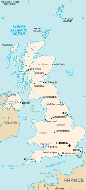
The United Kingdom
This is part of the list of United Kingdom locations: a gazetteer of place names in the United Kingdom showing each place's locality and geographical coordinates.
Llan (continued)
Llano–Llanr
| Location | Locality | Coordinates (links to map & photo sources) |
OS grid reference |
| Llanon | Pembrokeshire | 51°56′N 5°09′W / 51.93°N 05.15°W | SM8331 |
| Llanover | Monmouthshire | 51°46′N 3°00′W / 51.76°N 03.00°W | SO3108 |
| Llanpumsaint | Carmarthenshire | 51°56′N 4°19′W / 51.93°N 04.31°W | SN4129 |
| Llanreath | Pembrokeshire | 51°41′N 4°58′W / 51.68°N 04.96°W | SM9503 |
| Llanrhaeadr-ym-Mochnant | Powys | 52°49′N 3°18′W / 52.82°N 03.30°W | SJ1226 |
| Llanrhaeadr-yng-Nghinmeirch | Denbighshire | 53°09′N 3°22′W / 53.15°N 03.37°W | SJ0863 |
| Llanrhian | Pembrokeshire | 51°56′N 5°11′W / 51.93°N 05.18°W | SM8131 |
| Llanrhidian | Swansea | 51°36′N 4°11′W / 51.60°N 04.18°W | SS4992 |
| Llanrhos | Conwy | 53°18′N 3°49′W / 53.30°N 03.81°W | SH7980 |
| Llanrhyddlad | Isle of Anglesey | 53°22′N 4°31′W / 53.37°N 04.51°W | SH3389 |
| Llanrhystud | Ceredigion | 52°17′N 4°09′W / 52.29°N 04.15°W | SN5369 |
| Llanrug | Gwynedd | 53°08′N 4°11′W / 53.14°N 04.19°W | SH5363 |
| Llanrumney | Cardiff | 51°31′N 3°07′W / 51.51°N 03.12°W | ST2280 |
| Llanrwst | Conwy | 53°08′N 3°47′W / 53.13°N 03.79°W | SH8061 |
Llans
Llant
Llanu–Llanv
| Location | Locality | Coordinates (links to map & photo sources) |
OS grid reference |
| Llanuwchllyn | Gwynedd | 52°51′N 3°40′W / 52.85°N 03.67°W | SH8730 |
| Llanvaches | Monmouthshire | 51°37′N 2°49′W / 51.61°N 02.82°W | ST4391 |
| Llanvair-Discoed | City of Newport | 51°37′N 2°49′W / 51.62°N 02.81°W | ST4492 |
| Llanvapley | Monmouthshire | 51°49′N 2°56′W / 51.82°N 02.93°W | SO3614 |
| Llanvetherine | Monmouthshire | 51°50′N 2°56′W / 51.84°N 02.93°W | SO3617 |
| Llanveynoe | Herefordshire | 51°58′N 3°01′W / 51.97°N 03.02°W | SO3031 |
| Llanvihangel Crucorney | Monmouthshire | 51°52′N 2°59′W / 51.87°N 02.98°W | SO3220 |
| Llanvihangel Gobion | Monmouthshire | 51°46′N 2°57′W / 51.77°N 02.95°W | SO3409 |
| Llanvihangel-Ystern-Llewern | Monmouthshire | 51°49′N 2°49′W / 51.81°N 02.82°W | SO4313 |
Llanw
Llany
Llaw–Llaz
| Location | Locality | Coordinates (links to map & photo sources) |
OS grid reference |
| Llawhaden | Pembrokeshire | 51°49′N 4°49′W / 51.81°N 04.81°W | SN0617 |
| Llawnt | Shropshire | 52°52′N 3°08′W / 52.86°N 03.13°W | SJ2430 |
| Llawryglyn | Powys | 52°30′N 3°34′W / 52.50°N 03.57°W | SN9391 |
| Llay | Wrexham | 53°05′N 3°00′W / 53.08°N 03.00°W | SJ3355 |
Lle–Lly
This article is issued from Wikipedia. The text is licensed under Creative Commons - Attribution - Sharealike. Additional terms may apply for the media files.