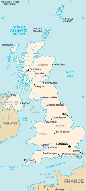
The United Kingdom
This is part of the list of United Kingdom locations: a gazetteer of place names in the United Kingdom showing each place's locality and geographical coordinates.
Sg
| Location | Locality | Coordinates (links to map & photo sources) |
OS grid reference |
| Sgeir a' Chail | Western Isles | 57°42′N 7°06′W / 57.70°N 07.10°W | NF960796 |
| Sgeir a' Mhill | Western Isles | 57°06′N 7°14′W / 57.10°N 07.23°W | NF831133 |
| Sgeir Iosal | Highland | 58°24′N 5°08′W / 58.40°N 05.13°W | NC1750 |
| Sgeotasaigh | Western Isles | 57°52′N 6°45′W / 57.87°N 06.75°W | NG185973 |
| Sgiogarstaigh | Western Isles | 58°28′N 6°13′W / 58.46°N 06.22°W | NB5461 |
| Sgoir Beag | Highland | 57°33′N 6°38′W / 57.55°N 06.64°W | NG2261 |
Sh
Sha
She
Shi
Sho
Shr
| Location | Locality | Coordinates (links to map & photo sources) |
OS grid reference |
| Shraleybrook | Staffordshire | 53°02′N 2°19′W / 53.03°N 02.32°W | SJ7849 |
| Shrawardine | Shropshire | 52°43′N 2°54′W / 52.72°N 02.90°W | SJ3915 |
| Shrawley | Worcestershire | 52°16′N 2°17′W / 52.27°N 02.29°W | SO8064 |
| Shreding Green | Buckinghamshire | 51°31′N 0°32′W / 51.51°N 00.53°W | TQ0281 |
| Shrewley | Warwickshire | 52°18′N 1°40′W / 52.30°N 01.67°W | SP2267 |
| Shrewley Common | Warwickshire | 52°18′N 1°41′W / 52.30°N 01.69°W | SP2167 |
| Shrewsbury | Shropshire | 52°42′N 2°45′W / 52.70°N 02.75°W | SJ4912 |
| Shrewton | Wiltshire | 51°11′N 1°55′W / 51.18°N 01.91°W | SU0643 |
| Shripney | West Sussex | 50°49′N 0°41′W / 50.81°N 00.68°W | SU9302 |
| Shrivenham | Oxfordshire | 51°35′N 1°39′W / 51.59°N 01.65°W | SU2489 |
| Shropham | Norfolk | 52°29′N 0°55′E / 52.49°N 00.91°E | TL9893 |
| Shroton or Iwerne Courtney | Dorset | 50°54′N 2°13′W / 50.90°N 02.21°W | ST8512 |
| Shrub End | Essex | 51°52′N 0°52′E / 51.87°N 00.86°E | TL9723 |
| Shrubs Hill | Berkshire | 51°23′N 0°37′W / 51.39°N 00.62°W | SU9667 |
Shu-Shw
This article is issued from Wikipedia. The text is licensed under Creative Commons - Attribution - Sharealike. Additional terms may apply for the media files.