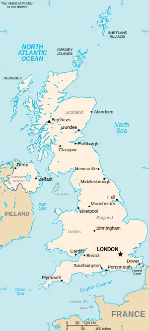
The United Kingdom

This is part of the list of United Kingdom locations: a gazetteer of place names in the United Kingdom showing each place's locality and geographical coordinates.

Cro (continued)

Croe-Crom

Location Locality Coordinates
(links to map & photo sources)
OS grid
reference
Croesau Bach Shropshire 52°50′N 3°07′W / 52.84°N 03.12°W / 52.84; -03.12 SJ2428
Croeserw Bridgend 51°38′N 3°38′W / 51.64°N 03.64°W / 51.64; -03.64 SS8695
Croes-goch Pembrokeshire 51°55′N 5°10′W / 51.92°N 05.17°W / 51.92; -05.17 SM8230
Croes-Hywel Monmouthshire 51°49′N 2°58′W / 51.82°N 02.97°W / 51.82; -02.97 SO3314
Croes-lan Ceredigion 52°04′N 4°22′W / 52.07°N 04.36°W / 52.07; -04.36 SN3844
Croes Llanfair Monmouthshire 51°45′N 2°58′W / 51.75°N 02.97°W / 51.75; -02.97 SO3307
Croesor Gwynedd 52°58′N 4°02′W / 52.97°N 04.04°W / 52.97; -04.04 SH6344
Croespenmaen Caerphilly 51°40′N 3°10′W / 51.67°N 03.17°W / 51.67; -03.17 ST1998
Croeswallt Shropshire 52°51′N 3°03′W / 52.85°N 03.05°W / 52.85; -03.05 SJ2929
Croes-wian Flintshire 53°14′N 3°19′W / 53.24°N 03.32°W / 53.24; -03.32 SJ1273
Croesyceiliog Torfaen 51°39′N 3°01′W / 51.65°N 03.01°W / 51.65; -03.01 ST3096
Croesyceilog Carmarthenshire 51°49′N 4°19′W / 51.81°N 04.32°W / 51.81; -04.32 SN4016
Croes-y-mwyalch Torfaen 51°37′N 3°01′W / 51.62°N 03.01°W / 51.62; -03.01 ST3092
Croes y pant Monmouthshire 51°44′N 3°00′W / 51.73°N 03.00°W / 51.73; -03.00 SO3104
Croesywaun Gwynedd 53°06′N 4°13′W / 53.10°N 04.21°W / 53.10; -04.21 SH5259
Croft Cheshire 53°26′N 2°33′W / 53.43°N 02.55°W / 53.43; -02.55 SJ6393
Croft Herefordshire 52°17′N 2°48′W / 52.28°N 02.80°W / 52.28; -02.80 SO4565
Croft Leicestershire 52°33′N 1°14′W / 52.55°N 01.24°W / 52.55; -01.24 SP5195
Croft Lincolnshire 53°07′N 0°14′E / 53.12°N 00.24°E / 53.12; 00.24 TF5061
Croftamie Stirling 56°02′N 4°27′W / 56.04°N 04.45°W / 56.04; -04.45 NS4786
Croftfoot City of Glasgow 55°49′N 4°14′W / 55.81°N 04.23°W / 55.81; -04.23 NS6060
Crofthandy Cornwall 50°14′N 5°11′W / 50.23°N 05.18°W / 50.23; -05.18 SW7342
Croftlands Cumbria 54°10′N 3°06′W / 54.17°N 03.10°W / 54.17; -03.10 SD2876
Croftmalloch West Lothian 55°51′N 3°41′W / 55.85°N 03.69°W / 55.85; -03.69 NS9464
Croft Mitchell Cornwall 50°11′N 5°16′W / 50.18°N 05.27°W / 50.18; -05.27 SW6637
Croftnacriech Highland 57°31′N 4°17′W / 57.51°N 04.28°W / 57.51; -04.28 NH6349
Crofton Bromley 51°22′N 0°04′E / 51.37°N 00.06°E / 51.37; 00.06 TQ4466
Crofton Cumbria 54°50′N 3°05′W / 54.84°N 03.09°W / 54.84; -03.09 NY3050
Crofton West Yorkshire 53°38′N 1°25′W / 53.64°N 01.42°W / 53.64; -01.42 SE3817
Crofton Wiltshire 51°21′N 1°37′W / 51.35°N 01.62°W / 51.35; -01.62 SU2662
Crofton Park Lewisham 51°27′N 0°02′W / 51.45°N 00.03°W / 51.45; -00.03 TQ367744
Croft-on-Tees North Yorkshire 54°28′N 1°34′W / 54.47°N 01.56°W / 54.47; -01.56 NZ2809
Croft Outerly Fife 56°11′N 3°13′W / 56.19°N 03.22°W / 56.19; -03.22 NO2401
Crofts Bank Trafford 53°27′N 2°22′W / 53.45°N 02.37°W / 53.45; -02.37 SJ7595
Crofts of Dipple Moray 57°37′N 3°08′W / 57.61°N 03.14°W / 57.61; -03.14 NJ3259
Crofts of Haddo Aberdeenshire 57°25′N 2°17′W / 57.42°N 02.28°W / 57.42; -02.28 NJ8337
Crofts of Kingscauseway Highland 57°47′N 4°04′W / 57.78°N 04.07°W / 57.78; -04.07 NH7779
Crofty Swansea 51°38′N 4°08′W / 51.63°N 04.14°W / 51.63; -04.14 SS5295
Croggan Argyll and Bute 56°22′N 5°43′W / 56.37°N 05.72°W / 56.37; -05.72 NM7027
Croglin Cumbria 54°49′N 2°40′W / 54.81°N 02.67°W / 54.81; -02.67 NY5747
Croich Highland 57°53′N 4°37′W / 57.88°N 04.61°W / 57.88; -04.61 NH4591
Croick Highland 58°28′N 3°54′W / 58.46°N 03.90°W / 58.46; -03.90 NC8954
Croir Western Isles 58°14′N 6°51′W / 58.24°N 06.85°W / 58.24; -06.85 NB1539
Cromarty Highland 57°40′N 4°02′W / 57.67°N 04.04°W / 57.67; -04.04 NH7867
Crombie Fife 56°02′N 3°32′W / 56.04°N 03.54°W / 56.04; -03.54 NT0485
Cromdale Highland 57°20′N 3°32′W / 57.33°N 03.54°W / 57.33; -03.54 NJ0728
Cromer Hertfordshire 51°56′N 0°07′W / 51.93°N 00.12°W / 51.93; -00.12 TL2928
Cromer Norfolk 52°56′N 1°17′E / 52.93°N 01.28°E / 52.93; 01.28 TG2142
Cromer-Hyde Hertfordshire 51°47′N 0°16′W / 51.79°N 00.26°W / 51.79; -00.26 TL2012
Cromford Derbyshire 53°06′N 1°34′W / 53.10°N 01.56°W / 53.10; -01.56 SK2956
Cromhall South Gloucestershire 51°36′N 2°26′W / 51.60°N 02.44°W / 51.60; -02.44 ST6990
Cromhall Common South Gloucestershire 51°35′N 2°26′W / 51.59°N 02.44°W / 51.59; -02.44 ST6989
Cromor Western Isles 58°06′N 6°25′W / 58.10°N 06.41°W / 58.10; -06.41 NB4021
Crompton Fold Oldham 53°34′N 2°05′W / 53.57°N 02.09°W / 53.57; -02.09 SD9409
Cromwell Nottinghamshire 53°08′N 0°49′W / 53.14°N 00.82°W / 53.14; -00.82 SK7961
Cromwell Bottom Calderdale 53°41′N 1°49′W / 53.69°N 01.81°W / 53.69; -01.81 SE1222

Cron-Crop

Location Locality Coordinates
(links to map & photo sources)
OS grid
reference
Cronberry East Ayrshire 55°28′N 4°13′W / 55.47°N 04.21°W / 55.47; -04.21 NS6022
Crondall Hampshire 51°13′N 0°52′W / 51.22°N 00.86°W / 51.22; -00.86 SU7948
Cronton Knowsley 53°23′N 2°46′W / 53.38°N 02.76°W / 53.38; -02.76 SJ4988
Crook Devon 50°49′N 3°11′W / 50.81°N 03.19°W / 50.81; -03.19 ST1602
Crook Durham 54°43′N 1°45′W / 54.71°N 01.75°W / 54.71; -01.75 NZ1635
Crook Cumbria 54°20′N 2°50′W / 54.34°N 02.83°W / 54.34; -02.83 SD4695
Crookdake Cumbria 54°46′N 3°16′W / 54.77°N 03.26°W / 54.77; -03.26 NY1943
Crooke Wigan 53°33′N 2°41′W / 53.55°N 02.68°W / 53.55; -02.68 SD5507
Crooked Billet Merton 51°25′N 0°14′W / 51.41°N 00.23°W / 51.41; -00.23 TQ2370
Crookedholm East Ayrshire 55°36′N 4°28′W / 55.60°N 04.46°W / 55.60; -04.46 NS4537
Crooked Soley Wiltshire 51°26′N 1°33′W / 51.44°N 01.55°W / 51.44; -01.55 SU3172
Crooked Withies Dorset 50°50′N 1°56′W / 50.84°N 01.93°W / 50.84; -01.93 SU0505
Crookes Sheffield 53°22′N 1°31′W / 53.37°N 01.52°W / 53.37; -01.52 SK3287
Crookesmoor Sheffield 53°22′N 1°30′W / 53.37°N 01.50°W / 53.37; -01.50 SK3387
Crookfur East Renfrewshire 55°46′N 4°20′W / 55.77°N 04.34°W / 55.77; -04.34 NS5356
Crookgate Bank Durham 54°53′N 1°43′W / 54.89°N 01.72°W / 54.89; -01.72 NZ1856
Crookhall Durham 54°50′N 1°50′W / 54.84°N 01.83°W / 54.84; -01.83 NZ1150
Crookham Berkshire 51°22′N 1°13′W / 51.37°N 01.22°W / 51.37; -01.22 SU5464
Crookham Northumberland 55°38′N 2°08′W / 55.63°N 02.14°W / 55.63; -02.14 NT9138
Crookham Village Hampshire 51°16′N 0°52′W / 51.26°N 00.86°W / 51.26; -00.86 SU7952
Crookhill Gateshead 54°58′N 1°46′W / 54.96°N 01.76°W / 54.96; -01.76 NZ1563
Crooklands Cumbria 54°14′N 2°43′W / 54.24°N 02.72°W / 54.24; -02.72 SD5383
Crook Log Bexley 51°27′32″N 0°07′41″E / 51.459°N 00.128°E / 51.459; 00.128 TQ478755
Crook of Devon Perth and Kinross 56°11′N 3°34′W / 56.18°N 03.56°W / 56.18; -03.56 NO0300
Crookston City of Glasgow 55°50′N 4°22′W / 55.83°N 04.36°W / 55.83; -04.36 NS5263
Croome East Riding of Yorkshire 54°05′N 0°34′W / 54.08°N 00.57°W / 54.08; -00.57 SE9365
Cropredy Oxfordshire 52°07′N 1°19′W / 52.11°N 01.32°W / 52.11; -01.32 SP4646
Cropston Leicestershire 52°41′N 1°11′W / 52.69°N 01.18°W / 52.69; -01.18 SK5511
Cropthorne Worcestershire 52°05′N 2°01′W / 52.09°N 02.01°W / 52.09; -02.01 SO9944
Cropton North Yorkshire 54°17′N 0°50′W / 54.29°N 00.84°W / 54.29; -00.84 SE7589
Cropwell Bishop Nottinghamshire 52°54′N 0°59′W / 52.90°N 00.99°W / 52.90; -00.99 SK6835
Cropwell Butler Nottinghamshire 52°55′N 0°59′W / 52.92°N 00.98°W / 52.92; -00.98 SK6837

Cros

Location Locality Coordinates
(links to map & photo sources)
OS grid
reference
Cros Western Isles 58°28′N 6°17′W / 58.46°N 06.28°W / 58.46; -06.28 NB5061
Crosbost Western Isles 58°07′N 6°26′W / 58.12°N 06.43°W / 58.12; -06.43 NB3924
Crosby Cumbria 54°43′N 3°26′W / 54.72°N 03.44°W / 54.72; -03.44 NY0738
Crosby Isle of Man 54°10′N 4°34′W / 54.17°N 04.57°W / 54.17; -04.57 SC3279
Crosby North Lincolnshire 53°35′N 0°41′W / 53.58°N 00.68°W / 53.58; -00.68 SE8711
Crosby Sefton 53°28′N 3°02′W / 53.47°N 03.04°W / 53.47; -03.04 SJ3198
Crosby Court North Yorkshire 54°19′N 1°24′W / 54.31°N 01.40°W / 54.31; -01.40 SE3991
Crosby Garrett Cumbria 54°28′N 2°26′W / 54.47°N 02.43°W / 54.47; -02.43 NY7209
Crosby-on-Eden Cumbria 54°55′N 2°50′W / 54.92°N 02.84°W / 54.92; -02.84 NY4659
Crosby Ravensworth Cumbria 54°31′N 2°35′W / 54.52°N 02.58°W / 54.52; -02.58 NY6214
Crosby Villa Cumbria 54°43′N 3°25′W / 54.72°N 03.41°W / 54.72; -03.41 NY0938
Croscombe Somerset 51°11′N 2°35′W / 51.19°N 02.58°W / 51.19; -02.58 ST5944
Crosemere Shropshire 52°51′N 2°50′W / 52.85°N 02.84°W / 52.85; -02.84 SJ4329
Crosland Edge Kirklees 53°35′N 1°51′W / 53.59°N 01.85°W / 53.59; -01.85 SE1011
Crosland Hill Kirklees 53°37′N 1°50′W / 53.62°N 01.83°W / 53.62; -01.83 SE1114
Crosland Moor Kirklees 53°38′N 1°50′W / 53.63°N 01.83°W / 53.63; -01.83 SE1115
Croslands Park Cumbria 54°07′N 3°13′W / 54.12°N 03.21°W / 54.12; -03.21 SD2171
Cross (Croyde) Devon 51°07′N 4°13′W / 51.12°N 04.21°W / 51.12; -04.21 SS4539
Cross (Goodleigh) Devon 51°05′N 4°00′W / 51.08°N 04.00°W / 51.08; -04.00 SS6034
Cross Somerset 51°17′N 2°50′W / 51.28°N 02.84°W / 51.28; -02.84 ST4154
Cross Shropshire 52°55′N 2°54′W / 52.91°N 02.90°W / 52.91; -02.90 SJ3936
Crossapol Argyll and Bute 56°29′N 6°53′W / 56.48°N 06.89°W / 56.48; -06.89 NL9943
Cross Ash Monmouthshire 51°52′N 2°52′W / 51.86°N 02.87°W / 51.86; -02.87 SO4019
Cross-at-Hand Kent 51°11′N 0°32′E / 51.18°N 00.54°E / 51.18; 00.54 TQ7846
Cross Bank Worcestershire 52°21′N 2°23′W / 52.35°N 02.38°W / 52.35; -02.38 SO7473
Crossbrae Aberdeenshire 57°33′N 2°31′W / 57.55°N 02.51°W / 57.55; -02.51 NJ6952
Crossburn Falkirk 55°55′N 3°49′W / 55.92°N 03.82°W / 55.92; -03.82 NS8672
Crossbush West Sussex 50°50′N 0°32′W / 50.84°N 00.53°W / 50.84; -00.53 TQ0306
Crosscanonby Cumbria 54°44′N 3°26′W / 54.73°N 03.44°W / 54.73; -03.44 NY0739
Cross Coombe Cornwall 50°19′N 5°12′W / 50.31°N 05.20°W / 50.31; -05.20 SW7251
Crosscrake Cumbria 54°16′N 2°44′W / 54.26°N 02.73°W / 54.26; -02.73 SD5286
Crossdale Street Norfolk 52°54′N 1°17′E / 52.90°N 01.29°E / 52.90; 01.29 TG2239
Cross End Bedfordshire 52°13′N 0°26′W / 52.21°N 00.44°W / 52.21; -00.44 TL0658
Cross End Milton Keynes 52°01′N 0°40′W / 52.02°N 00.67°W / 52.02; -00.67 SP9137
Cross End Essex 51°58′N 0°41′E / 51.96°N 00.69°E / 51.96; 00.69 TL8533
Crossens Sefton 53°40′N 2°57′W / 53.66°N 02.95°W / 53.66; -02.95 SD3719
Crossflatts Bradford 53°51′N 1°50′W / 53.85°N 01.84°W / 53.85; -01.84 SE1040
Crossford South Lanarkshire 55°41′N 3°52′W / 55.69°N 03.87°W / 55.69; -03.87 NS8246
Crossford Fife 56°03′N 3°31′W / 56.05°N 03.51°W / 56.05; -03.51 NT0686
Crossgate Cornwall 50°40′N 4°21′W / 50.66°N 04.35°W / 50.66; -04.35 SX3488
Cross Gate West Sussex 50°54′N 0°31′W / 50.90°N 00.52°W / 50.90; -00.52 TQ0413
Crossgate Staffordshire 52°56′N 2°05′W / 52.93°N 02.09°W / 52.93; -02.09 SJ9437
Crossgate Lincolnshire 52°49′N 0°10′W / 52.81°N 00.16°W / 52.81; -00.16 TF2426
Crossgates Powys 52°16′N 3°20′W / 52.26°N 03.34°W / 52.26; -03.34 SO0864
Crossgates Cumbria 54°34′N 3°26′W / 54.57°N 03.44°W / 54.57; -03.44 NY0721
Crossgates North Yorkshire 54°14′N 0°25′W / 54.24°N 00.42°W / 54.24; -00.42 TA0384
Cross Gates Bradford 53°50′N 1°52′W / 53.84°N 01.86°W / 53.84; -01.86 SE0939
Cross Gates Leeds 53°48′N 1°28′W / 53.80°N 01.47°W / 53.80; -01.47 SE3534
Crossgates Fife 56°04′N 3°23′W / 56.07°N 03.38°W / 56.07; -03.38 NT1488
Crossgill Cumbria 54°45′N 2°24′W / 54.75°N 02.40°W / 54.75; -02.40 NY7440
Crossgill Lancashire 54°03′N 2°41′W / 54.05°N 02.68°W / 54.05; -02.68 SD5562
Cross Green Devon 50°40′N 4°17′W / 50.66°N 04.29°W / 50.66; -04.29 SX3888
Cross Green (Hitcham) Suffolk 52°08′N 0°53′E / 52.13°N 00.89°E / 52.13; 00.89 TL9852
Cross Green (Cockfield) Suffolk 52°10′N 0°46′E / 52.16°N 00.76°E / 52.16; 00.76 TL8955
Cross Green (Hartest) Suffolk 52°08′N 0°40′E / 52.14°N 00.67°E / 52.14; 00.67 TL8353
Cross Green Leeds 53°47′N 1°31′W / 53.78°N 01.51°W / 53.78; -01.51 SE3232
Crossgreen Shropshire 52°44′N 2°47′W / 52.73°N 02.78°W / 52.73; -02.78 SJ4716
Cross Green Shropshire 52°42′N 2°34′W / 52.70°N 02.57°W / 52.70; -02.57 SJ6112
Cross Green Staffordshire 52°38′N 2°08′W / 52.64°N 02.13°W / 52.64; -02.13 SJ9105
Cross Hands Pembrokeshire 51°46′N 4°47′W / 51.77°N 04.79°W / 51.77; -04.79 SN0712
Crosshands Carmarthenshire 51°52′N 4°38′W / 51.86°N 04.63°W / 51.86; -04.63 SN1922
Cross Hands Carmarthenshire 51°47′N 4°05′W / 51.78°N 04.08°W / 51.78; -04.08 SN5612
Cross Heath Staffordshire 53°01′N 2°14′W / 53.02°N 02.23°W / 53.02; -02.23 SJ8447
Cross Hill Cornwall 50°32′N 4°46′W / 50.53°N 04.76°W / 50.53; -04.76 SX0474
Cross Hill Gloucestershire 51°40′N 2°39′W / 51.66°N 02.65°W / 51.66; -02.65 ST5596
Crosshill East Ayrshire 55°29′N 4°25′W / 55.48°N 04.42°W / 55.48; -04.42 NS4724
Crosshill South Ayrshire 55°19′N 4°38′W / 55.31°N 04.64°W / 55.31; -04.64 NS3206
Cross Hill Derbyshire 53°01′N 1°23′W / 53.02°N 01.39°W / 53.02; -01.39 SK4148
Crosshill Fife 56°09′N 3°20′W / 56.15°N 03.33°W / 56.15; -03.33 NT1796
Cross Hills North Yorkshire 53°53′N 2°00′W / 53.89°N 02.00°W / 53.89; -02.00 SE0044
Cross Holme North Yorkshire 54°21′N 1°08′W / 54.35°N 01.13°W / 54.35; -01.13 SE5696
Crosshouse East Ayrshire 55°36′N 4°33′W / 55.60°N 04.55°W / 55.60; -04.55 NS3938
Cross Houses (Bridgnorth) Shropshire 52°31′N 2°27′W / 52.51°N 02.45°W / 52.51; -02.45 SO6991
Cross Houses (Berrington) Shropshire 52°39′N 2°41′W / 52.65°N 02.68°W / 52.65; -02.68 SJ5407
Cross in Hand East Sussex 50°58′N 0°12′E / 50.96°N 00.20°E / 50.96; 00.20 TQ5521
Cross Inn (Dyffryn Arth) Ceredigion 52°15′N 4°08′W / 52.25°N 04.14°W / 52.25; -04.14 SN5464
Cross Inn (Llanllwchaiarn) Ceredigion 52°11′N 4°22′W / 52.18°N 04.37°W / 52.18; -04.37 SN3857
Cross Inn Carmarthenshire 51°47′N 4°29′W / 51.78°N 04.48°W / 51.78; -04.48 SN2912
Cross Inn Rhondda, Cynon, Taff 51°32′N 3°22′W / 51.53°N 03.37°W / 51.53; -03.37 ST0583
Crosskeys Caerphilly 51°37′N 3°07′W / 51.61°N 03.12°W / 51.61; -03.12 ST2291
Cross Keys Kent 51°15′N 0°10′E / 51.25°N 00.16°E / 51.25; 00.16 TQ5153
Cross Keys Wiltshire 51°26′N 2°11′W / 51.43°N 02.18°W / 51.43; -02.18 ST8771
Crosskirk Highland 58°35′N 3°40′W / 58.59°N 03.67°W / 58.59; -03.67 ND0369
Crosslands Cumbria 54°17′N 3°01′W / 54.29°N 03.01°W / 54.29; -03.01 SD3489
Cross Lane Cheshire 53°08′N 2°29′W / 53.13°N 02.49°W / 53.13; -02.49 SJ6760
Cross Lane Head Shropshire 52°33′N 2°26′W / 52.55°N 02.44°W / 52.55; -02.44 SO7095
Cross Lanes Dorset 50°49′N 2°20′W / 50.81°N 02.34°W / 50.81; -02.34 ST7602
Cross Lanes Cornwall 50°02′N 5°13′W / 50.04°N 05.22°W / 50.04; -05.22 SW6921
Cross Lanes Oxfordshire 51°29′N 1°02′W / 51.49°N 01.03°W / 51.49; -01.03 SU6778
Cross Lanes North Yorkshire 54°04′N 1°12′W / 54.07°N 01.20°W / 54.07; -01.20 SE5265
Cross Lanes Wrexham 53°01′N 2°56′W / 53.01°N 02.94°W / 53.01; -02.94 SJ3747
Crosslanes Shropshire 52°45′N 3°00′W / 52.75°N 03.00°W / 52.75; -03.00 SJ3218
Crosslee Renfrewshire 55°52′N 4°33′W / 55.86°N 04.55°W / 55.86; -04.55 NS4066
Crossley Hall Bradford 53°47′N 1°48′W / 53.79°N 01.80°W / 53.79; -01.80 SE1333
Cross Llyde Herefordshire 51°56′N 2°50′W / 51.93°N 02.84°W / 51.93; -02.84 SO4227
Crossmichael Dumfries and Galloway 54°58′N 3°59′W / 54.97°N 03.98°W / 54.97; -03.98 NX7366
Crossmill East Renfrewshire 55°48′N 4°23′W / 55.80°N 04.39°W / 55.80; -04.39 NS5059
Crossmoor Lancashire 53°50′N 2°51′W / 53.83°N 02.85°W / 53.83; -02.85 SD4438
Crossmyloof City of Glasgow 55°50′N 4°17′W / 55.83°N 04.28°W / 55.83; -04.28 NS5762
Crossness Bexley 51°30′29″N 0°08′17″W / 51.508°N 0.138°W / 51.508; -0.138 TQ484810
Cross Oak Powys 51°53′N 3°18′W / 51.89°N 03.30°W / 51.89; -03.30 SO1023
Cross of Jackston Aberdeenshire 57°22′N 2°26′W / 57.37°N 02.43°W / 57.37; -02.43 NJ7432
Cross o'th hands Derbyshire 53°01′N 1°35′W / 53.01°N 01.58°W / 53.01; -01.58 SK2846
Cross o' th' Hill Cheshire 53°01′N 2°46′W / 53.01°N 02.76°W / 53.01; -02.76 SJ4947
Crosspost West Sussex 50°59′N 0°13′W / 50.98°N 00.22°W / 50.98; -00.22 TQ2522
Crossroads Aberdeenshire 57°02′N 2°25′W / 57.03°N 02.41°W / 57.03; -02.41 NO7594
Cross Roads Bradford 53°49′N 1°56′W / 53.82°N 01.94°W / 53.82; -01.94 SE0437
Cross Roads Devon 50°39′N 4°11′W / 50.65°N 04.19°W / 50.65; -04.19 SX4586
Crossroads East Ayrshire 55°34′N 4°25′W / 55.57°N 04.42°W / 55.57; -04.42 NS4734
Crossroads Fife 56°10′N 3°02′W / 56.17°N 03.03°W / 56.17; -03.03 NT3699
Cross Street Suffolk 52°20′N 1°11′E / 52.33°N 01.19°E / 52.33; 01.19 TM1876
Crosston Angus 56°41′N 2°47′W / 56.69°N 02.78°W / 56.69; -02.78 NO5256
Crosstown Cornwall 50°54′N 4°34′W / 50.90°N 04.56°W / 50.90; -04.56 SS2015
Crosstown The Vale Of Glamorgan 51°25′N 3°23′W / 51.41°N 03.38°W / 51.41; -03.38 ST0469
Cross Town Cheshire 53°17′N 2°22′W / 53.29°N 02.37°W / 53.29; -02.37 SJ7578
Crosswater Surrey 51°08′N 0°47′W / 51.14°N 00.78°W / 51.14; -00.78 SU8539
Crossway Powys 52°13′N 3°23′W / 52.21°N 03.39°W / 52.21; -03.39 SO0558
Crossway Monmouthshire 51°52′N 2°49′W / 51.86°N 02.81°W / 51.86; -02.81 SO4419
Crossway Herefordshire 51°58′N 2°34′W / 51.97°N 02.56°W / 51.97; -02.56 SO6131
Crossway Green Worcestershire 52°19′N 2°14′W / 52.31°N 02.23°W / 52.31; -02.23 SO8468
Crossway Green Monmouthshire 51°38′N 2°41′W / 51.64°N 02.69°W / 51.64; -02.69 ST5294
Crossways Hampshire 51°08′N 0°47′W / 51.13°N 00.78°W / 51.13; -00.78 SU8538
Crossways Dorset 50°41′N 2°19′W / 50.69°N 02.32°W / 50.69; -02.32 SY7788
Crossways Monmouthshire 51°52′N 2°59′W / 51.87°N 02.98°W / 51.87; -02.98 SO3220
Crossways South Gloucestershire 51°36′N 2°30′W / 51.60°N 02.50°W / 51.60; -02.50 ST6590
Crosswell Pembrokeshire 51°59′N 4°44′W / 51.99°N 04.73°W / 51.99; -04.73 SN1236
Crosswood Ceredigion 52°19′N 3°58′W / 52.32°N 03.96°W / 52.32; -03.96 SN6672
Crosthwaite Cumbria 54°19′N 2°52′W / 54.31°N 02.86°W / 54.31; -02.86 SD4491
Croston Lancashire 53°40′N 2°47′W / 53.66°N 02.78°W / 53.66; -02.78 SD4819
Crostwick Norfolk 52°41′N 1°19′E / 52.69°N 01.32°E / 52.69; 01.32 TG2516
This article is issued from Wikipedia. The text is licensed under Creative Commons - Attribution - Sharealike. Additional terms may apply for the media files.