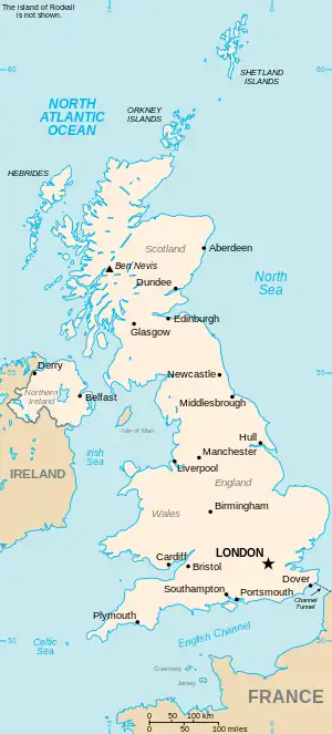
The United Kingdom
This is part of the list of United Kingdom locations: a gazetteer of place names in the United Kingdom showing each place's locality and geographical coordinates.
Par
Pas
| Location | Locality | Coordinates (links to map & photo sources) |
OS grid reference |
| Pasford | Staffordshire | 52°35′N 2°17′W / 52.58°N 02.29°W | SO8099 |
| Passenham | Northamptonshire | 52°02′N 0°52′W / 52.04°N 00.86°W | SP7839 |
| Passfield | Hampshire | 51°05′N 0°50′W / 51.09°N 00.83°W | SU8234 |
| Passingford Bridge | Essex | 51°39′N 0°10′E / 51.65°N 00.16°E | TQ5097 |
| Passmores | Essex | 51°45′N 0°05′E / 51.75°N 00.08°E | TL4408 |
| Paston | Cambridgeshire | 52°36′N 0°14′W / 52.60°N 00.24°W | TF1902 |
| Paston | Norfolk | 52°51′N 1°26′E / 52.85°N 01.44°E | TG3234 |
| Paston Green | Norfolk | 52°51′N 1°25′E / 52.85°N 01.42°E | TG3134 |
| Pasturefields | Staffordshire | 52°49′N 2°01′W / 52.82°N 02.01°W | SJ9925 |
Pat
Pau
| Location | Locality | Coordinates (links to map & photo sources) |
OS grid reference |
| Paul | Cornwall | 50°05′N 5°33′W / 50.08°N 05.55°W | SW4627 |
| Paulerspury | Northamptonshire | 52°05′N 0°58′W / 52.09°N 00.96°W | SP7145 |
| Paull | East Riding of Yorkshire | 53°43′N 0°14′W / 53.71°N 00.24°W | TA1626 |
| Paul's Green | Cornwall | 50°08′N 5°22′W / 50.14°N 05.36°W | SW6033 |
| Paulsgrove | City of Portsmouth | 50°51′N 1°06′W / 50.85°N 01.10°W | SU6306 |
| Paulton | Bath and North East Somerset | 51°18′N 2°30′W / 51.30°N 02.50°W | ST6556 |
| Paulville | West Lothian | 55°53′N 3°38′W / 55.89°N 03.64°W | NS9768 |
Pav
| Location | Locality | Coordinates (links to map & photo sources) |
OS grid reference |
| Pave Lane | Shropshire | 52°44′N 2°22′W / 52.74°N 02.37°W | SJ7516 |
| Pavenham | Bedfordshire | 52°11′N 0°33′W / 52.18°N 00.55°W | SP9955 |
Paw
| Location | Locality | Coordinates (links to map & photo sources) |
OS grid reference |
| Pawlett | Somerset | 51°10′N 3°01′W / 51.17°N 03.01°W | ST2942 |
| Pawlett Hill | Somerset | 51°11′N 3°01′W / 51.18°N 03.01°W | ST2943 |
| Pawston | Northumberland | 55°35′N 2°14′W / 55.58°N 02.23°W | NT8532 |
Pax
| Location | Locality | Coordinates (links to map & photo sources) |
OS grid reference |
| Paxford | Gloucestershire | 52°02′N 1°44′W / 52.03°N 01.73°W | SP1837 |
| Paxton | Scottish Borders | 55°46′N 2°07′W / 55.77°N 02.11°W | NT9353 |
Pay
| Location | Locality | Coordinates (links to map & photo sources) |
OS grid reference |
| Payden Street | Kent | 51°15′N 0°45′E / 51.25°N 00.75°E | TQ9254 |
| Payhembury | Devon | 50°48′N 3°18′W / 50.80°N 03.30°W | ST0801 |
| Paynes Green | Surrey | 51°07′N 0°22′W / 51.12°N 00.37°W | TQ1437 |
| Paynter's Cross | Cornwall | 50°27′N 4°16′W / 50.45°N 04.26°W | SX3964 |
| Paynter's Lane End | Cornwall | 50°14′N 5°16′W / 50.24°N 05.26°W | SW6743 |
| Paythorne | Lancashire | 53°57′N 2°16′W / 53.95°N 02.26°W | SD8351 |
| Payton | Somerset | 50°58′N 3°16′W / 50.97°N 03.26°W | ST1120 |
This article is issued from Wikipedia. The text is licensed under Creative Commons - Attribution - Sharealike. Additional terms may apply for the media files.