The United Kingdom

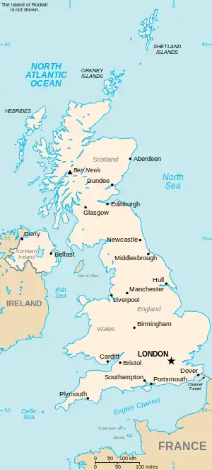
This is part of the list of United Kingdom locations: a gazetteer of place names in the United Kingdom showing each place's locality and geographical coordinates.

Cr (continued)

Cru

Location Locality Coordinates
(links to map & photo sources)
OS grid
reference
Cruckmeole Shropshire 52°40′N 2°50′W / 52.67°N 02.84°W / 52.67; -02.84 SJ4309
Cruckton Shropshire 52°41′N 2°50′W / 52.68°N 02.84°W / 52.68; -02.84 SJ4310
Cruden Bay Aberdeenshire 57°25′N 1°51′W / 57.41°N 01.85°W / 57.41; -01.85 NK0936
Crudgington Shropshire 52°45′N 2°32′W / 52.75°N 02.54°W / 52.75; -02.54 SJ6318
Crudwell Wiltshire 51°37′N 2°04′W / 51.62°N 02.07°W / 51.62; -02.07 ST9592
Crugmeer Cornwall 50°32′N 4°58′W / 50.54°N 04.96°W / 50.54; -04.96 SW9076
Crugybar Carmarthenshire 52°01′N 3°58′W / 52.01°N 03.96°W / 52.01; -03.96 SN6537
Cruise Hill Worcestershire 52°16′N 2°00′W / 52.26°N 02.00°W / 52.26; -02.00 SP0063
Crulabhig Western Isles 58°11′N 6°49′W / 58.19°N 06.81°W / 58.19; -06.81 NB1733
Crumlin County Antrim 54°37′N 6°13′W / 54.62°N 06.21°W / 54.62; -06.21 J1576
Crumlin Caerphilly 51°40′N 3°08′W / 51.67°N 03.14°W / 51.67; -03.14 ST2198
Crumplehorn Cornwall 50°20′N 4°32′W / 50.33°N 04.53°W / 50.33; -04.53 SX2051
Crumpsall Manchester 53°31′N 2°14′W / 53.51°N 02.24°W / 53.51; -02.24 SD8402
Crumpsbrook Shropshire 52°23′N 2°33′W / 52.39°N 02.55°W / 52.39; -02.55 SO6278
Crumpton Hill Herefordshire 52°08′N 2°21′W / 52.13°N 02.35°W / 52.13; -02.35 SO7648
Crundale Kent 51°12′N 0°58′E / 51.20°N 00.96°E / 51.20; 00.96 TR0749
Crundale Pembrokeshire 51°49′N 4°56′W / 51.82°N 04.94°W / 51.82; -04.94 SM9718
Cruwys Morchard Devon 50°53′N 3°36′W / 50.89°N 03.60°W / 50.89; -03.60 SS8712
Crux Easton Hampshire 51°18′N 1°23′W / 51.30°N 01.39°W / 51.30; -01.39 SU4256
Cruxton Dorset 50°46′N 2°34′W / 50.76°N 02.56°W / 50.76; -02.56 SY6096

Crw

Location Locality Coordinates
(links to map & photo sources)
OS grid
reference
Crwbin Carmarthenshire 51°47′N 4°13′W / 51.79°N 04.22°W / 51.79; -04.22 SN4713

Cry

Location Locality Coordinates
(links to map & photo sources)
OS grid
reference
Cryers Hill Buckinghamshire 51°39′N 0°44′W / 51.65°N 00.74°W / 51.65; -00.74 SU8796
Crymych Pembrokeshire 51°58′N 4°39′W / 51.96°N 04.65°W / 51.96; -04.65 SN1833
Crynant Neath Port Talbot 51°43′N 3°45′W / 51.72°N 03.75°W / 51.72; -03.75 SN7904
Crystal Palace Bromley 51°25′48″N 0°04′16″W / 51.430°N 00.071°W / 51.430; -00.071 TQ341708

Cu

Location Locality Coordinates
(links to map & photo sources)
OS grid
reference
Cuaig Highland 57°32′N 5°50′W / 57.54°N 05.84°W / 57.54; -05.84 NG7057
Cuan Argyll and Bute 56°16′N 5°38′W / 56.26°N 05.63°W / 56.26; -05.63 NM7514
Cubbington Warwickshire 52°18′N 1°30′W / 52.30°N 01.50°W / 52.30; -01.50 SP3468
Cubeck North Yorkshire 54°17′N 2°04′W / 54.29°N 02.07°W / 54.29; -02.07 SD9589
Cubert Cornwall 50°22′N 5°07′W / 50.37°N 05.12°W / 50.37; -05.12 SW7857
Cubitt Town Tower Hamlets 51°29′N 0°01′W / 51.49°N 00.01°W / 51.49; -00.01 TQ3879
Cubley Barnsley 53°31′N 1°38′W / 53.51°N 01.63°W / 53.51; -01.63 SE2402
Cubley Common Derbyshire 52°56′N 1°46′W / 52.94°N 01.76°W / 52.94; -01.76 SK1639
Cublington Buckinghamshire 51°53′N 0°47′W / 51.89°N 00.79°W / 51.89; -00.79 SP8322
Cuckfield West Sussex 51°00′N 0°08′W / 51.00°N 00.14°W / 51.00; -00.14 TQ3024
Cucklington Somerset 51°02′N 2°21′W / 51.04°N 02.35°W / 51.04; -02.35 ST7527
Cuckney Nottinghamshire 53°14′N 1°10′W / 53.23°N 01.16°W / 53.23; -01.16 SK5671
Cuckold's Green Suffolk 52°23′N 1°38′E / 52.38°N 01.64°E / 52.38; 01.64 TM4882
Cuckold's Green Wiltshire 51°19′N 2°02′W / 51.31°N 02.03°W / 51.31; -02.03 ST9857
Cuckoo Green Suffolk 52°32′N 1°41′E / 52.53°N 01.69°E / 52.53; 01.69 TM5199
Cuckoo's Corner Hampshire 51°10′N 0°56′W / 51.16°N 00.94°W / 51.16; -00.94 SU7441
Cuckoo's Corner Wiltshire 51°19′N 1°57′W / 51.31°N 01.95°W / 51.31; -01.95 SU0357
Cuckoo's Knob Wiltshire 51°21′N 1°43′W / 51.35°N 01.72°W / 51.35; -01.72 SU1962
Cuckoo Tye Suffolk 52°04′N 0°43′E / 52.06°N 00.72°E / 52.06; 00.72 TL8744
Cuckron Shetland Islands 60°14′N 1°16′W / 60.24°N 01.27°W / 60.24; -01.27 HU4051
Cucumber Corner Norfolk 52°35′N 1°31′E / 52.59°N 01.51°E / 52.59; 01.51 TG3806
Cuddesdon Oxfordshire 51°43′N 1°08′W / 51.72°N 01.13°W / 51.72; -01.13 SP6003
Cuddington Buckinghamshire 51°47′N 0°56′W / 51.79°N 00.94°W / 51.79; -00.94 SP7311
Cuddington Cheshire 53°14′N 2°37′W / 53.23°N 02.61°W / 53.23; -02.61 SJ5971
Cuddington Heath Cheshire 53°00′N 2°47′W / 53.00°N 02.79°W / 53.00; -02.79 SJ4746
Cuddy Hill Lancashire 53°49′N 2°46′W / 53.82°N 02.77°W / 53.82; -02.77 SD4937
Cudham Bromley 51°19′N 0°04′E / 51.31°N 00.06°E / 51.31; 00.06 TQ4459
Cudlipptown Devon 50°35′N 4°05′W / 50.59°N 04.09°W / 50.59; -04.09 SX5279
Cudworth Surrey 51°09′N 0°16′W / 51.15°N 00.27°W / 51.15; -00.27 TQ2141
Cudworth Somerset 50°53′N 2°53′W / 50.88°N 02.89°W / 50.88; -02.89 ST3710
Cudworth Barnsley 53°34′N 1°25′W / 53.56°N 01.42°W / 53.56; -01.42 SE3808
Cudworth Common Barnsley 53°33′N 1°25′W / 53.55°N 01.41°W / 53.55; -01.41 SE3907
Cuerden Green Lancashire 53°43′N 2°41′W / 53.71°N 02.68°W / 53.71; -02.68 SD5524
Cuerdley Cross Cheshire 53°22′N 2°41′W / 53.37°N 02.69°W / 53.37; -02.69 SJ5487
Cufaude Hampshire 51°18′N 1°05′W / 51.30°N 01.08°W / 51.30; -01.08 SU6457
Cuffern Pembrokeshire 51°50′N 5°04′W / 51.84°N 05.06°W / 51.84; -05.06 SM8921
Cuffley Hertfordshire 51°43′N 0°07′W / 51.71°N 00.11°W / 51.71; -00.11 TL3003
Cuffurach Moray 57°38′N 3°01′W / 57.63°N 03.02°W / 57.63; -03.02 NJ3961
Cuidhtinis Western Isles 57°46′N 6°53′W / 57.77°N 06.89°W / 57.77; -06.89 NG0987
Cuidrach Highland 57°32′N 6°23′W / 57.54°N 06.39°W / 57.54; -06.39 NG3759
Cuiken Midlothian 55°50′N 3°14′W / 55.83°N 03.23°W / 55.83; -03.23 NT2361
Cuil Highland 56°38′N 5°17′W / 56.64°N 05.29°W / 56.64; -05.29 NM9855
Culbokie Highland 57°35′N 4°20′W / 57.59°N 04.34°W / 57.59; -04.34 NH6059
Culburnie Highland 57°26′N 4°32′W / 57.43°N 04.53°W / 57.43; -04.53 NH4841
Culcabock Highland 57°28′N 4°12′W / 57.46°N 04.20°W / 57.46; -04.20 NH6844
Culcharry Highland 57°31′N 3°54′W / 57.52°N 03.90°W / 57.52; -03.90 NH8650
Culcheth Cheshire 53°27′N 2°31′W / 53.45°N 02.52°W / 53.45; -02.52 SJ6595
Culduie Highland 57°23′N 5°49′W / 57.39°N 05.81°W / 57.39; -05.81 NG7140
Culford Suffolk 52°17′N 0°41′E / 52.29°N 00.68°E / 52.29; 00.68 TL8370
Culfordheath Suffolk 52°20′N 0°43′E / 52.33°N 00.71°E / 52.33; 00.71 TL8574
Culgaith Cumbria 54°39′N 2°37′W / 54.65°N 02.62°W / 54.65; -02.62 NY6029
Culham Oxfordshire 51°39′N 1°16′W / 51.65°N 01.27°W / 51.65; -01.27 SU5095
Culkein Highland 58°14′N 5°21′W / 58.24°N 05.35°W / 58.24; -05.35 NC0333
Culkein Drumbeg Highland 58°14′N 5°13′W / 58.24°N 05.22°W / 58.24; -05.22 NC1133
Culkerton Gloucestershire 51°39′N 2°06′W / 51.65°N 02.10°W / 51.65; -02.10 ST9395
Cullen Moray 57°41′N 2°49′W / 57.69°N 02.82°W / 57.69; -02.82 NJ5167
Cullercoats North Tyneside 55°01′N 1°26′W / 55.02°N 01.43°W / 55.02; -01.43 NZ3670
Cullicudden Highland 57°38′N 4°16′W / 57.64°N 04.26°W / 57.64; -04.26 NH6564
Cullingworth Bradford 53°49′N 1°55′W / 53.82°N 01.91°W / 53.82; -01.91 SE0636
Cullipool Argyll and Bute 56°14′N 5°40′W / 56.24°N 05.66°W / 56.24; -05.66 NM7312
Cullivoe Shetland Islands 60°41′N 1°01′W / 60.69°N 01.01°W / 60.69; -01.01 HP5402
Culloch Perth and Kinross 56°20′N 3°58′W / 56.33°N 03.97°W / 56.33; -03.97 NN7817
Culloden Highland 57°29′N 4°09′W / 57.48°N 04.15°W / 57.48; -04.15 NH7146
Cullompton Devon 50°51′N 3°23′W / 50.85°N 03.39°W / 50.85; -03.39 ST0207
Culm Davy Devon 50°55′N 3°15′W / 50.92°N 03.25°W / 50.92; -03.25 ST1215
Culmer Surrey 51°08′N 0°39′W / 51.14°N 00.65°W / 51.14; -00.65 SU9439
Culmers Kent 51°19′N 0°56′E / 51.32°N 00.94°E / 51.32; 00.94 TR0562
Culmington Shropshire 52°26′N 2°45′W / 52.43°N 02.75°W / 52.43; -02.75 SO4982
Culmore Stirling 56°08′N 4°08′W / 56.13°N 04.14°W / 56.13; -04.14 NS6796
Culmstock Devon 50°54′N 3°17′W / 50.90°N 03.28°W / 50.90; -03.28 ST1013
Culnacnoc Highland 57°34′N 6°10′W / 57.57°N 06.16°W / 57.57; -06.16 NG5162
Culpho Suffolk 52°05′N 1°13′E / 52.09°N 01.22°E / 52.09; 01.22 TM2149
Culrain Highland 57°55′N 4°25′W / 57.91°N 04.41°W / 57.91; -04.41 NH5794
Culrigrein Western Isles 58°13′N 6°22′W / 58.22°N 06.37°W / 58.22; -06.37 NB4334
Culross Fife 56°02′N 3°38′W / 56.04°N 03.63°W / 56.04; -03.63 NS9885
Culroy South Ayrshire 55°23′N 4°40′W / 55.39°N 04.67°W / 55.39; -04.67 NS3114
Culswick Shetland Islands 60°11′N 1°31′W / 60.18°N 01.51°W / 60.18; -01.51 HU2745
Cults City of Aberdeen 57°06′N 2°11′W / 57.10°N 02.18°W / 57.10; -02.18 NJ8902
Cultybraggan Perth and Kinross 56°20′N 4°00′W / 56.34°N 04.00°W / 56.34; -04.00 NN7619
Culverlane Devon 50°25′N 3°46′W / 50.42°N 03.77°W / 50.42; -03.77 SX7460
Culverstone Green Kent 51°20′N 0°20′E / 51.33°N 00.33°E / 51.33; 00.33 TQ6362
Culverthorpe Lincolnshire 52°56′N 0°29′W / 52.94°N 00.48°W / 52.94; -00.48 TF0240
Culworth Northamptonshire 52°06′N 1°13′W / 52.10°N 01.21°W / 52.10; -01.21 SP5446
Cumberlow Green Hertfordshire 51°57′N 0°06′W / 51.95°N 00.10°W / 51.95; -00.10 TL3030
Cumbernauld North Lanarkshire 55°56′N 3°59′W / 55.94°N 03.98°W / 55.94; -03.98 NS7674
Cumbernauld Village North Lanarkshire 55°58′N 3°59′W / 55.96°N 03.98°W / 55.96; -03.98 NS7676
Cumber's Bank Wrexham 52°56′N 2°50′W / 52.94°N 02.83°W / 52.94; -02.83 SJ4439
Cumberworth Lincolnshire 53°14′N 0°14′E / 53.23°N 00.24°E / 53.23; 00.24 TF5073
Cumdivock Cumbria 54°49′N 3°01′W / 54.82°N 03.02°W / 54.82; -03.02 NY3448
Cumeragh Village Lancashire 53°49′N 2°40′W / 53.81°N 02.66°W / 53.81; -02.66 SD5636
Cuminestown Aberdeenshire 57°32′N 2°20′W / 57.54°N 02.33°W / 57.54; -02.33 NJ8050
Cumledge Scottish Borders 55°47′N 2°20′W / 55.79°N 02.33°W / 55.79; -02.33 NT7956
Cumlewick Shetland Islands 59°59′N 1°14′W / 59.98°N 01.24°W / 59.98; -01.24 HU4222
Cummersdale Cumbria 54°52′N 2°58′W / 54.86°N 02.96°W / 54.86; -02.96 NY3853
Cummertrees Dumfries and Galloway 54°59′N 3°20′W / 54.98°N 03.34°W / 54.98; -03.34 NY1466
Cummings Park City of Aberdeen 57°10′N 2°09′W / 57.16°N 02.15°W / 57.16; -02.15 NJ9108
Cummingstown Moray 57°41′N 3°28′W / 57.69°N 03.46°W / 57.69; -03.46 NJ1368
Cumnock East Ayrshire 55°26′N 4°16′W / 55.44°N 04.26°W / 55.44; -04.26 NS5719
Cumnor Oxfordshire 51°44′N 1°20′W / 51.73°N 01.33°W / 51.73; -01.33 SP4604
Cumnor Hill Oxfordshire 51°44′N 1°19′W / 51.74°N 01.32°W / 51.74; -01.32 SP4705
Cumrew Cumbria 54°50′N 2°43′W / 54.84°N 02.71°W / 54.84; -02.71 NY5450
Cumwhinton Cumbria 54°52′N 2°51′W / 54.86°N 02.85°W / 54.86; -02.85 NY4552
Cumwhitton Cumbria 54°52′N 2°47′W / 54.86°N 02.78°W / 54.86; -02.78 NY5052
Cundall North Yorkshire 54°08′N 1°21′W / 54.14°N 01.35°W / 54.14; -01.35 SE4272
Cundy Cross Barnsley 53°32′N 1°26′W / 53.54°N 01.44°W / 53.54; -01.44 SE3706
Cundy Hos Barnsley 53°28′N 1°32′W / 53.46°N 01.53°W / 53.46; -01.53 SK3197
Cunninghamhead North Ayrshire 55°38′N 4°35′W / 55.63°N 04.59°W / 55.63; -04.59 NS3741
Cunnister Shetland Islands 60°38′N 1°03′W / 60.64°N 01.05°W / 60.64; -01.05 HU5296
Cupar Fife 56°19′N 3°01′W / 56.31°N 03.02°W / 56.31; -03.02 NO3714
Cupar Muir Fife 56°18′N 3°02′W / 56.30°N 03.03°W / 56.30; -03.03 NO3613
Cupernham Hampshire 50°59′N 1°29′W / 50.99°N 01.48°W / 50.99; -01.48 SU3622
Cupid Green Hertfordshire 51°46′N 0°27′W / 51.76°N 00.45°W / 51.76; -00.45 TL0709
Cupid's Hill Monmouthshire 51°55′N 2°52′W / 51.92°N 02.87°W / 51.92; -02.87 SO4025
Curbar Derbyshire 53°16′N 1°37′W / 53.26°N 01.62°W / 53.26; -01.62 SK2574
Curborough Staffordshire 52°42′N 1°49′W / 52.70°N 01.82°W / 52.70; -01.82 SK1212
Curbridge Hampshire 50°53′N 1°16′W / 50.89°N 01.26°W / 50.89; -01.26 SU5211
Curbridge Oxfordshire 51°46′N 1°31′W / 51.76°N 01.52°W / 51.76; -01.52 SP3308
Curdridge Hampshire 50°55′N 1°14′W / 50.91°N 01.24°W / 50.91; -01.24 SU5313
Curdworth Birmingham 52°31′N 1°45′W / 52.52°N 01.75°W / 52.52; -01.75 SP1792
Curgurrell Cornwall 50°11′N 4°58′W / 50.19°N 04.97°W / 50.19; -04.97 SW8837
Curland Somerset 50°56′N 3°02′W / 50.94°N 03.04°W / 50.94; -03.04 ST2717
Curland Common Somerset 50°56′N 3°02′W / 50.94°N 03.04°W / 50.94; -03.04 ST2717
Curlew Green Suffolk 52°14′N 1°29′E / 52.23°N 01.48°E / 52.23; 01.48 TM3865
Curling Tye Green Essex 51°44′N 0°38′E / 51.73°N 00.63°E / 51.73; 00.63 TL8207
Curload Somerset 51°02′N 2°56′W / 51.04°N 02.94°W / 51.04; -02.94 ST3428
Currian Vale Cornwall 50°22′N 4°52′W / 50.37°N 04.87°W / 50.37; -04.87 SW9657
Curridge Berkshire 51°26′N 1°19′W / 51.43°N 01.31°W / 51.43; -01.31 SU4871
Currie City of Edinburgh 55°53′N 3°19′W / 55.88°N 03.31°W / 55.88; -03.31 NT1867
Currock Cumbria 54°52′N 2°56′W / 54.87°N 02.93°W / 54.87; -02.93 NY4054
Curry Lane Cornwall 50°43′N 4°25′W / 50.71°N 04.42°W / 50.71; -04.42 SX2993
Curry Mallet Somerset 50°59′N 2°58′W / 50.98°N 02.97°W / 50.98; -02.97 ST3221
Curry Rivel Somerset 51°01′N 2°52′W / 51.02°N 02.87°W / 51.02; -02.87 ST3925
Cursiter Orkney Islands 58°59′N 3°05′W / 58.99°N 03.09°W / 58.99; -03.09 HY3712
Curteis' Corner Kent 51°07′N 0°38′E / 51.12°N 00.64°E / 51.12; 00.64 TQ8539
Curtisden Green Kent 51°08′N 0°29′E / 51.13°N 00.48°E / 51.13; 00.48 TQ7440
Curtisknowle Devon 50°22′N 3°47′W / 50.36°N 03.78°W / 50.36; -03.78 SX7353
Curtismill Green Essex 51°38′N 0°11′E / 51.64°N 00.18°E / 51.64; 00.18 TQ5196
Cury Cornwall 50°02′N 5°15′W / 50.04°N 05.25°W / 50.04; -05.25 SW6721
Cusbay Orkney Islands 59°13′N 2°47′W / 59.21°N 02.79°W / 59.21; -02.79 HY5537
Cusgarne Cornwall 50°13′N 5°09′W / 50.21°N 05.15°W / 50.21; -05.15 SW7540
Cushuish Somerset 51°04′N 3°09′W / 51.06°N 03.15°W / 51.06; -03.15 ST1930
Cusop Herefordshire 52°04′N 3°07′W / 52.06°N 03.12°W / 52.06; -03.12 SO2341
Custards Hampshire 50°52′N 1°35′W / 50.87°N 01.58°W / 50.87; -01.58 SU2908
Custom House Newham 51°31′N 0°02′E / 51.51°N 00.03°E / 51.51; 00.03 TQ4181
Cusveorth Coombe Cornwall 50°14′N 5°08′W / 50.24°N 05.14°W / 50.24; -05.14 SW7643
Cusworth Doncaster 53°32′N 1°11′W / 53.53°N 01.18°W / 53.53; -01.18 SE5404
Cutcombe Somerset 51°08′N 3°32′W / 51.14°N 03.54°W / 51.14; -03.54 SS9239
Cutgate Rochdale 53°37′N 2°13′W / 53.62°N 02.21°W / 53.62; -02.21 SD8614
Cuthill East Lothian 55°57′N 2°59′W / 55.95°N 02.99°W / 55.95; -02.99 NT3874
Cutiau Gwynedd 52°44′N 4°02′W / 52.73°N 04.03°W / 52.73; -04.03 SH6317
Cutlers Green Essex 51°56′N 0°19′E / 51.94°N 00.31°E / 51.94; 00.31 TL5930
Cutler's Green Somerset 51°16′N 2°35′W / 51.26°N 02.58°W / 51.26; -02.58 ST5952
Cutmadoc Cornwall 50°26′N 4°41′W / 50.43°N 04.69°W / 50.43; -04.69 SX0963
Cutmere Cornwall 50°25′N 4°22′W / 50.41°N 04.36°W / 50.41; -04.36 SX3260
Cutnall Green Worcestershire 52°19′N 2°11′W / 52.31°N 02.19°W / 52.31; -02.19 SO8768
Cutsdean Gloucestershire 51°58′N 1°53′W / 51.96°N 01.88°W / 51.96; -01.88 SP0830
Cutsyke Wakefield 53°43′N 1°22′W / 53.71°N 01.36°W / 53.71; -01.36 SE4224
Cutteslowe Oxfordshire 51°47′N 1°16′W / 51.78°N 01.27°W / 51.78; -01.27 SP5010
Cutthorpe Derbyshire 53°15′N 1°29′W / 53.25°N 01.49°W / 53.25; -01.49 SK3473
Cuttiford's Door Somerset 50°53′N 2°58′W / 50.88°N 02.96°W / 50.88; -02.96 ST3210
Cuttybridge Pembrokeshire 51°50′N 5°00′W / 51.83°N 05.00°W / 51.83; -05.00 SM9319
Cuttyhill Aberdeenshire 57°32′N 1°56′W / 57.54°N 01.93°W / 57.54; -01.93 NK0450
Cuxham Oxfordshire 51°39′N 1°02′W / 51.65°N 01.04°W / 51.65; -01.04 SU6695
Cuxton Kent 51°22′N 0°26′E / 51.36°N 00.44°E / 51.36; 00.44 TQ7066
Cuxwold Lincolnshire 53°29′N 0°14′W / 53.49°N 00.23°W / 53.49; -00.23 TA1701
This article is issued from Wikipedia. The text is licensed under Creative Commons - Attribution - Sharealike. Additional terms may apply for the media files.