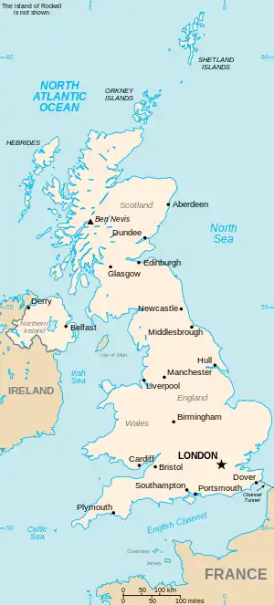
The United Kingdom
This is part of the list of United Kingdom locations: a gazetteer of place names in the United Kingdom showing each place's locality and geographical coordinates.
He
Hea
Heb
| Location | Locality | Coordinates (links to map & photo sources) |
OS grid reference |
| Hebburn | South Tyneside | 54°58′N 1°31′W / 54.97°N 01.51°W | NZ3164 |
| Hebburn Colliery | South Tyneside | 54°58′N 1°31′W / 54.97°N 01.51°W | NZ3165 |
| Hebburn New Town | South Tyneside | 54°58′N 1°32′W / 54.97°N 01.53°W | NZ3064 |
| Hebden | North Yorkshire | 54°04′N 1°58′W / 54.06°N 01.97°W | SE0263 |
| Hebden Bridge | Calderdale | 53°44′N 2°02′W / 53.73°N 02.03°W | SD9827 |
| Hebden Green | Cheshire | 53°11′N 2°34′W / 53.18°N 02.57°W | SJ6265 |
| Hebing End | Hertfordshire | 51°53′N 0°05′W / 51.88°N 00.09°W | TL3122 |
| Hebrides (Western Isles) | Highland | 57°25′N 6°22′W / 57.42°N 06.36°W | NG382451 |
| Hebron | Carmarthenshire | 51°55′N 4°38′W / 51.91°N 04.64°W | SN1827 |
| Hebron | Northumberland | 55°11′N 1°42′W / 55.19°N 01.70°W | NZ1989 |
| Hebron | Isle of Anglesey | 53°20′N 4°19′W / 53.33°N 04.32°W | SH4584 |
Hec
| Location | Locality | Coordinates (links to map & photo sources) |
OS grid reference |
| Heck | Dumfries and Galloway | 55°06′N 3°25′W / 55.10°N 03.42°W | NY0980 |
| Heckdyke | Nottinghamshire | 53°27′N 0°49′W / 53.45°N 00.81°W | SK7996 |
| Heckfield | Hampshire | 51°20′N 0°58′W / 51.33°N 00.96°W | SU7260 |
| Heckfield Green | Suffolk | 52°20′N 1°11′E / 52.33°N 01.19°E | TM1875 |
| Heckfordbridge | Essex | 51°51′N 0°49′E / 51.85°N 00.81°E | TL9421 |
| Heckingham | Norfolk | 52°31′N 1°30′E / 52.52°N 01.50°E | TM3898 |
| Heckington | Lincolnshire | 52°59′N 0°18′W / 52.98°N 00.30°W | TF1444 |
| Heckmondwike | Kirklees | 53°42′N 1°41′W / 53.70°N 01.68°W | SE2123 |
Hed
Hee
| Location | Locality | Coordinates (links to map & photo sources) |
OS grid reference |
| Heelands | Milton Keynes | 52°02′N 0°47′W / 52.04°N 00.79°W | SP8339 |
| Heeley | Sheffield | 53°21′N 1°28′W / 53.35°N 01.47°W | SK3584 |
Heg
| Location | Locality | Coordinates (links to map & photo sources) |
OS grid reference |
| Heggle Lane | Cumbria | 54°42′N 2°59′W / 54.70°N 02.99°W | NY3635 |
| Heglibister | Shetland Islands | 60°14′N 1°19′W / 60.24°N 01.31°W | HU3851 |
Hei
| Location | Locality | Coordinates (links to map & photo sources) |
OS grid reference |
| Heighington | Darlington | 54°35′N 1°38′W / 54.59°N 01.63°W | NZ2422 |
| Heighington | Lincolnshire | 53°12′N 0°27′W / 53.20°N 00.45°W | TF0369 |
| Heighley | Staffordshire | 53°01′N 2°20′W / 53.02°N 02.34°W | SJ7747 |
| Height End | Lancashire | 53°42′N 2°19′W / 53.70°N 02.31°W | SD7923 |
| Heightington | Worcestershire | 52°20′N 2°21′W / 52.33°N 02.35°W | SO7671 |
| Heights | Oldham | 53°34′N 2°02′W / 53.56°N 02.03°W | SD9808 |
| Heights of Kinlochewe | Highland | 57°37′N 5°15′W / 57.62°N 05.25°W | NH0664 |
| Heisker (Monarch Islands) | Western Isles | 57°31′N 7°37′W / 57.52°N 07.61°W | NF639618 |
| Heiton | Scottish Borders | 55°34′N 2°28′W / 55.56°N 02.46°W | NT7130 |
Hel
Hem
This article is issued from Wikipedia. The text is licensed under Creative Commons - Attribution - Sharealike. Additional terms may apply for the media files.